Watching The Tropics…?
Yep, we’re in hurricane season. That means really at anytime, even if not climatologically favored, tropical development can manifest. Here below we’re actually watching a pretty robust African tropical wave emerge into the eastern tropical Atlantic producing a broad area of disorganized thunderstorms. According to the National Hurricane Center, it currently has a 10% of tropical development in the next 2 days, with a 50% of formation over the course of a week.
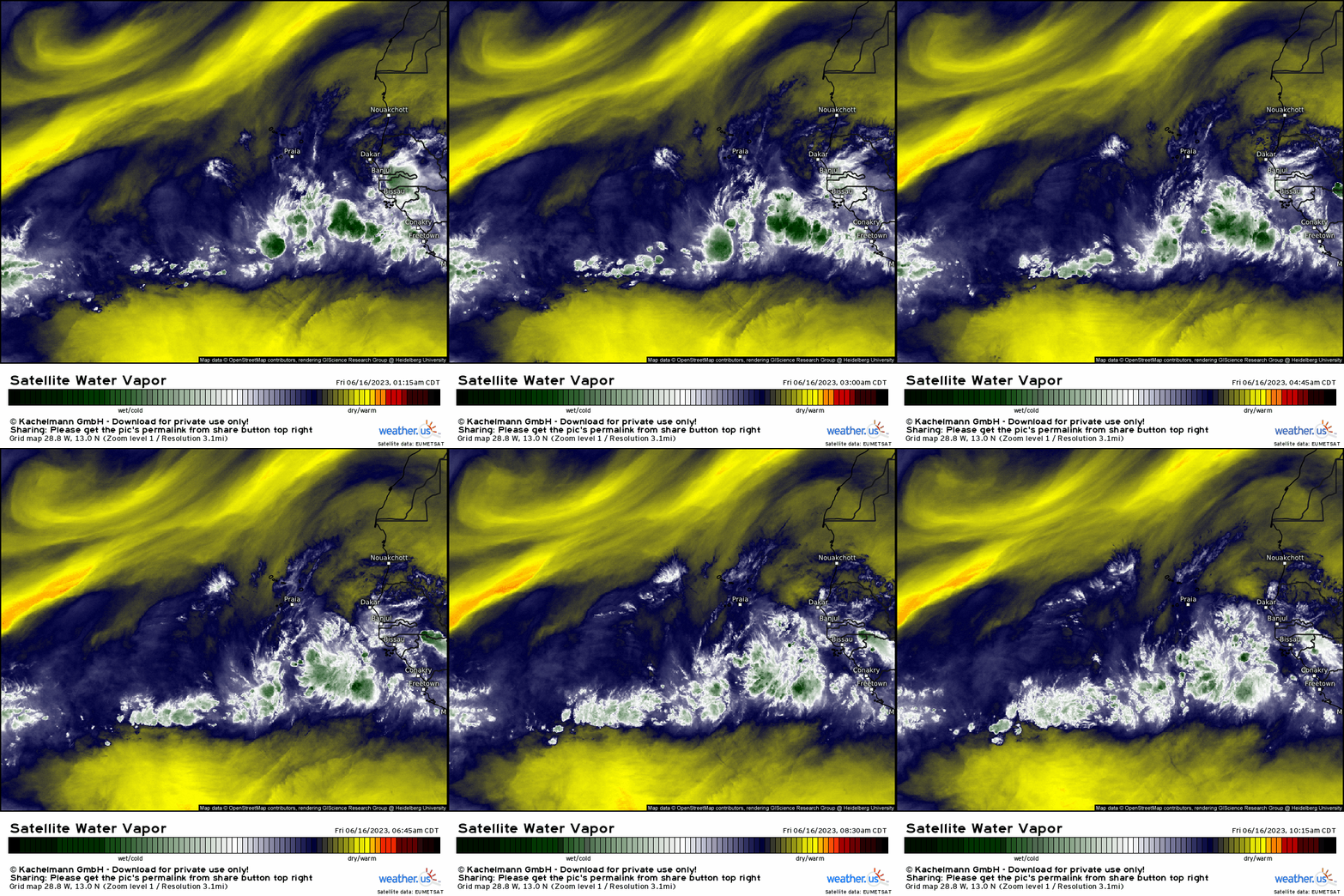
Lets look at the ambient environment over the next several days into early next week in terms of vertical wind shear and humidity. Typically, this time of year we see points of origin and interest remain mostly confined toward the Caribbean, Gulf of Mexico, and southwest Atlantic. We also usually at this time of year have a strong Azores subtropical ridge out in the Atlantic that tends to filter dry air into the tropical Atlantic along with wind shear; however, we’re in somewhat unusual territory given the extreme warmth we’re seeing now in the MDR (Main Development Region) and lack of shear.
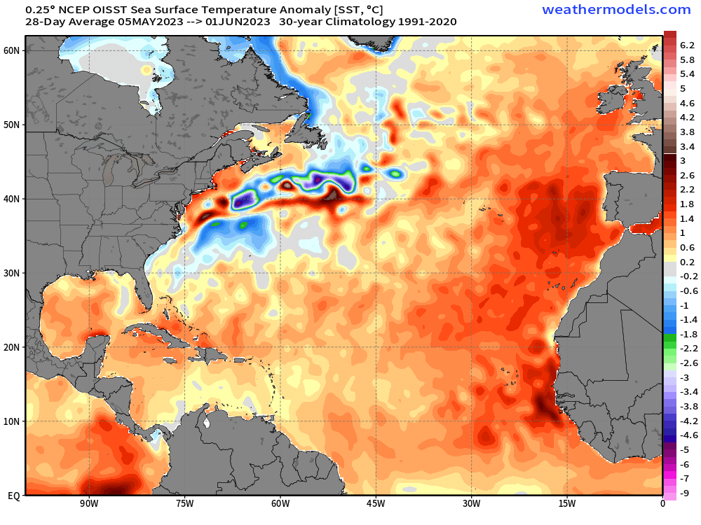
Just to illustrate this point, we’re actually in record territory for how warm the eastern tropical Atlantic is where sea surface temperatures are over 1-2 standard deviations above normal. We see these types of values by late August and early September, and statistically speaking over the last 30 year average, these temperatures don’t show up until the first week of September! Quite astonishing.
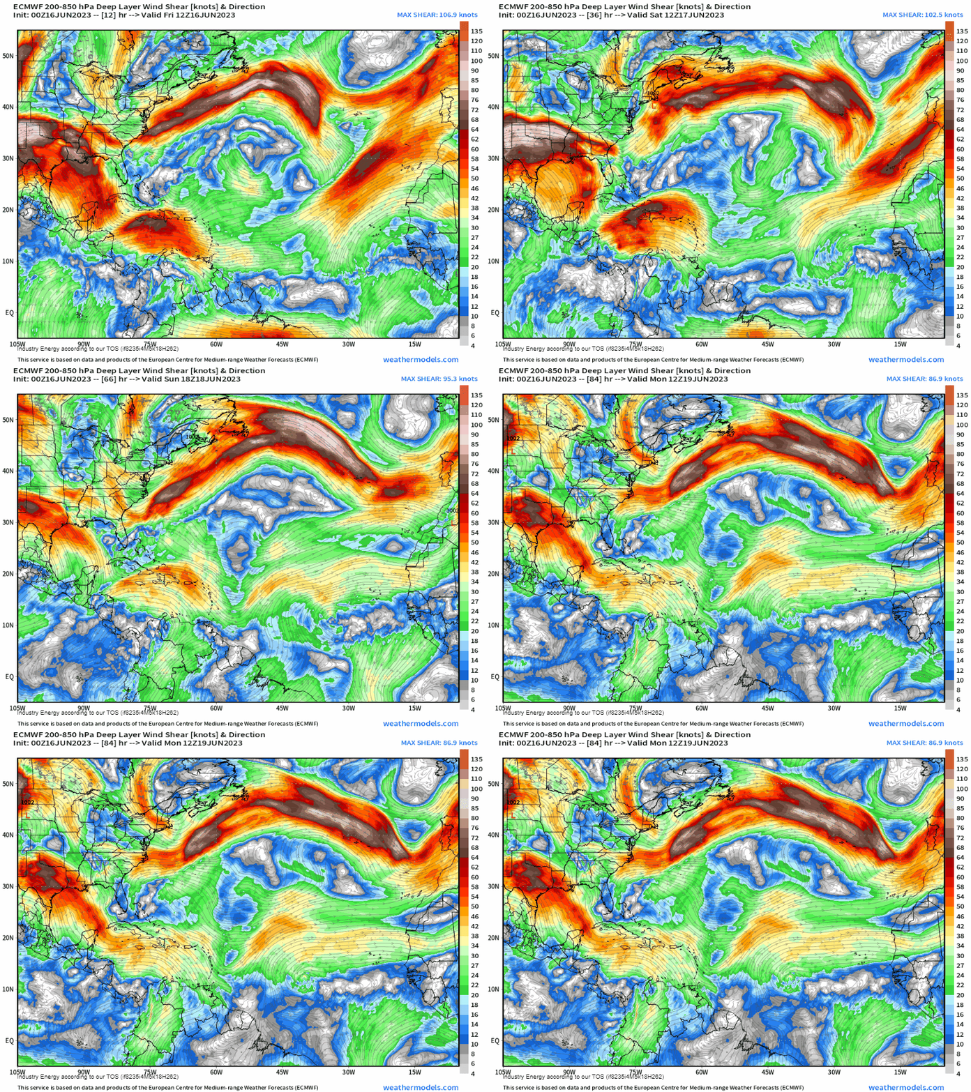
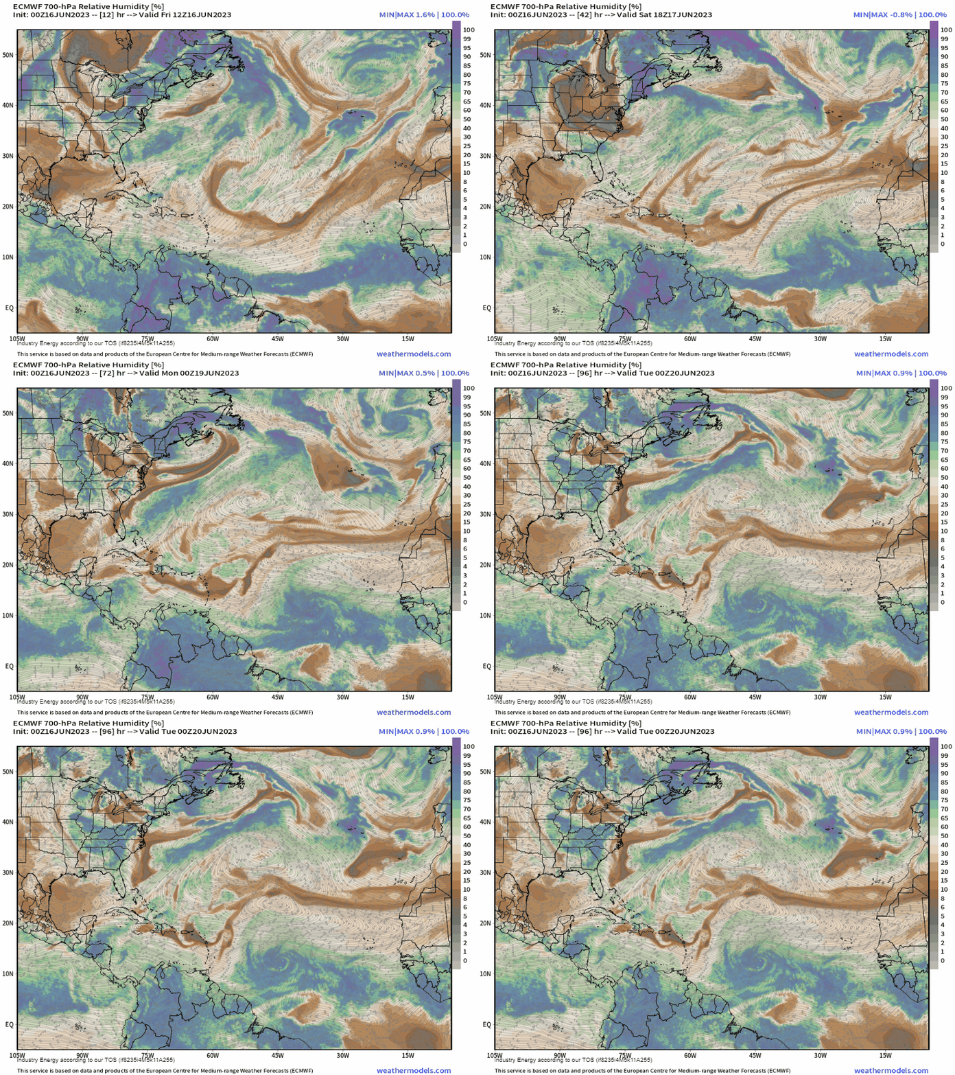
Below, we see over the next several days the wave verbatim gradually tracks westward. Notice the lack of harmful wind shear surrounding its circulation (we typically want to see less than ~20 knots in order for intensification). Right below, compare that to the general relative humidity at 700mb as it’s shrouded by moisture so we know we have an environment conducive for this wave to form into a depression once coined an invest likely by this weekend.
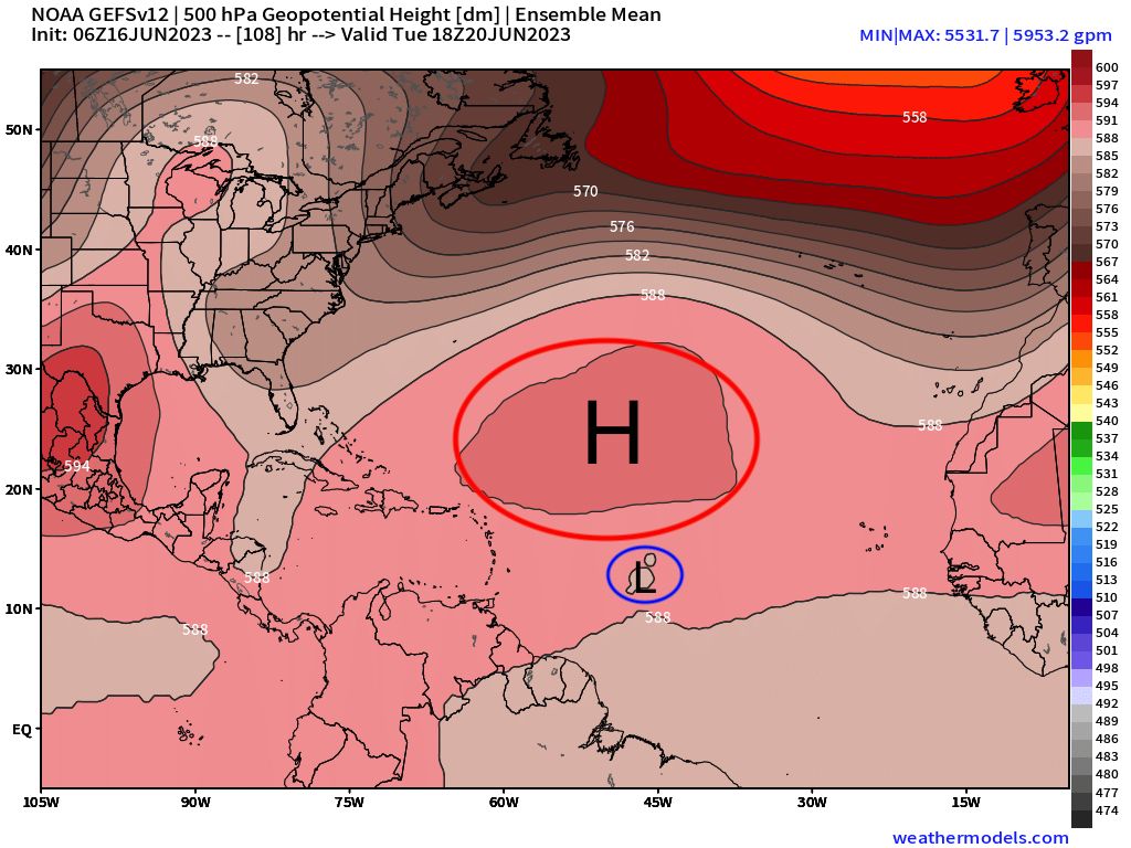
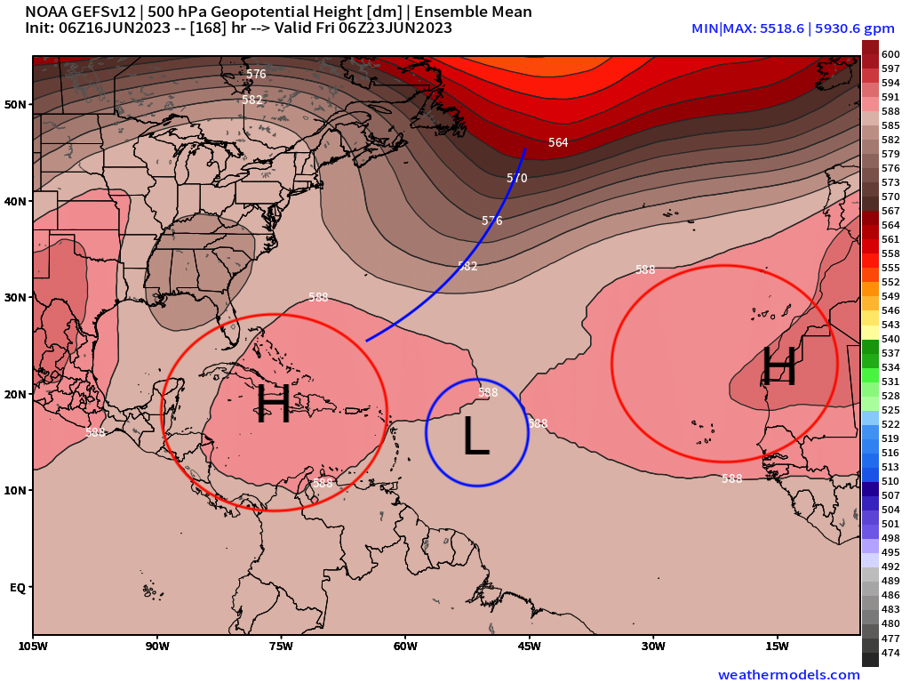
Lets fast forward to early next week when we’ll be watching this disturbance, which may be a depression by then, trek across the central Atlantic. The synoptic height pattern will have a large subtropical Bermuda ridge (though relatively weak) to the north, with the disturbance south of it tracking west. By then later next week, we’ll see the central subtropical ridge allocate toward the eastern Atlantic, with a trough shifting into the northern Atlantic. It’s at this juncture that creates an “opening” for the tropical disturbance to be pulled northward. Now, it’s at this time we’ll know especially if becomes as strong as what some of the models are showing (i.e. GFS, EURO) or remains weak. If the former is true, then the cyclone will “feel” the steering winds around it and a stronger cyclone is able to be more vertically elevated in the atmosphere as opposed to a weaker system. The latter would make things more interesting since it could continue toward the Caribbean as it won’t “feel” the prevailing steering flow.
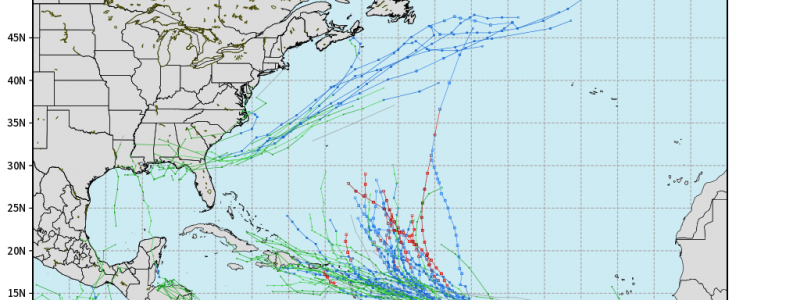
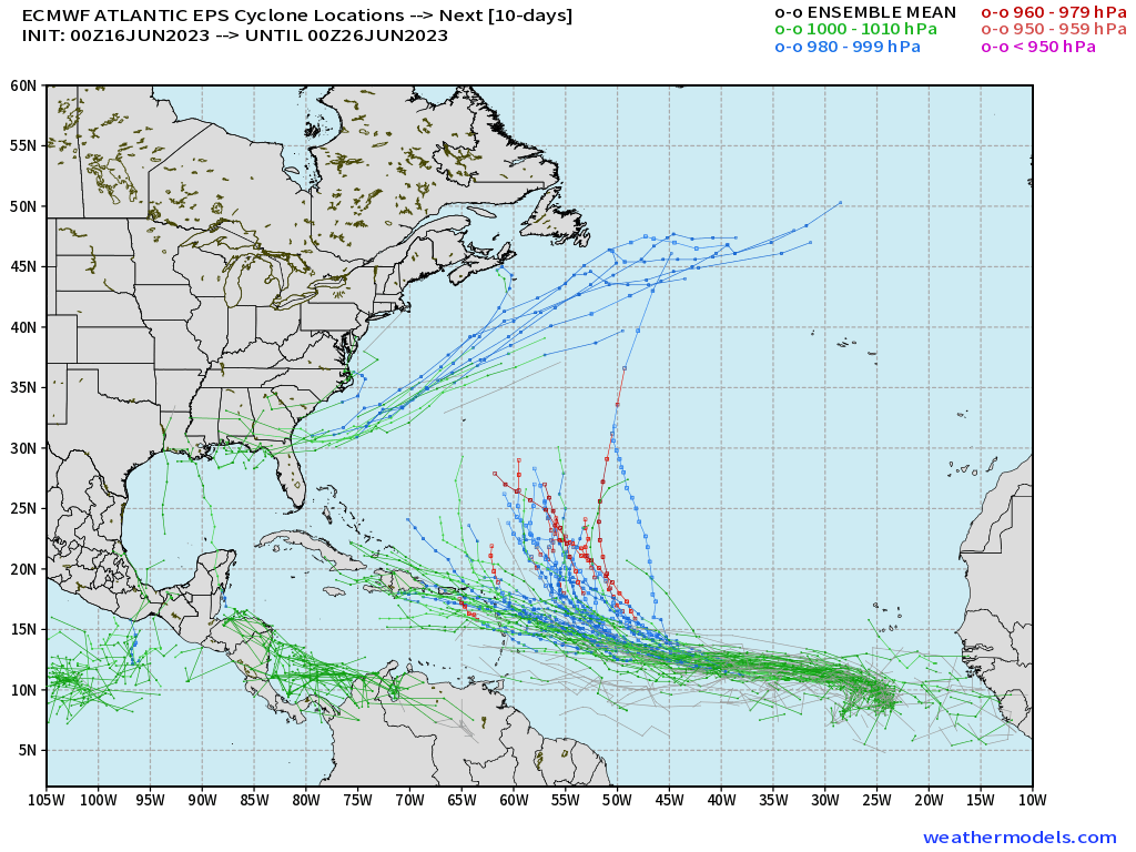
This is reflected through the forecasted cyclone tracks via the EPS, which remember is an ensemble so we can get numerous variations by re-running the model in this case 51 times to see what plausible outcomes there can be. As we can see, a solid split in two types of tracks are shown given the discussed differences in strength of the cyclone and what happens with the steering mechanisms next week. This is a week out, so expect a whole bunch of uncertainty and stay away from any of those wild social media posts (especially the GFS fantasyland ones!).
For now, we’ll monitor and watch over the next several days. The NHC likely will dub this as an invest, then it’ll most likely form into a tropical depression by early next week. We’ll be watching and keeping all informed so stay tuned!


