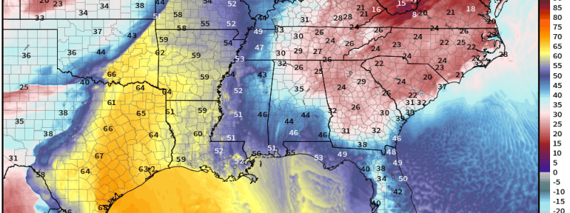
Warmth, Severe Weather Makes a Brief Return
So, how about those morning lows, Eastern US?

Yikes.
Spatially, nearly half of the US was at/under freezing this morning. Many saw their coldest morning lows since early February. A hard freeze for some has effectively (but temporarily) put the brakes on an early start to the growing season. I know my magnolias, which had gorgeous blossoms not 36 hours ago, now looks mostly dead again.
But, the March sun angle does wonders for eradicating that chill in the air. The same areas that were in the 20s and 30s this morning are in the 50s or higher 40s this afternoon.
In addition to the power of the March sun, a quick (and again, temporary) pattern change will allow warmth to sneak back northward ahead of the next system.

Though it won’t be quite as potent as the shots of above-average temps of the past couple of months, warmer air will creep north from the Southern Plains into the Northeast as the week wears on.
However, it will be – you guessed it – temporary as another shot of cold air sinks in behind a potent system. And this impending system is what we’re talking about today.
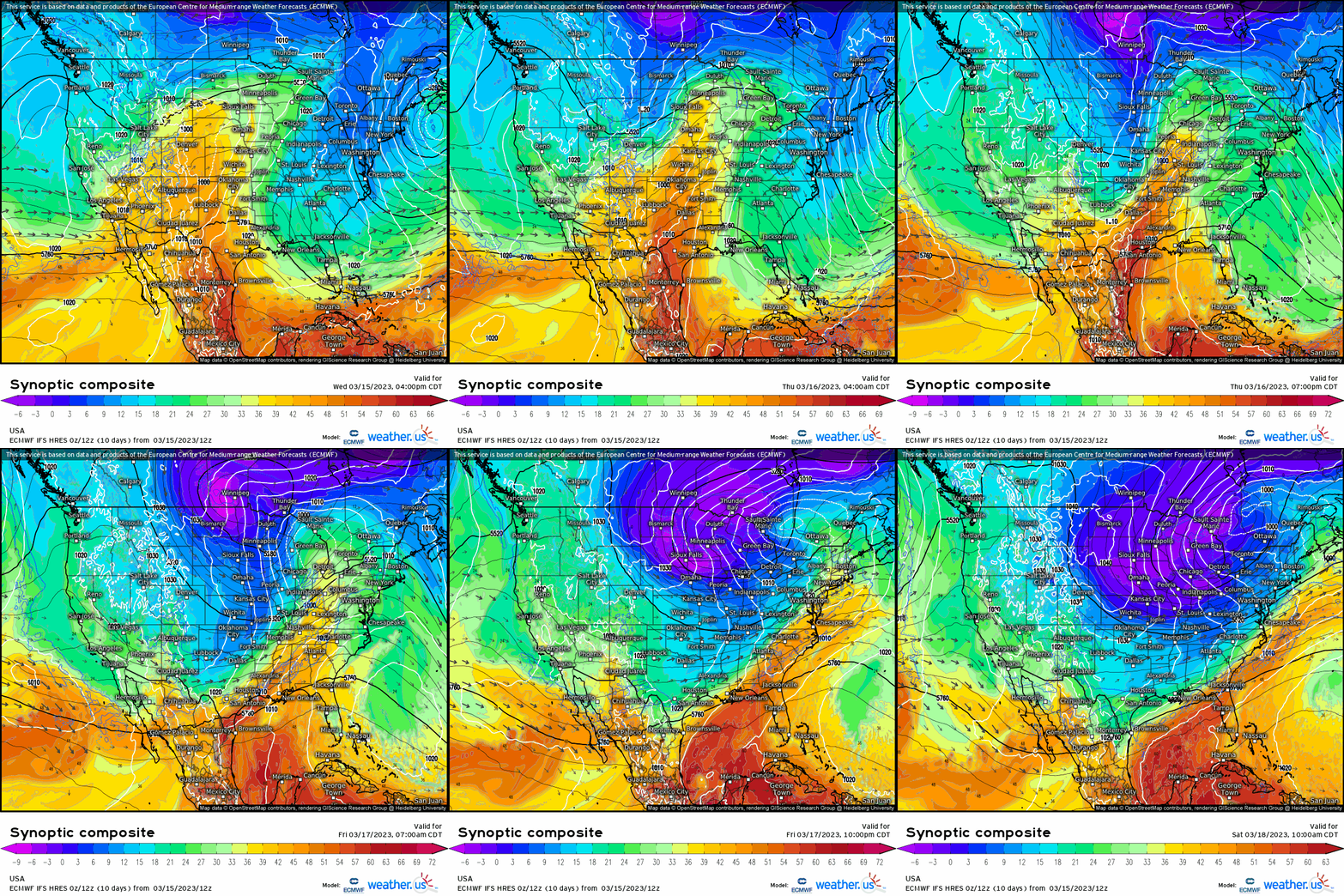
This will be a coast-to-coast event. The same “energy” that helped drive another atmospheric river into the California coast yesterday will continue east through the week. Ahead of it, warm, moist air will be pulled northward and another severe weather threat will take shape for Thursday.
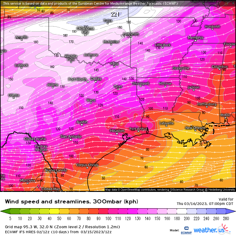
By Thursday evening, we can identify a good amount of diffluence (wind vectors spreading apart) aloft over the Southern Plains which, as mentioned in previous blogs, allows for rising air at the surface. Additionally, the region will be located under the right entrance region of a jet streak (a region of faster winds within the jet stream), which is favored for enhancing rising air at the surface.
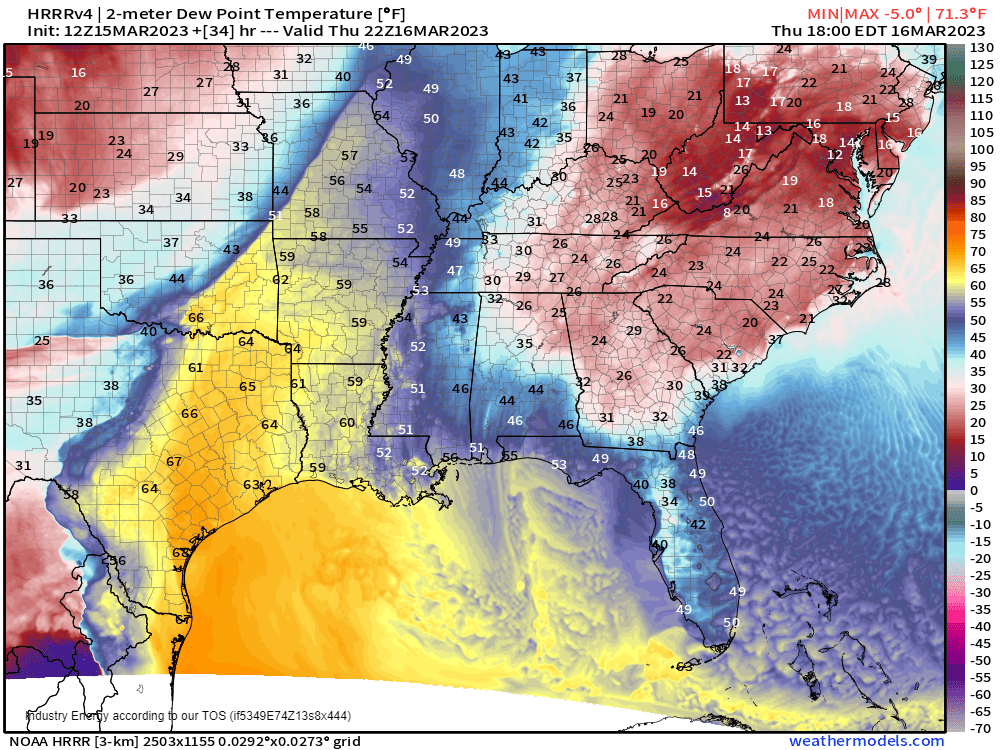
Modeling suggests a fairly narrow plume of deeper moisture with dew points in the upper 50s to mid 60s pulled north through eastern Texas, eastern Oklahoma, and into the western reaches of Arkansas and Louisiana.
The combination of best moisture and forcing will put a bullseye, so to speak, on the region where a few major interstates – I-35, I-20, and I-30 converge.
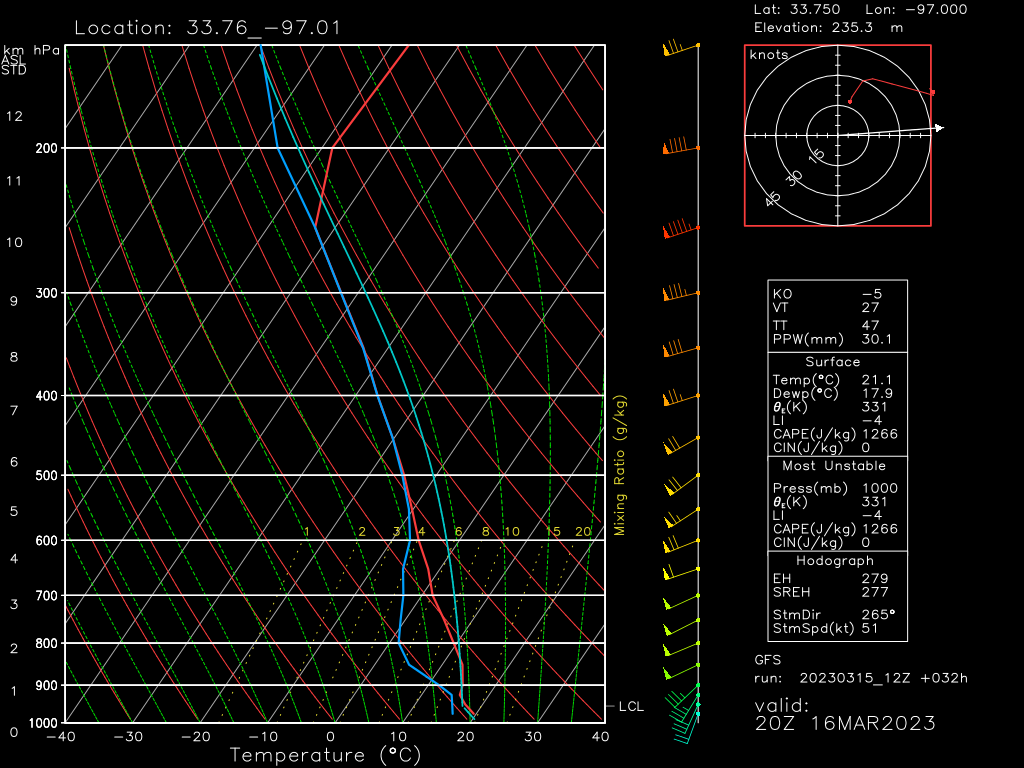
Let’s take a look at this forecasted sounding, pulled from along the OK/TX border region for tomorrow evening.
- Low-level speed/directional shear isn’t great. The wind is nearly unidirectional through 900 mb with no veering with height that would indicate a potent tornado threat. While a few tornadoes are possible, it doesn’t seem to be the main threat.
- Deep-layer shear is decent. There is some veering with height and also a good change in speed. This can help organize and sustain storms.
- Dry air is available aloft with 50 to 65 kt winds in the mid-levels. If this air entrains into updrafts, it could pose a damaging wind threat.
- Fairly steep mid-level lapse rates and elevated CAPE are present. This could allow for a severe hail threat, especially initially/closer to the colder air aloft.
So to sum up: Damaging winds and hail seem to be tomorrow’s biggest threats. A tornado or two is possible, but is not the number one hazard.
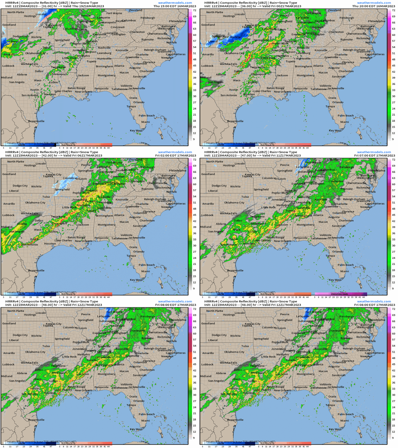
As far as timing goes: Storms should begin to form in the late afternoon/early evening hours over western/central Oklahoma and expand southeastward with time.
Storms have the potential to remain severe through the evening and after-dark hours as instability lingers. The line is expected to weaken some overnight as it enters more stable air, but a severe storm or two carrying a wind damage threat is not out of the question.
As the line moves toward the Gulf Coast on Friday, severe weather may be on tap once again. But the highest risk will remain mostly confined to the near-coast region of LA, MS, AL, and the FL Panhandle.


