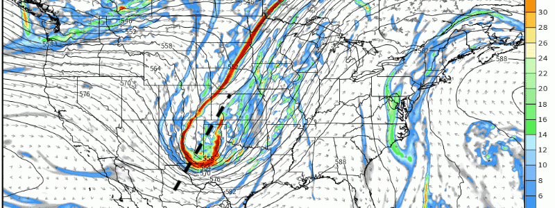
Uptick in Severe Weather This Week – Insight In Forecasting!
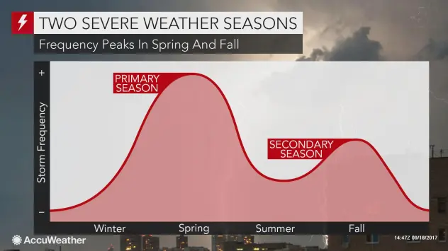
As we continue to transition closer to winter and further from summer, we typically see relatively strong clashes of air masses as the polar jet streak dips from the higher latitudes while moisture and warmth return via Gulf lingers. This manifestation is what supplies ingredients for severe weather, and it’s this very reason why the season of Fall is coined as the “second severe season”. This graphic supplied via Accuweather is a very simplistic visualization showing this!
Today, lets dive into the general synoptic pattern and make our way down toward the boundary layer for mesoscale analysis as we start “big picture” and narrow down toward the bottom of the troposphere. This is how meteorologists forecast, and doing this analysis will help reveal the “top-down”approach and what forecasters/meteorologists look at!
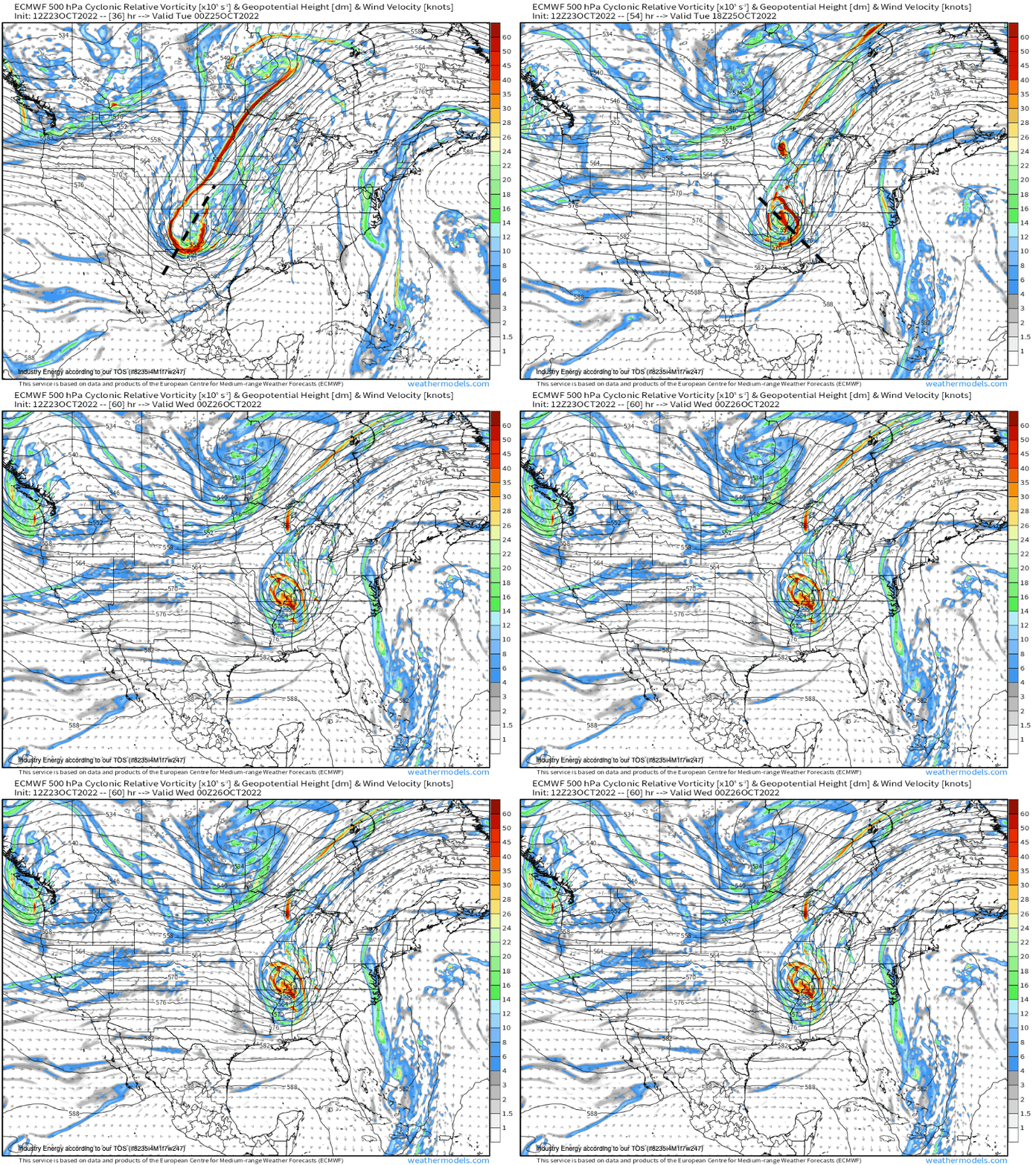
First, we look aloft. I’d typically start at 250-300mb because the upper-level jet can support divergence or convergence, however for this event, there’s really not much support from this level. So we progress to the mid levels at 500mb. This is a classic shortwave trough that begins out positively tilted and transitions to a negative tilt, supplying divergence out ahead and cyclonic vorticity advection (needed for large-scale ascent). We have this here, and it’s quite a robust looking trough that is occluding as it treks through the Deep South and into the Southeast. So we have a catalyst for lift, check!
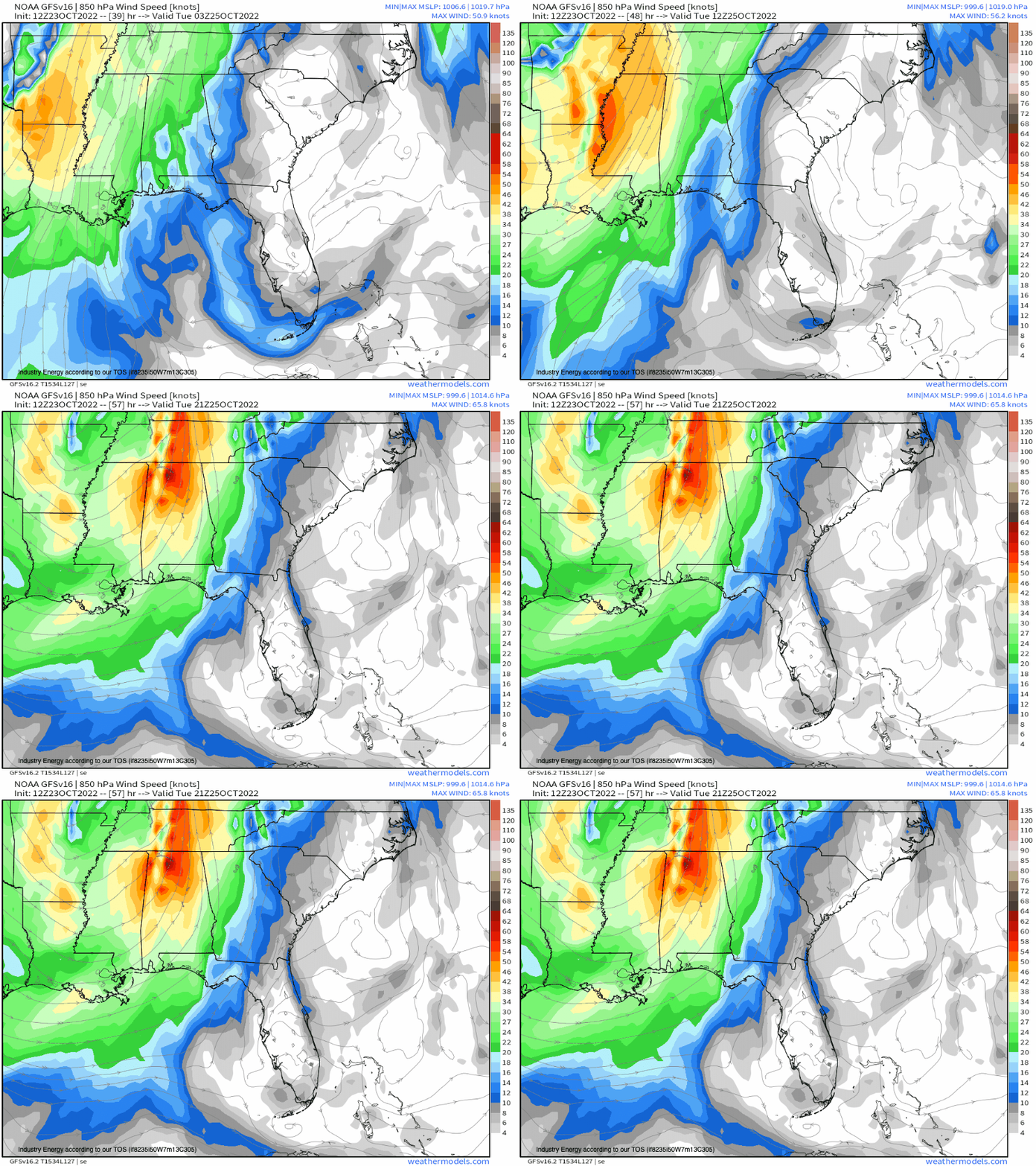
Next, we analyze below using 850/700mb for thermal advection and moisture advection. Below, we have a robust low level jet in the 850mb level ahead of the cold front and within the warm sector. The 850mb LLJ helps deliver wind shear and more importantly, moisture advection. Verbatim, we’re looking at a 30+ knot LLJ, with good veering from the surface-850mb along with warm air advection via the Gulf. So this supports in the very least, thunderstorm organization given the strong shear from the surface to 500mb! So check!
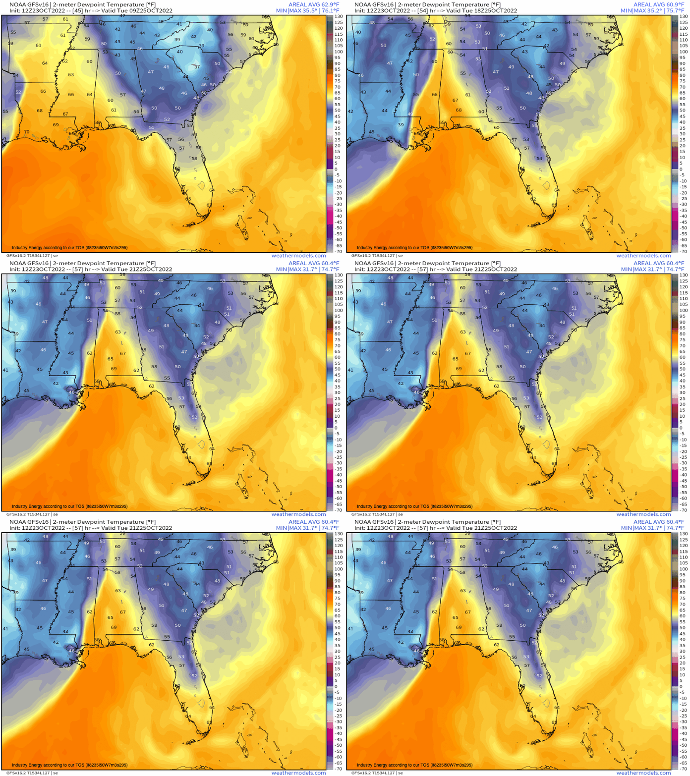
Next we look toward the surface now analyzing the mesoscale parameters like convergence or moisture advection in the boundary layer. Notice the surge of dew points greater than 60*F. Typically, you want to see dew points greater than 60*F, and we certainly have more than sufficient. Notice the sharp drop-off in dew points, which is indicative of the surging sharp cold front.
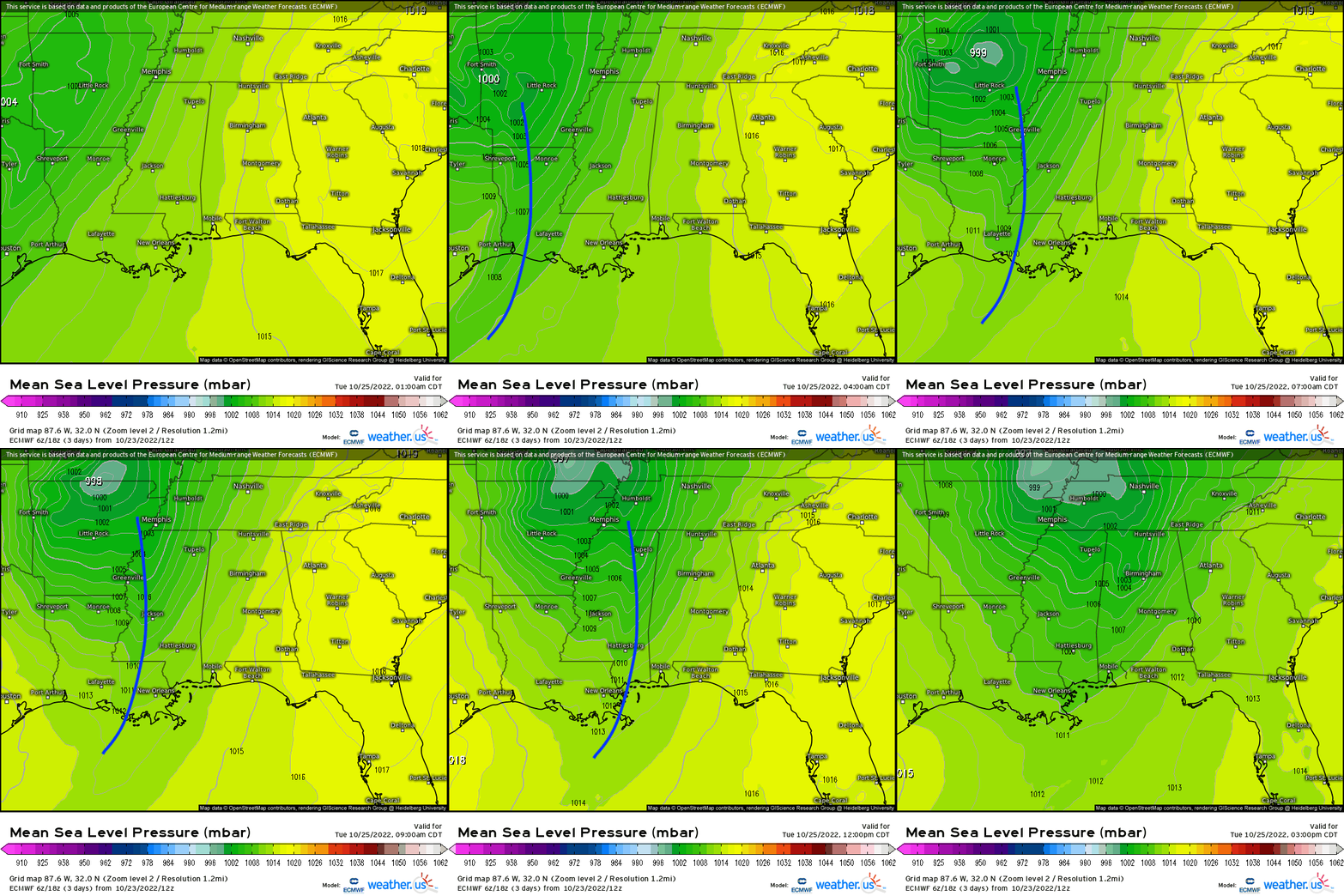
Next, we look for boundaries given we have large-scale forcing via trough, and now we have another synoptic forcing mechanism in the cold front. It’s ahead of the attendant surface low that tracks through the ArkLaTex region bringing a warm front and then a trailing cold front. It’s typically in the warm sector that we look for storms to intensify and build into thunderstorms depending on the environment of course. Below, we certainly have a strong forcing mechanism demarcated by the cold front. This is through Tuesday.
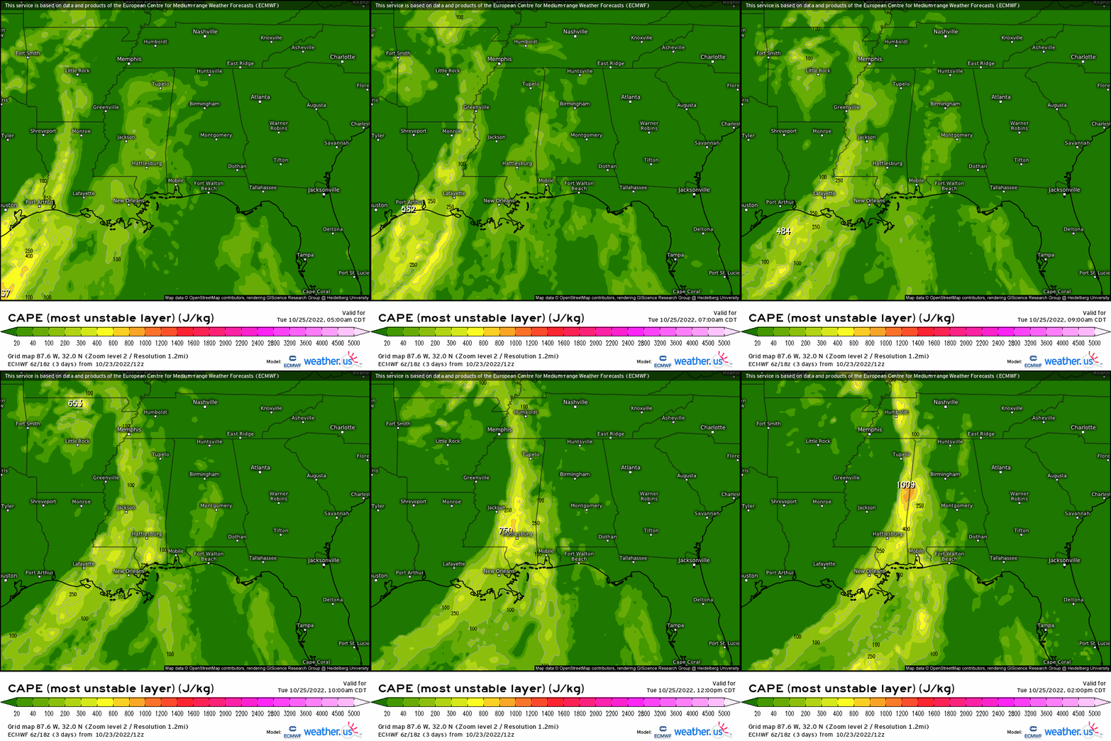
So we did a quick “checklist” from aloft toward the PBL, however, this is one caveat with this setup. We’re lacking instability to an extent despite strong forcing and shear. Shear determines storm type and instability determines storm strength. So while we can get thunderstorm organization, the fact that CAPE is lacking is what is hampering the overall setup that otherwise could be more concerning. Verbatim, CAPE won’t necessarily exceed 1000J/kg, even though sometimes in setups like these you don’t need that much, which is always uncertain in these setups and predictability can be sometimes low. Being that I experienced quite a bit of similar events down there while attending Mississippi State University, normal we’d see actually too much forcing where there was too much wind shear and cloud-cover especially, meaning instability was meager. This is considered a high shear/low CAPE setup, where the main hazards are damaging wind gusts and a non-zero risk for tornadoes.
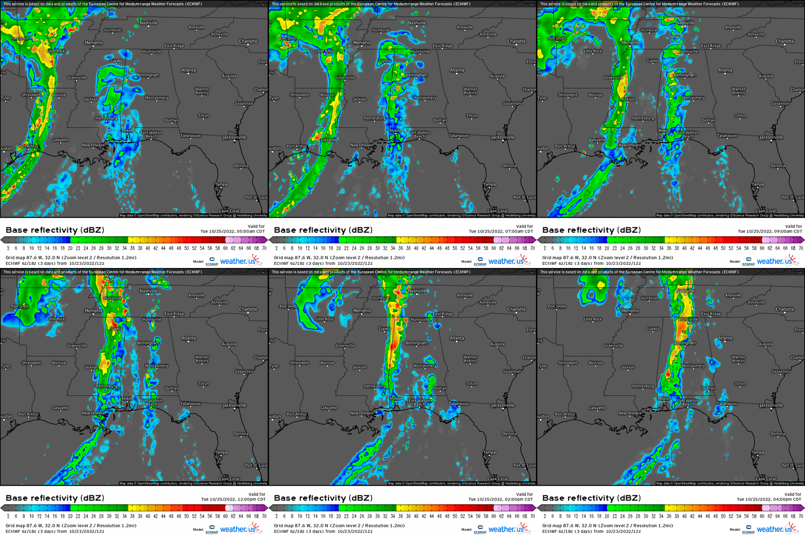
So putting it all together, it’ll likely look something like what the ECMWF has where there’s thunderstorms that fire along the cold front, congealing into a line segment moving quickly given the strong wind shear aloft.
Now there are certainly many parameters to look at when analyzing severe weather events, but sometimes you can save yourself the extra analysis by judging the environment and knowing whether this may be a more of a higher shear/low CAPE situation or vice-versa! Soundings especially help reveal the entire environment since it can significantly bolster confidence in severe weather setups, which is another powerful tool in our “arsenal”. Every setup is unique in its own way, so this was just a quick rundown of what forecasters and meteorologists such as myself looks for, along with meshing in some experience!


