Upslope Snow: How the South Gets a Winter Wonderland
Good Monday morning!
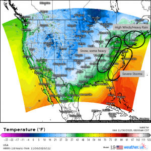
Well, the event we had been talking about all last week is finally here and underway and brings with it a multitude of hazards.
Severe storms containing damaging winds and a few tornadoes may be found in the warm sector of the cyclone. High winds and heavy rain will inundate the New England coast. Heavy snow is forecast in parts of the Mid-west, Great Lakes, and Appalachians.
Jacob published two very detailed blogs over the weekend expounding on these threats so today I’m going to focus on only a very small part of it. If you’re interested in reading more about the severe threat, you can find that blog here. If you’re interested in the details of the winter weather, you can find that one here.
I’m going to focus on the south’s only area of significant snow: The Smokies (partly because this is my home and I am extremely familiar with how the terrain influences weather processes and partly because I love this kind of event). Per local forecasts, the highest elevations of the Smokies are expecting snow totals of generally 4 to 8 inches with some places, mainly the highest peaks, having the possibility of seeing up to 12 inches.
But why, exactly, would this area see so much snow when the surrounding areas will see next to nothing? Well, that answer is two-fold.
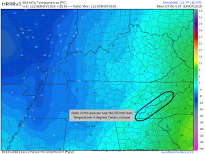
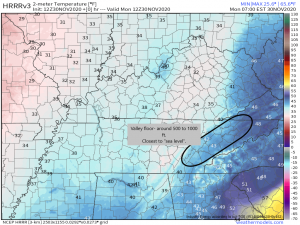
Firstly: elevation. The Smoky Mountains have a variety of peaks that range in height from ~3,000 ft all the way up to it’s tallest peak, Clingman’s Dome, which comes in at a whopping 6,643 ft and is the second highest peak east of the Mississippi, losing out only to Mt. Mitchell (in the Blue Ridge of North Carolina) at 6,684 ft. In normal conditions, as long as an inversion isn’t present, the higher the elevation = the lower the temperature. Elevation puts a decent portion of these mountains at, near, or even higher than the 850 mb level (~5000 ft). So for comparison, lets look at surface temperatures in the valley vs 850 mb temperatures.
While the valley floor is still well above freezing at ~43 degrees currently, the elevations of the Smokies have already dropped to or below freezing which is more than sufficient for the rain to change over to snow. The mountains will spend at least 8 more hours below freezing than the valley will which gives them a prolonged window of time for snow to form, fall, and accumulate.
The second reason for the higher totals, at least in the case of this particular system, is something an called Upslope Snow Event. I’m sure some of you are wondering what that is. Don’t worry, I’m about to explain.
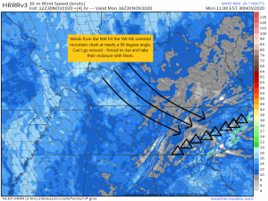
An upslope snow event happens when the winds hit the western slopes of a mountain chain at a favorable angle and are forced to rise over the mountains, bringing any moisture in the area with them. As they ascend, the air is cooled and reaches the dew point, causing clouds to form and eventually (frozen) precipitation to fall.
For the Smokies, the favorable direction for the flow to come from is the NW, since the mountain chain itself is oriented in a SW to NE direction. As long as the wind is coming out of the NW, it will continue to lift whatever moisture is available in the area into the mountains where, once it reaches the dew point, it will snow. This process will continue until the winds change or there is no more available moisture.
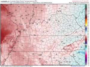
As you can see from the above map, the dew points in the mountains sit around freezing, give or take a degree. As we saw earlier with the temperature map, the mountains are already at freezing in the higher terrain, which means that any moisture being lifted right now is likely falling as snow. Down in the valley, however, the dew point is 34 degrees where as the air temperature is 42 degrees or so. The ~8 degree difference between the two means not only is there likely not any precipitation falling currently, but if there is, it is falling as rain.
And that right there is how the mountains end up with significantly more snowfall than the surrounding areas.
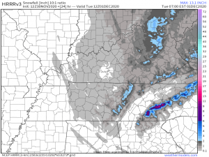
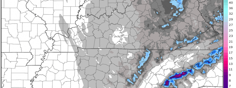
We can see this process at work when we look at the current guidance for total snowfall. The valleys see little to absolutely no accumulation while the mountains receive up to 12 inches. They will undoubtedly be a veritable winter wonderland by this time tomorrow.
Stay tuned to our blog and twitter feed for updates throughout the day on all modes of weather from this system.
Have a wonderful day!!
