Update on Tropical Storm Ian Plus a Look Ahead At The Tropics Heading Into October!
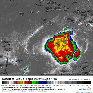
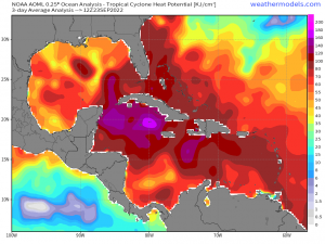
Tropical Storm Ian currently spinning across the southern Caribbean and trekking westward and will eventually turn W/NW before turning NW by Monday, barring significant changes or deviations. It’s beginning to enter into an environment that is favorable for intensification – denoted by increased organization of the cyclone, cooling cloud tops (i.e. darker/brighter colors mean clouds are getting higher into troposphere), and one thing to note is the cirrus outflow radially increasing. The latter implies shear is lowering. An environment with very low vertical wind shear will continue through today and into tomorrow, and what’s worrisome is that it’s approaching some of the warmest sea surface temperatures across the entire globe (outside the western pacific)! Fuel will be absolutely no issue for this hurricane to “tap” into.
In terms of tropical cyclone heat potential, it’s analogous to CAPE in terms of severe weather. Higher CAPE normally means an updraft can grow rapidly and intensity substantially. Here, we’re talking very high values of “CAPE”, just in a tropical meteorology context. Speaking of CAPE, Ian will be entering into an unstable and very moist environment, again emphasizing the point of how favorable for intensification is this weekend and into next week!
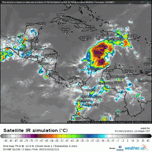
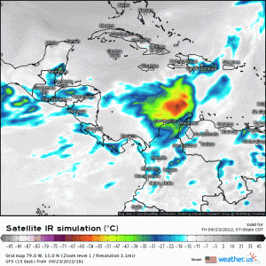
What’s uncertain, however, is beyond day 3. Below are two animations from the GFS and ECMWF that display the future development of Ian through the weekend and into early next week. As one can see, both are fairly similar regarding the rapid intensification and strengthening as it approaches Cuba; however, it should be noted that the track as it reaches the northern portion of the Caribbean still is one uncertainty among others of course. This could have implications once it reaches Cuba, if it does, and how it further tracks once it gets into the gulf – if it does. Now the latter appears to be more likely given the most recent data, and now it’s forecasted to become a major hurricane (e.g. Category 3) by midweek next week once it emerges in the Gulf after passing through Cuba.
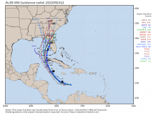
Below are the most recent progged tracks from deterministic and ensembles numerical weather models, showing overall a solid cross-track consensus; however, please keep in mind that just because there is good agreement in tracks doesn’t mean it’s correct! We need to monitor how the cyclone moves in the next 12-24 hours across the Caribbean as it could still track westward toward the Yucatan.
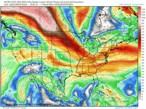
Another major uncertainty and impediments are what is ahead for Ian in terms of steering flow and what it does, if it emerges into the Gulf. A large-scale trough will dig into the Southeast, and will be largely responsible in dictating the cyclone’s track. It also will be imparting dry air and shear. We won’t necessarily know how this could factor into Ian’s ultimate track toward the U.S. IF it does indeed reach that warning threshold where the U.S. mainland becomes a concerning target – especially Florida. Ian could theoretically miss the trough connection, and then get stuck in the Gulf. The other option is of course hitting the Gulf coast states somewhere, with Florida as of now being a main target. However, anywhere from LA to FL is at risk!
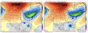
Here are two main differences between the ECMWF and the GFS for instance, that is a big uncertainty in the coming days: The depth and progression of the long wave trough. We won’t know how deep it’ll dig until we get closer because its location and how amplified it is has major implications in Ian’s track! Will it be deeper like the European model or more progressive like the GFS? We shall monitor this in the coming days!
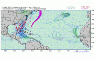
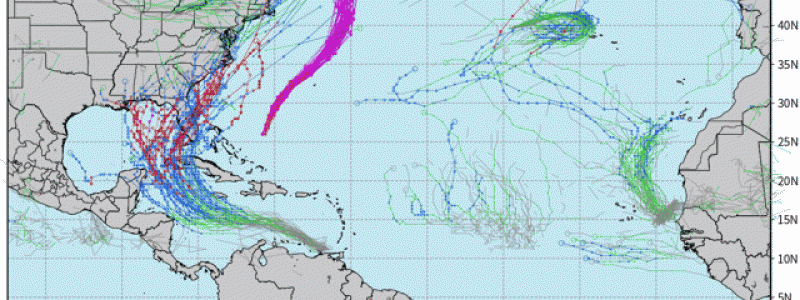
We’ll be monitoring this in the coming days of course! Now, the Atlantic season has certainly picked up in terms of activity over the last week. It appears we may see some waves emerge off Africa in the coming 7-14 days, although as of now nothing eye-popping aside from what we’re dealing with now! What has to be watched as we transition later into the season is development in the Caribbean and southern Gulf. Below displays tracks modeled out to mid-October via EPS
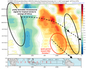
Looking ahead utilizing a medium-long range forecasting approach through hovmollers, the intraseasonal tropical state appears favorable through early-mid October via kelvin waves (i.e. CCKW’s) passing now over Africa, therefore yielding a favorable environment for tropical waves to moisten and propagate into the Eastern Atlantic. Thereafter, we may deal with a quiet period as verbatim, an unfavorable background state will occur at least in terms of Cape Verde waves. What’ll have to be closely watched are developments in the aforementioned places such as the Gulf and Caribbean.
We have a busy upcoming week ahead of us tracking Ian and quite the busy Atlantic, so stay tuned!
