Unraveling The Block
As we slide into the weekend ahead, we’ll finally, finally begin to see some movement in what has been a very stagnant flow. As the things get moving again, a “split flow” will aid in producing an active period, with widespread severe weather chances returning.
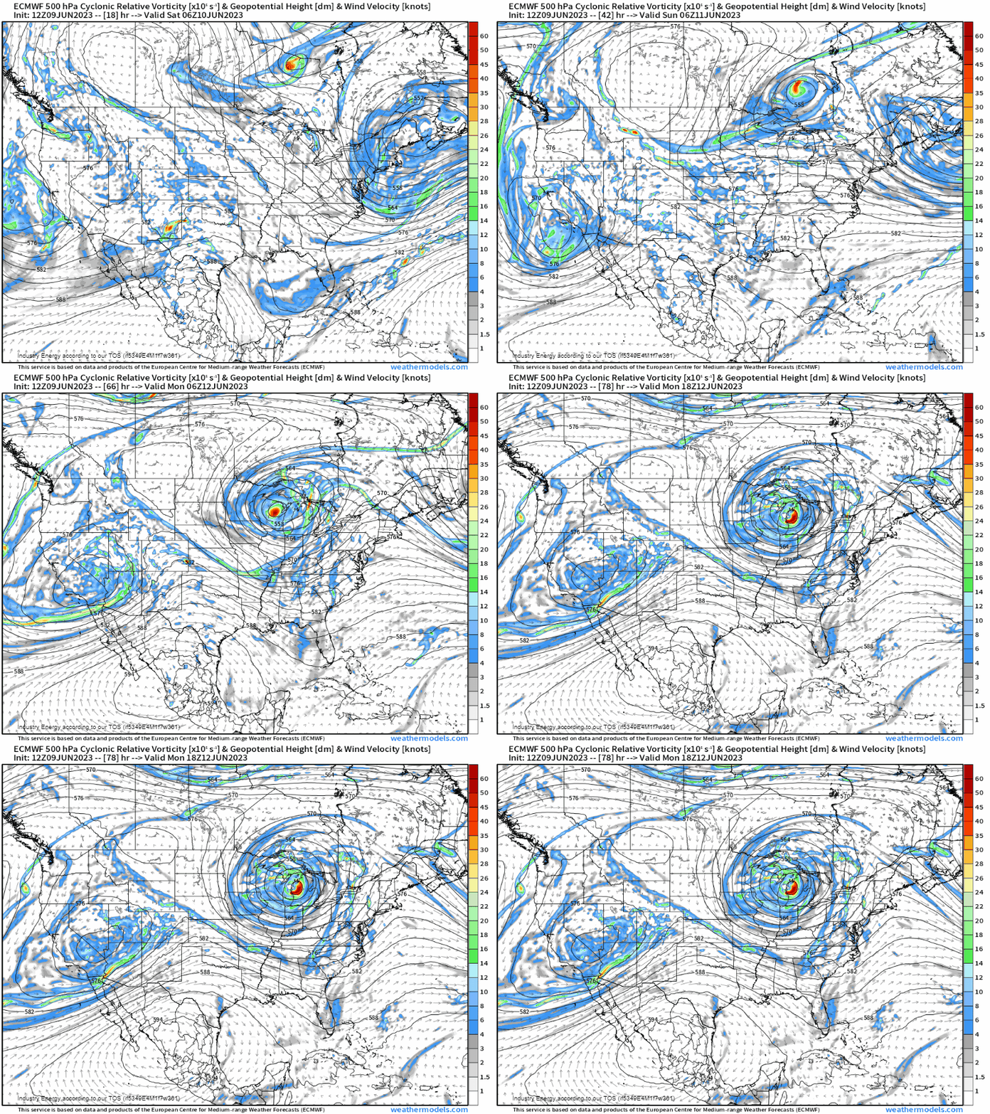
If we look at the gif above, we can clearly see a few different pieces at work here.
- A large upper low off the southwest coast.
- A ridge of high pressure over the far northern US/southern Canada.
- A surface trough over the Southern High Plains.
- A low just north of the Great Lakes region.
- A large upper low over the Northeast US.
As we kick off Saturday, the weak surface trough over the Southern High Plains and a cold front originating from the disturbance north of the Great Lakes will be our primary focus
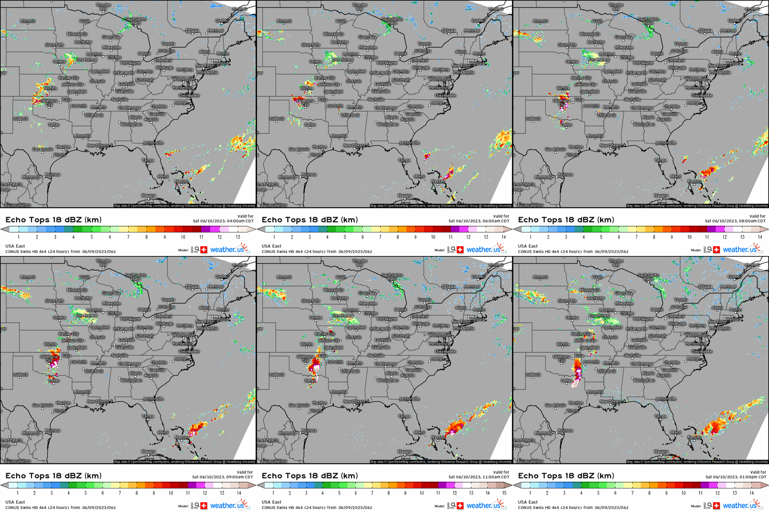
Storms will likely be ongoing from the previous night (tonight, Friday) around dawn Saturday across the Southern High Plains. As the sun rises and energy builds, these storms should intensify as they enter a more favorable atmosphere during the afternoon hours.
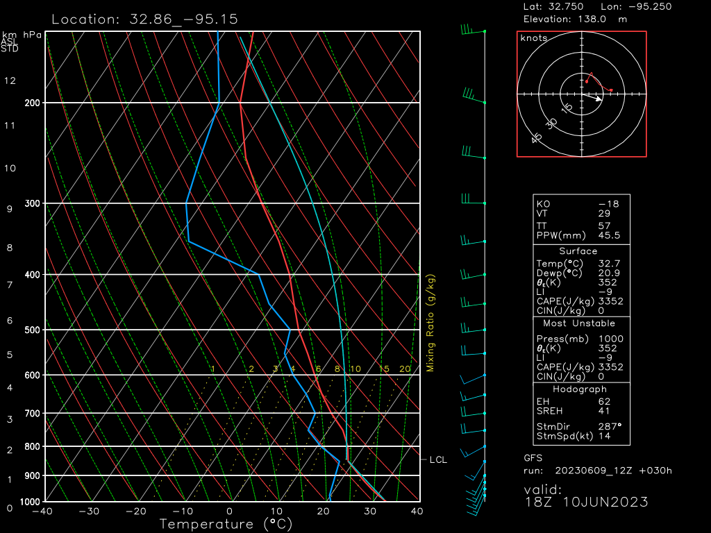
Steep lapse rates and ample instability point toward a large hail threat, especially in the early stages of this event. Additionally, dry air in the mid-levels points toward a damaging wind threat, especially as the storms become more linear.
Though shear doesn’t look too impressive, a tornado or two can’t be totally ruled out. Tornado potential will likely depend heavily on mesoscale details that won’t be worked out until the morning hours AND be confined to the north/central Texas region where storms have the potential to begin as supercells.
As for the cold front in the Northern Plains I mentioned: a much more isolated risk of severe weather will exist along this front for the North/Central Plains.
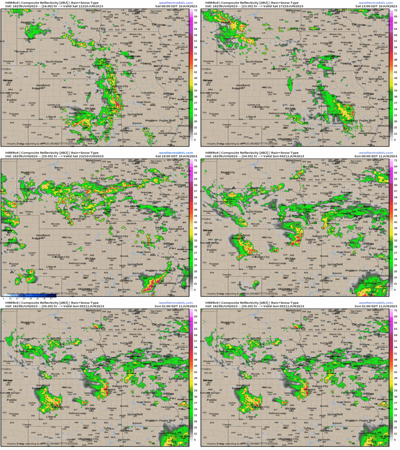
If any of these storms should become severe, they will carry a lower-end hail and damaging wind threat.
As Sunday dawns, our main player will likely be the low moving southward over the Great Lakes Region and its attendant cold front.
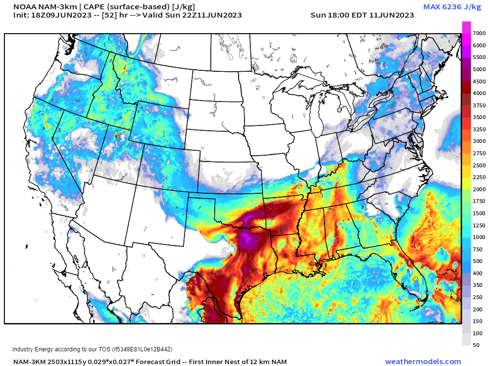
Daytime heating ahead of a southward-sagging frontal boundary should provide enough energy for scattered severe storms, especially in the Mid-South region and eastward into the Tennessee and lower Ohio Valley regions
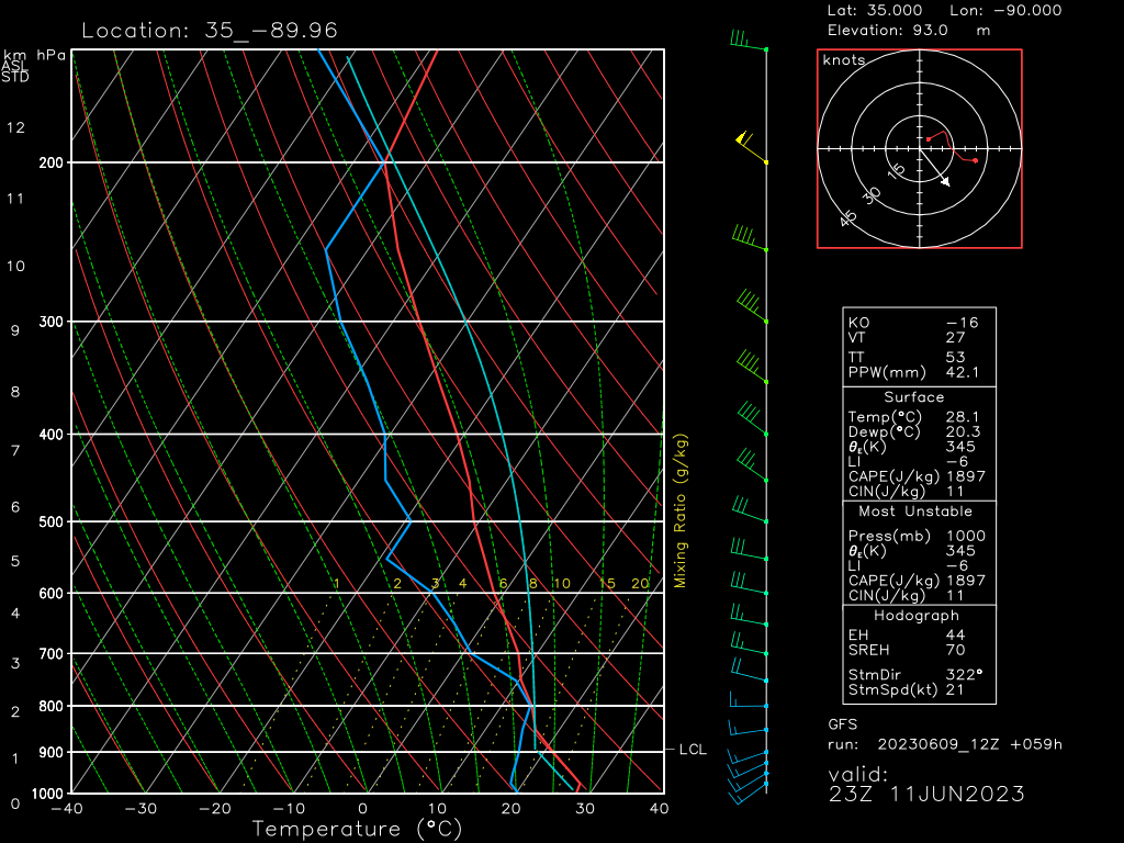
With dry air and 30 kt+ winds available aloft, damaging winds seem to be the main threat at the moment. Weak speed shear and lack of directional shear should keep a tornado threat from materializing. However, some small hail may be possible in stronger storms.
Regardless of whether or not storms in your area become severe, remain weather aware in any of your outdoor activities as a lightning will undoubtedly accompany these storms.
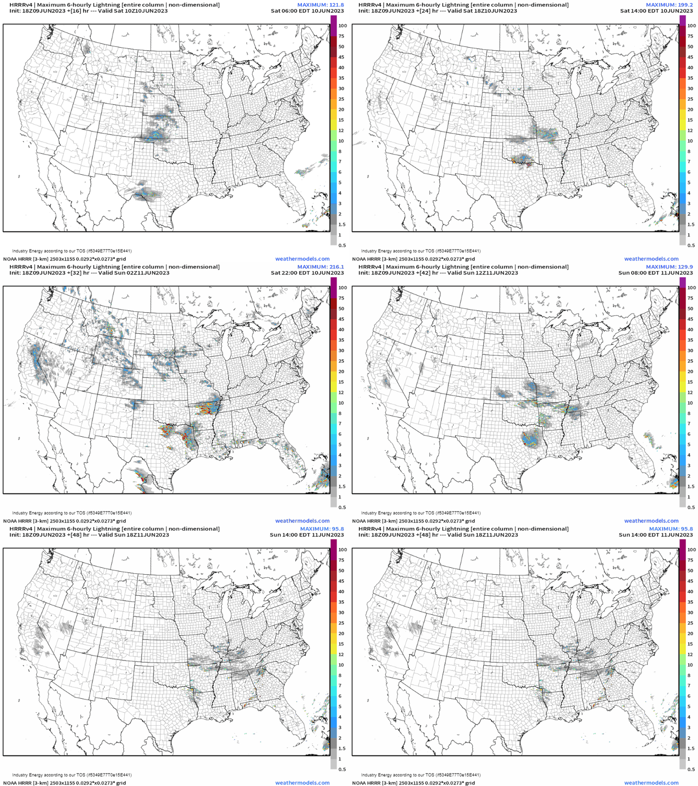
Remember, if you’re close enough to hear thunder, you’re close enough to be struck by lightning. This is very important to remember in the summer months when many spend a lot of time outdoors.
Lastly, heavy rain from these storms could introduce flash flooding issues.
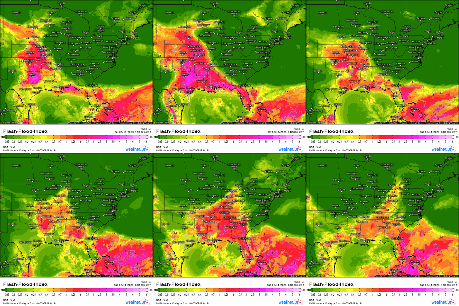
If you’re traveling this weekend, be aware of any evolving situations and remember to never drive through flood waters as the road could be washed out underneath.
We’ll be looking at big changes next week as significant heat could materialize for the Southern US. More on that early next week!


Great job (as always), Meghan!
Just a little comment related to the forecasted soundings…..can you highlight (graphically circle) the specifics in the soundings that you are writing about in the article? Lapse rates, dry air, and 30+ kts might be easy for some, but still not everyone is an educated Met when reading the blogs.
Keep up the great work!