Uncertainties Regarding How A Pacific Northwest Trough May Impact Thanksgiving Weather
If you live in the Northwestern part of the US, you may have noticed that the air quality hasn’t been the greatest over the last few days.
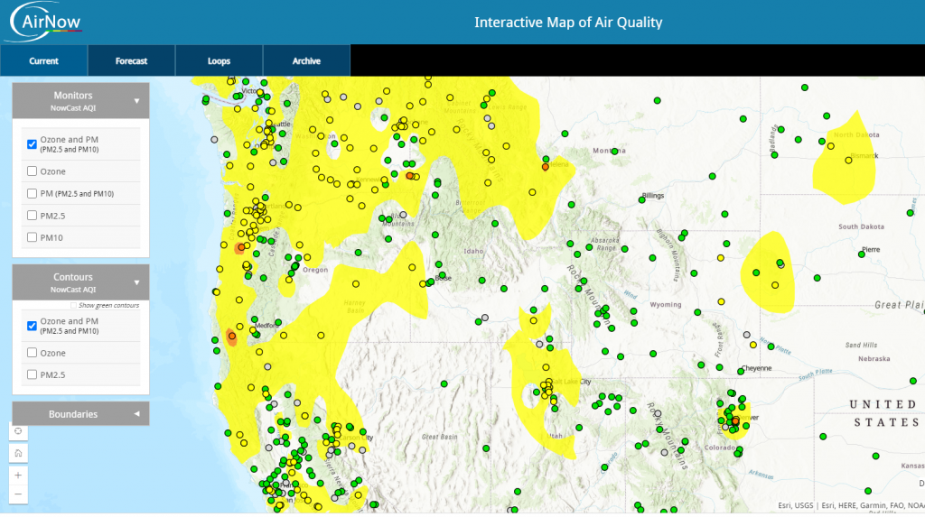
An extended period of ridging has lead to a stagnant air mass. The light winds associated with ridging haven’t been enough to clear the contaminants out of the air either horizontally or vertically, so they just linger.
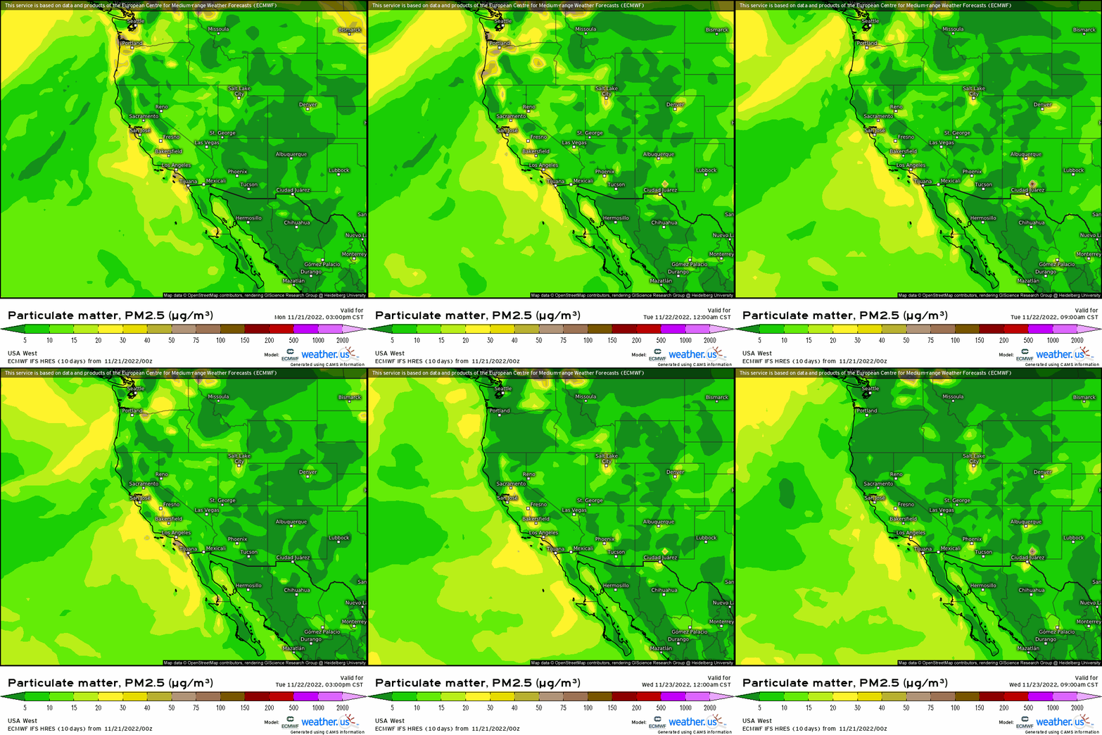
And, unfortunately, this will be the case through tomorrow evening. At least until a trough enters the picture.
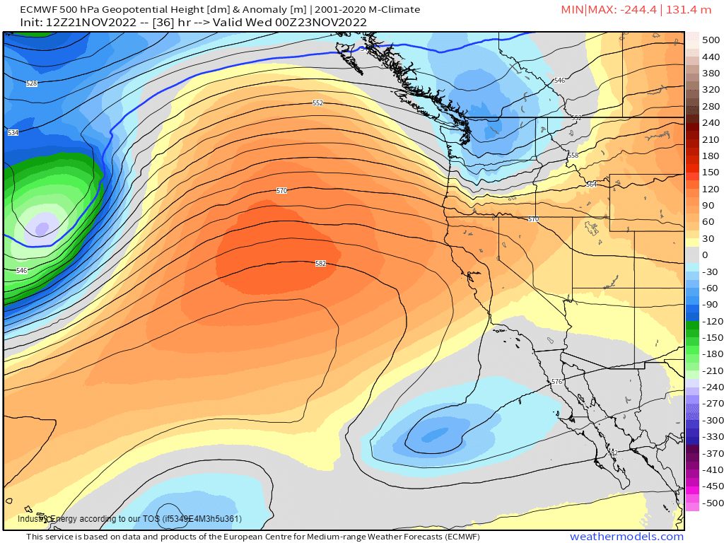
Around the Tuesday afternoon timeframe, a trough will swing ashore in the Pacific Northwest. The wind shift and increase in wind speed will help to clear the air of pollutants. Additionally, it will provide a shot of rain (and higher elevation snow) for this region – which has been dry in recent days.

While it isn’t an incredible event by any means, it’ll provide some limited moisture to the valleys and additional snow pack to the Northern Cascades and Northern Rockies.
But this trough, while nothing big initially, will become an important player in the weather downstream as we slide into the holiday and following weekend. We’ll be talking a lot about this feature over the next few blogs, especially since model consensus hasn’t been great thus far.
Although, it’s beginning to come into agreement.
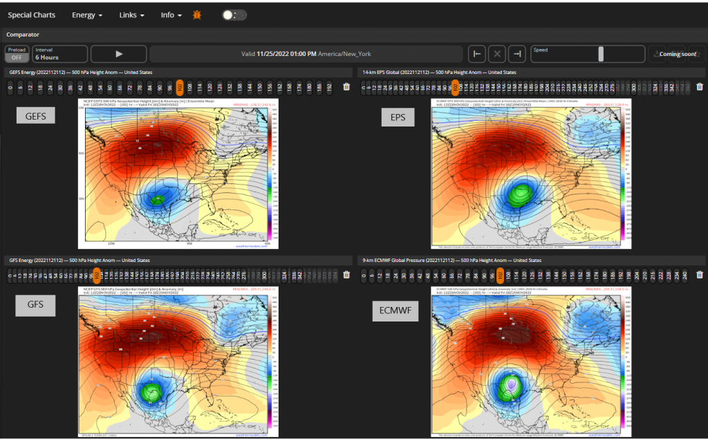
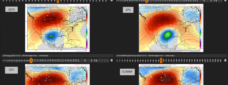
Above are the 12z runs of the GEFS, EPS, GFS, and ECMWF. The ECMWF had, up until now, remained a bit of an outlier by way of producing a more progressive trough rather than what appears to be a cut-off low like the other global models. However, it seems to be caving to the majority solution.
Is it a short-term trend? Is it the correct solution? Jury is still out on that one. Sometimes a majority solution isn’t always the correct one. We’ll know more once the energy associated with the trough “comes ashore” tomorrow and that data can be sampled and fed into the models.
One thing is for sure, however. Whichever solution ends up being the correct one – trough vs cut-off low – the sensible weather will be quite different.
Cut off:
- Slower, more drawn-out timing.
- Possibility of severe weather as a (relatively more) prolonged period of moisture return is allowed to materialize.
- No dip in the jet means no access to arctic air – event will likely be rain for everyone except naturally colder high elevations and perhaps some of the interior NE.
- Warmer temperatures for those outside of the upper low as arctic air stays locked up north.
Trough
- Faster progression. In and out more quickly.
- Severe weather unlikely due to no quality moisture return.
- Dip in the jet would provide arctic air for some snowfall (where depends highly on track and timing) and colder temperatures overall.
So, as you can see, this forecast is still up in the air a bit. The ECMWF caving to the rest of the global models today on the 12z run was a step toward consensus, but we’ll need to monitor the trends – especially once the trough is ashore.
Expect to hear much more on this topic throughout the week!


