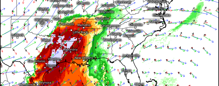
Two Days of Severe Weather Ahead
A quick look at water vapor imagery this morning shows us a positively-tilted trough moving eastward with moisture flowing northward out in front of it.
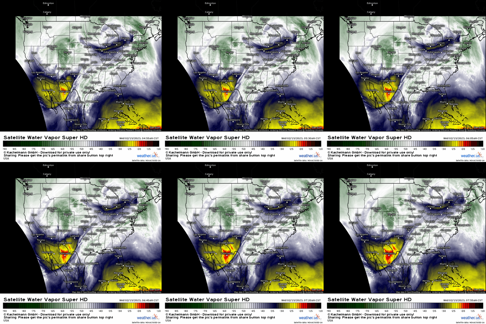
The multi-day severe threat we’ve been mentioning in our blogs and twitter posts over the last week is on it’s way to materializing later today.
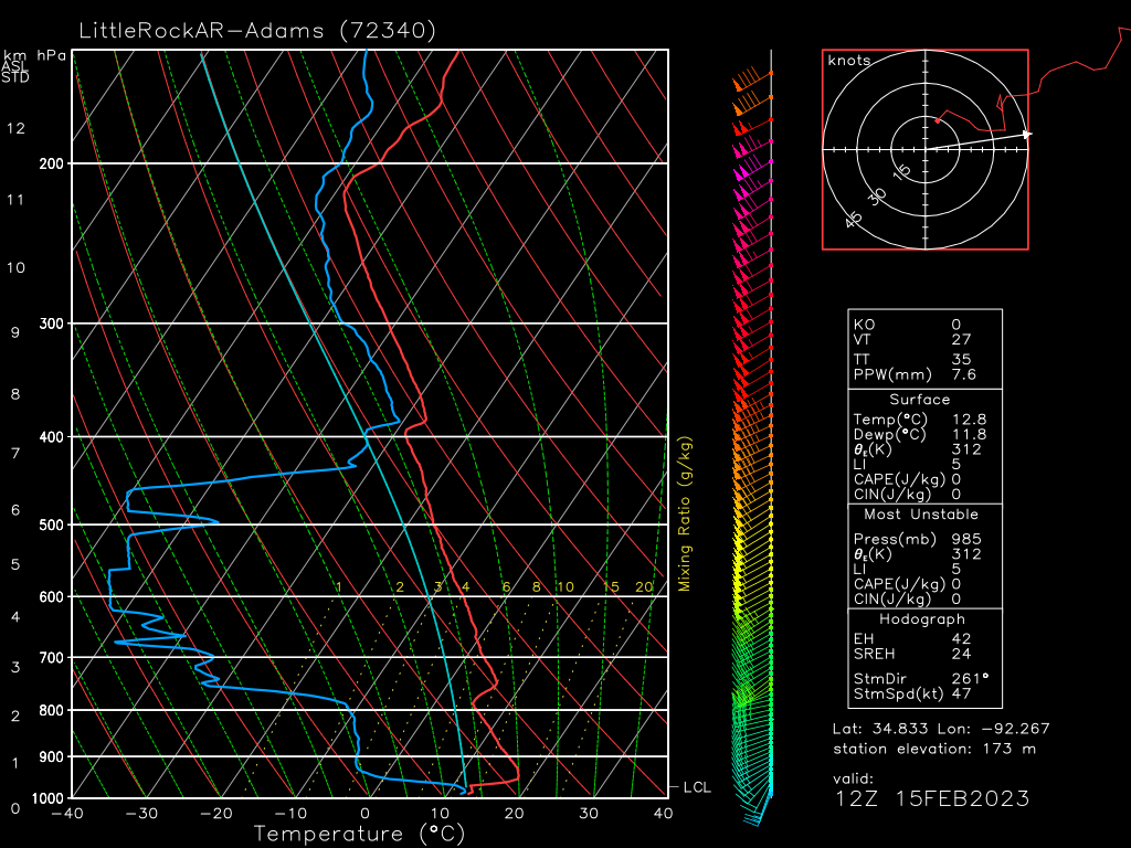
The observed 12Z sounding from Little Rock, Arkansas – which is within the “bullseye” for severe weather today – shows a heavily capped atmosphere.
In the hours since this sounding, moisture return has begun over the region and we are well on our way to eroding that cap. Additionally, broken cloud cover is in place over the region. Day-time heating in addition to moisture advection should contribute to the erosion of the aforementioned cap.
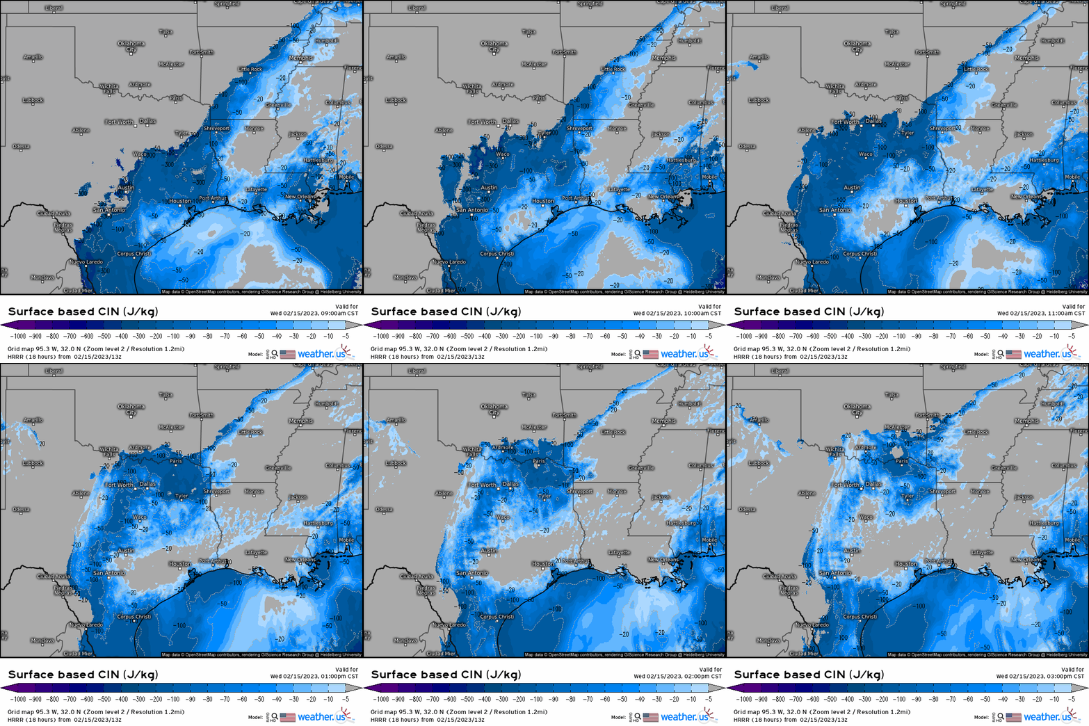
Modeling suggests that any significant capping will erode by the late afternoon hours – just in time for our event to kick off.
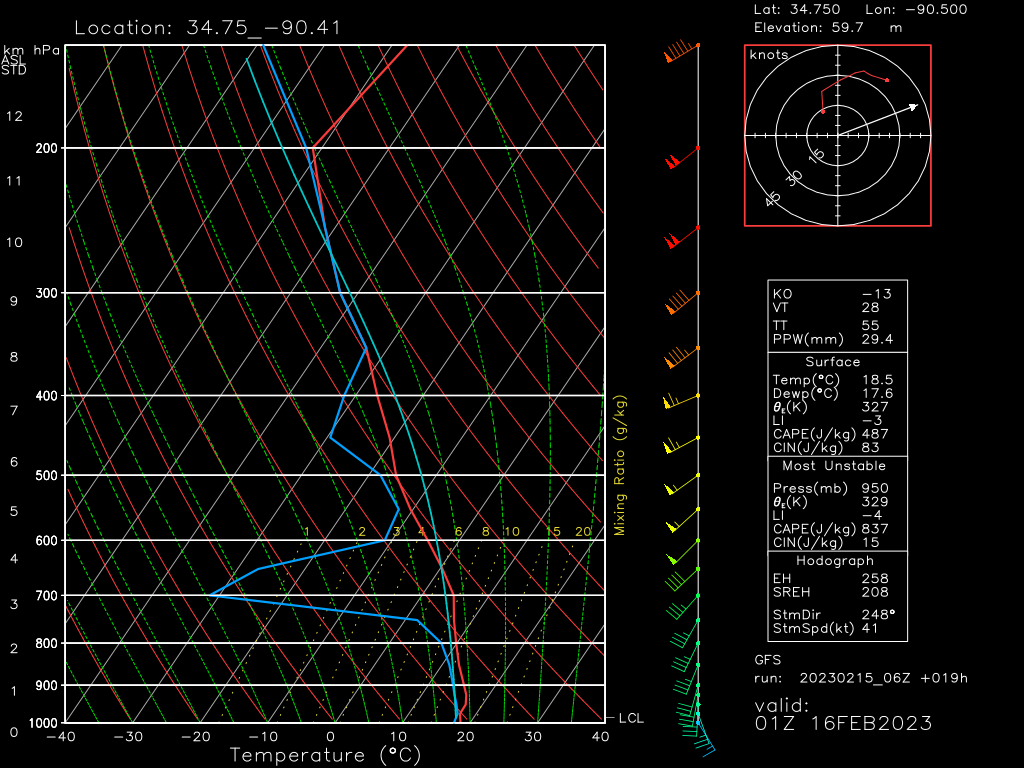
By the evening hours, forecasted soundings from the Mississippi River Valley region show an atmosphere that could mean business.
- Winds back from the SE, giving excellent low-level directional shear.
- Speed shear is adequate – roughly 40 kts from surface to 6 km which is enough to organize supercells.
- Mid-level dry air is available to pose a damaging wind risk.
- CAPE is adequate to power updrafts (May be depicted on the lower end due to the resolution of the model)
Today’s severe threat will come in two waves:
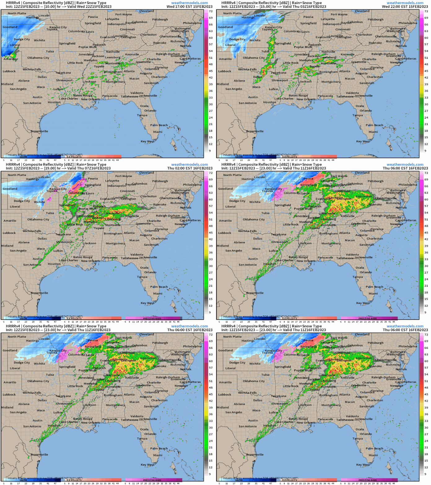
First, convection should fire this afternoon as a dryline pushes east over East/Central Texas. The main threat posed by this round of convection will be wind damage and large hail. A tornado threat exists as well, but is on the lower end due to lack-luster directional shear. Convection is expected to evolve quickly into a linear mode.
Second, a more potent threat may materialize across the Mid-South late afternoon/early evening as the low-level jet cranks up and a warm front lifts across the region. Uncertainty remains in development of supercells in the open warm sector during the afternoon/evening hours, but if these storms develop as depicted by the above HRRR, they have the potential to be dangerous.
Otherwise, storms along the warm front in the evening/overnight hours also have the potential to be dangerous. As we saw on the forecasted sounding above, the environment looks to have potential for rough weather.

Storms will weaken toward the early morning hours as they encounter more stable air. However, we’ll face a renewed, more widespread threat for Thursday afternoon onward.

By the afternoon, modeling shows a corridor of dewpoints in the 60s/70s stretching from the Gulf Coast to the Ohio River Valley.
As the cold front pushes east throughout the day, severe weather will be possible as re-developing storms encounter a more favorable environment.
All hazards are on the table for this corridor. Damaging winds are the most likely threat overall. However, a significant tornado risk exists for the region around the MS/AL border where better moisture, more instability, and better shear will be located.
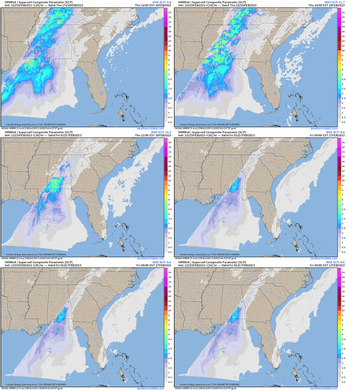
As heating reaches its peak, discrete supercell development is possible. We’ll need to monitor this potential and revisit this forecast in the morning.
Elsewhere, as mentioned above, damaging winds will be the main threat on Thursday. However, a few tornadoes remain possible as far north as the Ohio Valley within that corridor of higher dewpoints.
Take Action:
- Dangerous weather is possible both today and tomorrow. Monitor the forecast evolution for your area. Any information more than 3 hours old is out-of-date – seek the latest information.
- Have your weather radios ready to go. Have at least one other way to receive warnings, including one that will wake you as part of this threat will last into the overnight period.
- Know your plan to shelter and be ready to use it if necessary. Given the risk for damaging winds, shelter for severe thunderstorm warnings as you would for a tornado warning.
- If you must be out and about during the period when severe weather is likely for your region, know where you can go to shelter if it becomes necessary.
We’ll keep you updated as the event unfolds today and tomorrow. Stay safe!


