Tropical Troubles
Summer is now officially here and we’re talking the tropics in today’s blog.

As you’ve likely heard, we have one named storm currently active in the Atlantic Basin: Tropical Storm Bret. Additionally, trailing behind Bret, we have a disturbance dubbed Invest 93L. Let’s tackle them individually below.
Tropical Storm Bret
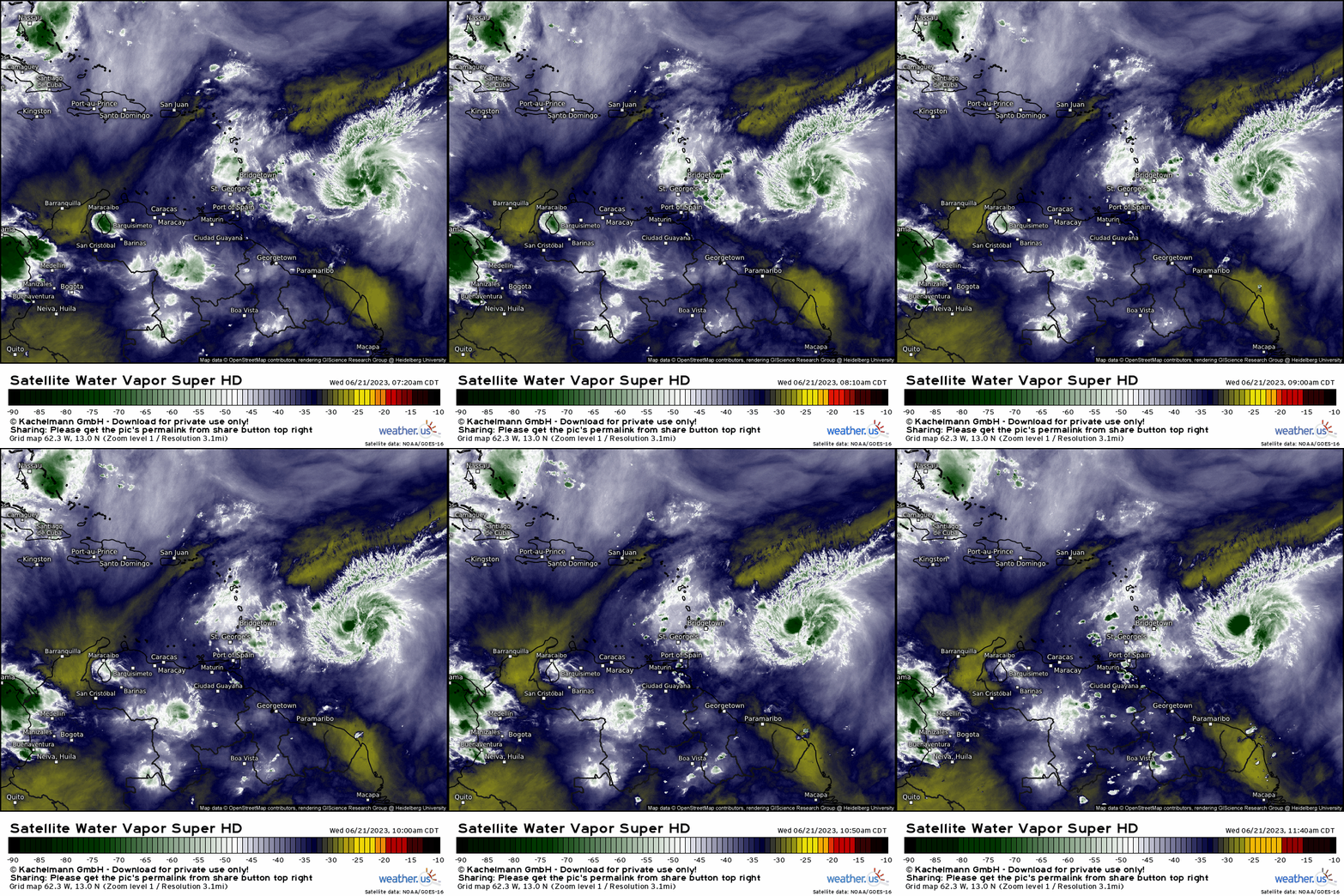
Bret was originally forecast to strengthen into a hurricane as it approached the Lesser Antilles and the Caribbean. As of the latest official forecast, that is no longer the case. Bret is now forecast to remain a tropical storm before dissipating in the Caribbean sometime this weekend.
Why the change? Despite above average water temperatures fueling the development of these tropical waves, several environmental factors are working against the TC.
As you can see on the animation above, Bret is struggling against some drier air, especially to its north. It has been unable to sustain deep convection and fully wrap it around it’s core, though it seems to be firing some as we move into this afternoon.
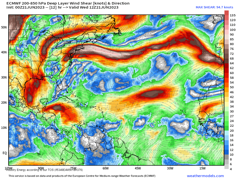
Bret is also struggling with westerly shear, mainly on its north side. If you’ll look back at water vapor imagery, the shear can be seen in the way the clouds are blown eastward on the aforementioned northern side.
Unfortunately for Bret, even more shear awaits it further into the Western Caribbean. This is likely why the TC is forecast to dissipate this weekend; shear is expected to tear it apart.
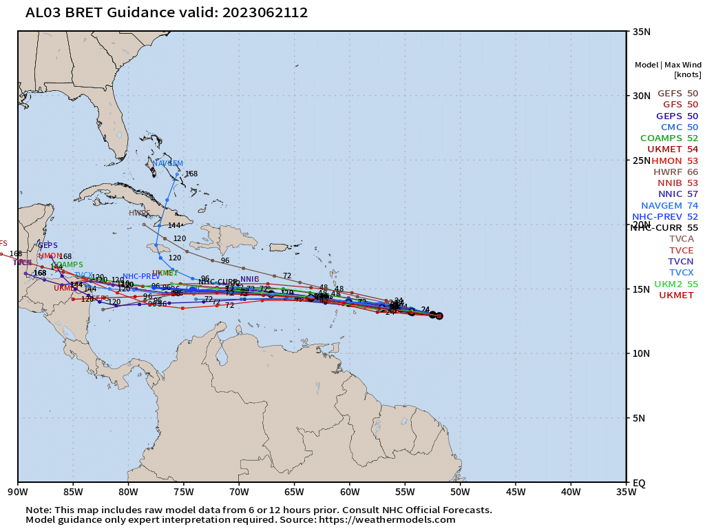
As Bret will most likely remain below hurricane status and therefore on the weaker side, it is forecast to continue chugging westward over the Lesser Antilles and into the open water of the Caribbean.
As we’ve learned in the past, weak storms don’t equate to little to no impact. Heavy rain, tropical storm force winds, storm surge, and dangerous seas will batter the Lesser Antilles as the storm crosses into the Caribbean late Thursday/early Friday. Some further impacts could be felt on the various islands of the Caribbean, but severity of those impacts will depend on the size of the TC.
Invest 93L
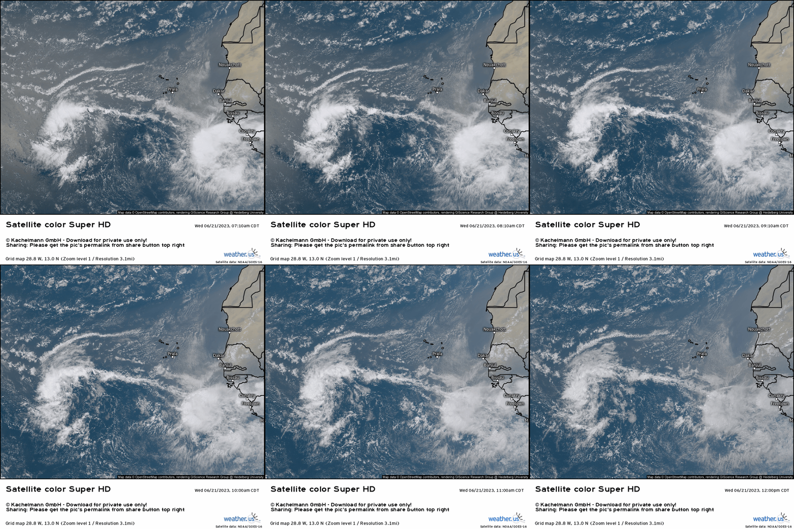
Invest 93L is just about halfway across the MDR now and still has a high chance of development over the next 48 hours/7 days.
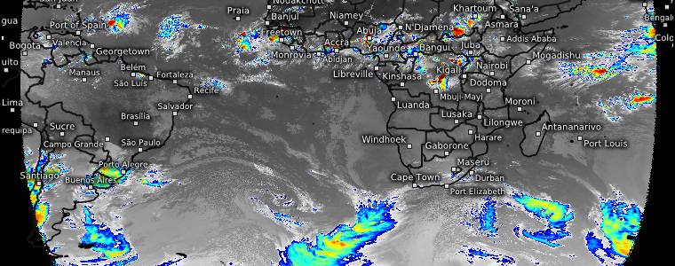
Sustained convection has also been hard to come by for this disturbance, as you can see on the visible (and cloud tops at the beginning of the blog) satellite loop. Dry air and shear are working on 93L a bit as well.
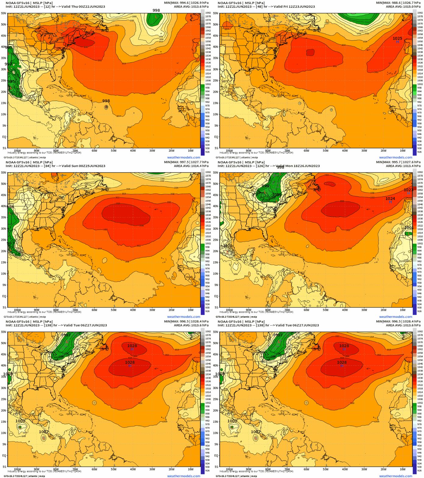
Unlike Bret, this disturbance is not forecast to continue westward into the Caribbean. As the Bermuda-Azores High retreats slightly east this weekend, 93L should “feel” the weakness and turn NNW, escaping into open ocean.
Will it then become a threat to the US East Coast? With low pressure forecast to be over much of the northern half of the coast, it seems unlikely at the moment.
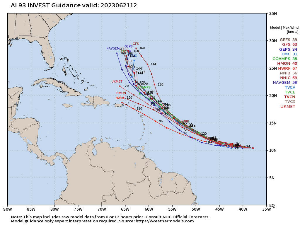
Still, with no defined center apparent yet and therefore no actual center to track, we’ll have to at least keep one eye on it’s development and trends. Remember, without a defined center, models and the tracks they generate will jump around a bit from run to run.
Behind 93L, another fairly healthy-looking wave is emerging from the African coast.
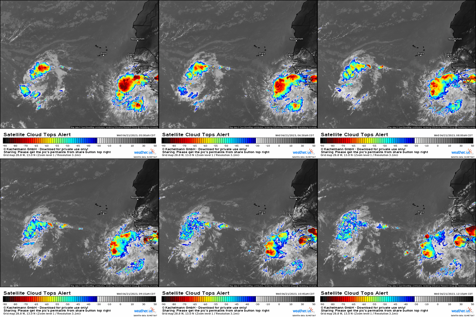
Will this one be able to develop as well? Only time will tell.
As I mentioned earlier, though waters are more than warm enough to facilitate development of these waves, shear and dry air still may stand in the way.
We’ll keep you updated on the state of the tropics as needed!


