Traveling This Holiday? Outlook Heading into Thanksgiving & Holiday Overview!
Today and tomorrow will feature over 50 million people that’ll be traveling for Thanksgiving this week (can you even believe it?!); that is quite a lot of people! Of course, it always comes down to weather and when is the “ideal” time to travel, aside from work or personal-related concerns. This week, we’re looking at a rather “tranquil” weather-pattern from a very broad, generic overview from coast-to-coast!
Today and Wednesday:
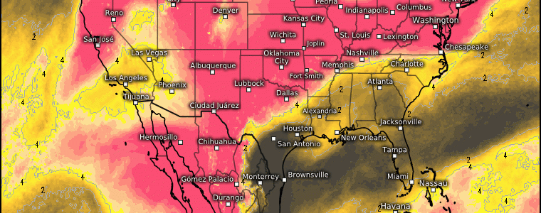
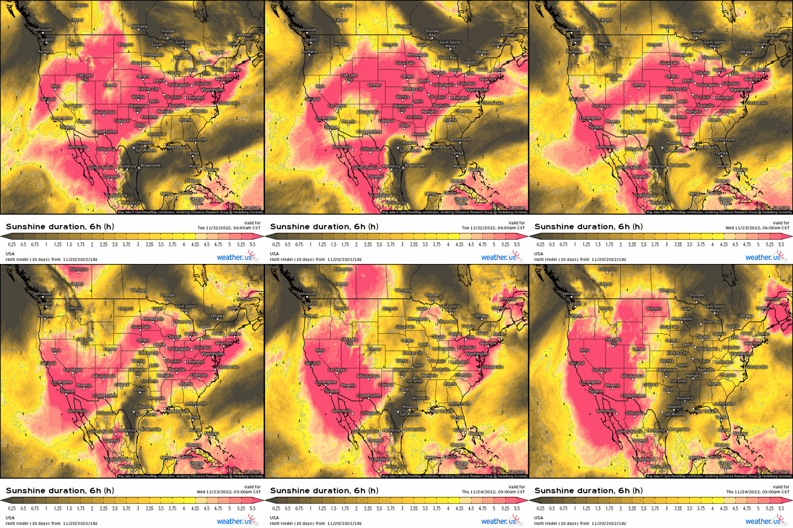
Rain and some isolated thunderstorms across Florida via stationary boundary providing forcing for ascent, along with some showers across the Southwest. Out across the Pacific NW, especially along the Cascade Mountains, heavy snowfall along with heavy rainfall for lower elevations, along with some snowfall for the northern tier of the Intermountain west. Outside of these main areas, we’re looking at high pressure systems expanding across the nation, making for a splendid traveling day! We can garner a sense of how weather conditions are expected to turn out through determining how much sunshine regions see over the course of 6-hours: Notice the large and expansive areas of higher values, indicative of where you’re likely to see sunshine, and therefore high pressure! This runs right into Thanksgiving by the way.
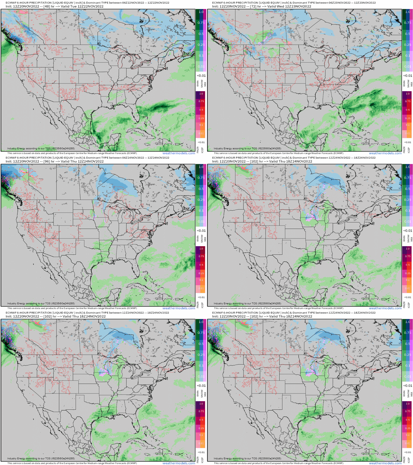
Looking at the surface through Wednesday, we see the threat of rain across the Southeast and especially Florida. Across the Pacific NW, heavy snowfall and rain will occur, and across the upper northern Plains we may see a light clipper across N.D. and MN quickly scoot by.
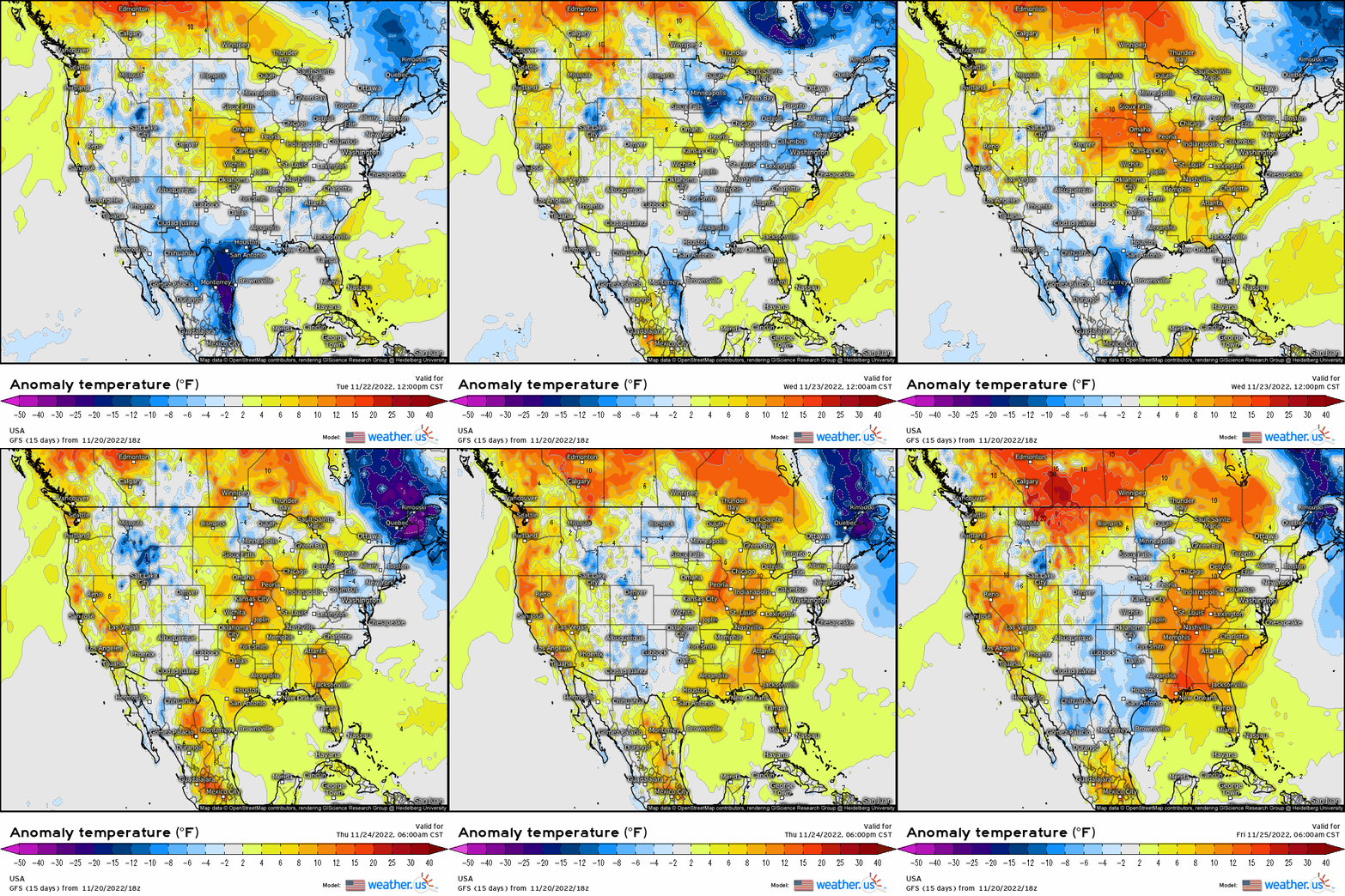
With the aforementioned areas of high pressure, the good news is that these high pressure systems won’t be bringing polar air masses; instead, we see their circulations induce a moderating trend for a large majority of the country, especially east of the Rockies. We get to rid of the polar grip and crazy week of snow events that we saw last week for the time-being, which just so happens to work out fabulously!
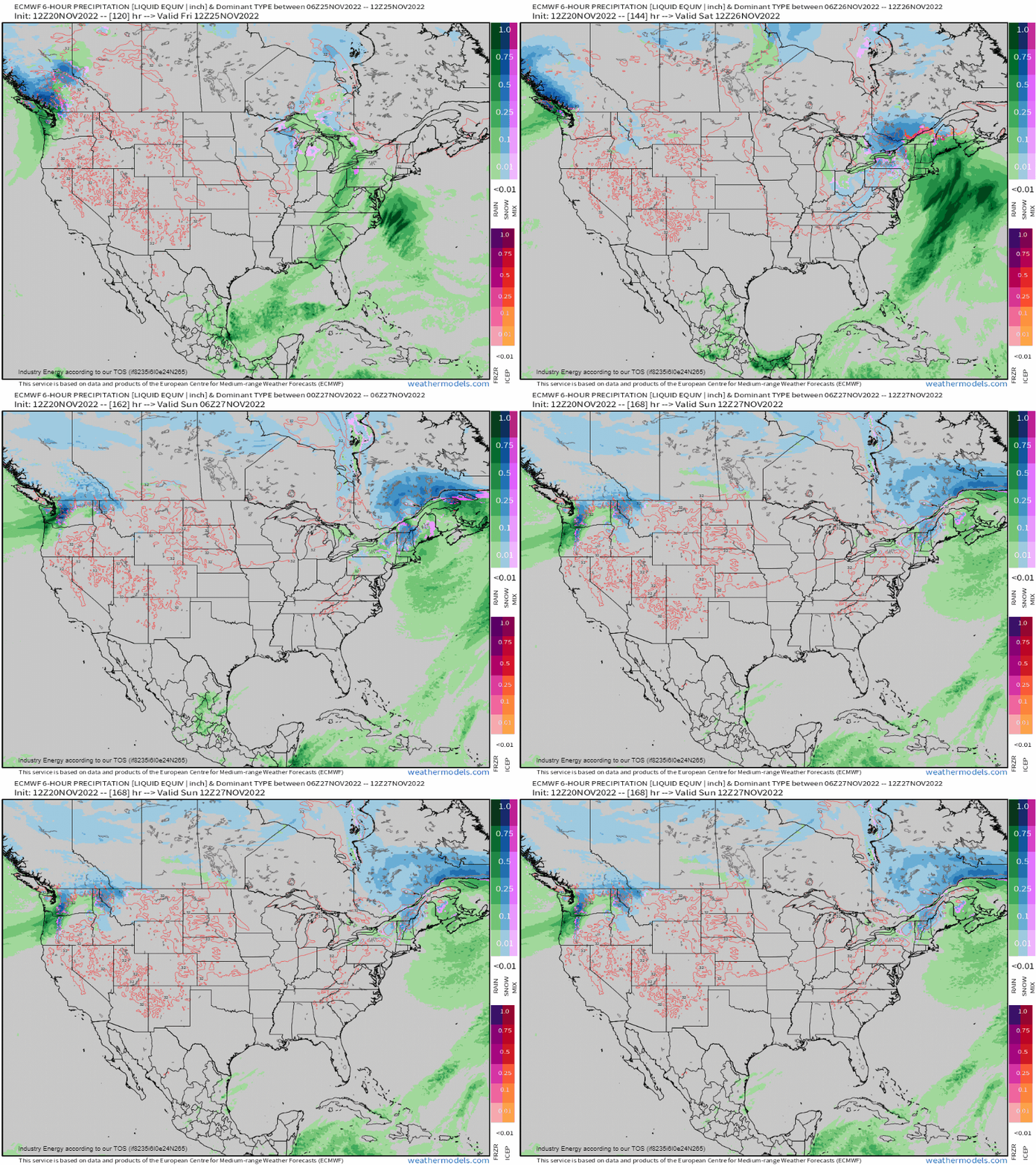
Now, what is to come after the big Holiday is still somewhat uncertain; however, the original idea that we were going to possibly see a much more threatening winter event has certainly trended in the opposite direction. Instead of seeing a coherent interaction between two different shortwave troughs, we have now shifted to the idea of a singular main trough that will somewhat become elongated and “messy”. This setup, while it still is poised to potentially deliver a rather large-storm and impact traveling back for this upcoming weekend, looks to render more wet than white this weekend for a majority. Now, we still could be dealing with wintry precipitation issues for far interior places like update NY and into VT, NH, and even northern ME, but details still need to be ironed out regarding those nuances. For now, we’re confident that a decently-sized event will take place following Thanksgiving into this weekend, that will end up disrupting travel. We then may have to deal with yet some more lake-effect on the backside, but we’ll see what shakes out in the following days! Fully expect a more in-depth write-up regarding this matter by midweek!
Thanksgiving:
For the big holiday, we’re looking at overall a general nice sensible weather pattern. One large and expansive high pressure will slowly shift from the Pacific NW into the heart of the Intermountain West and into the Great Plains. On the opposite side, we’ll see another relatively large area of high pressure shift from the Northeast and into the Western Atlantic providing clear conditions! The latter will expand down along the Eastern Seaboard, with a slight chance at some scattered showers across the Southeast, although lesser from a probabilistic standpoint compared to earlier this week!
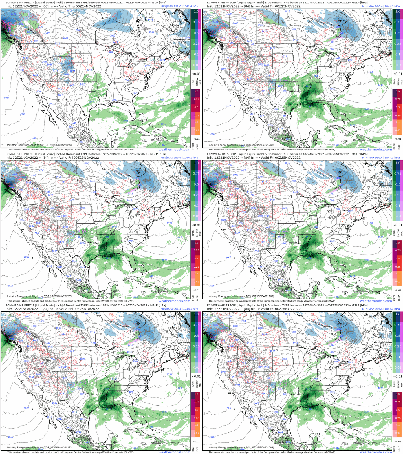
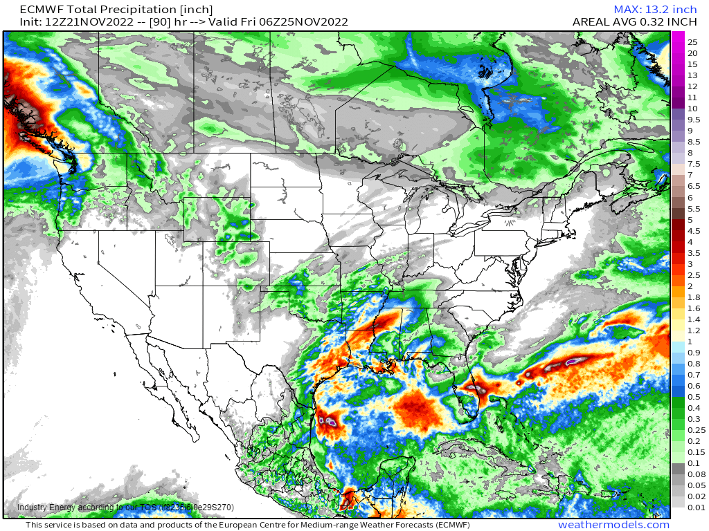
The main troublemaker is going to be centered across the Deep South. Places like TX, AR, MS, MO, and along the MS river valley will be dealing with locally heavy rain. This is our next system, which has implications for the Ohio Valley, Great Lakes, and Northeast later this weekend as this disturbance begins to manifest across the Deep South by Thursday.
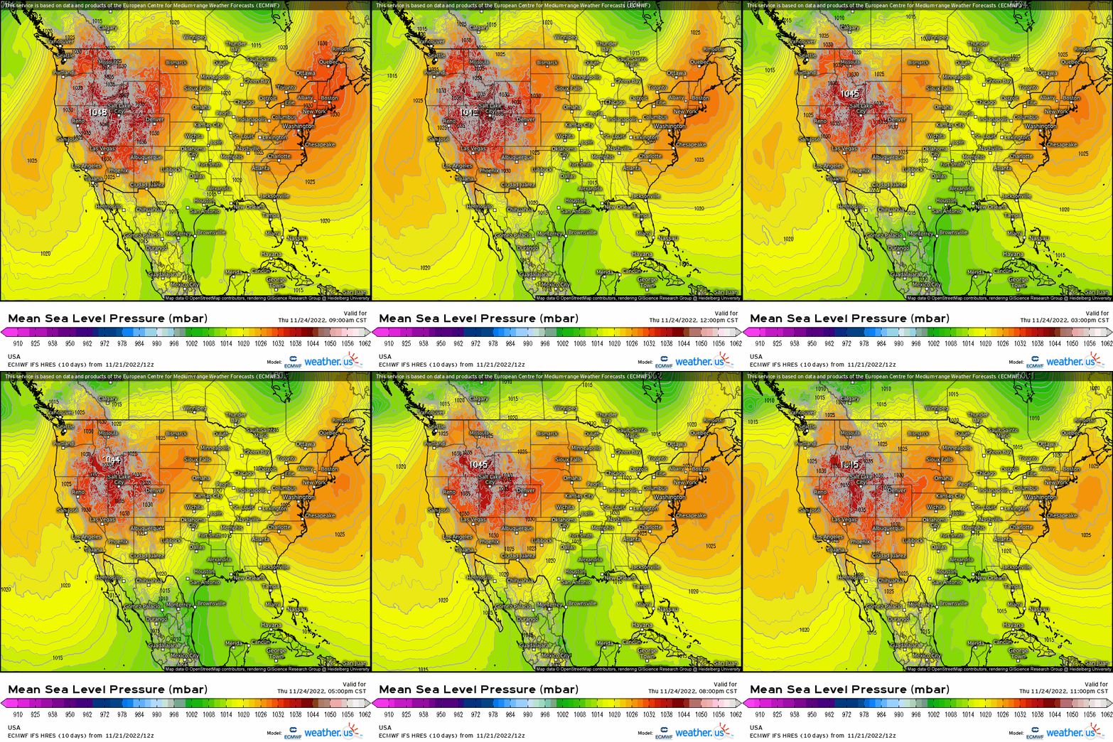
Below reveals precipitation-type to reveal what we’re looking at. Notice how above we see two areas of high pressure, with an area of low pressure lodged in between; this is our next weather-maker as aforementioned.
In terms of how much rainfall, well, we could see up to an inch or more across the Deep South in those areas mentioned. This is through Thursday night:
The silver-lining in this is that at least come Thursday, many will have already settled into their final destinations and enjoying large meals indoors! With that being said, hopefully everyone has a very wonderful holiday and safe travels!


