Tracking the Tropics: What to Expect From PTC 3
We’ve been watching this area of low pressure for over a week now as it casually and unhurriedly wandered the Bay of Campeche. It’s finally on the move with its sights set on the upper Gulf Coast.
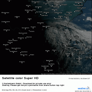
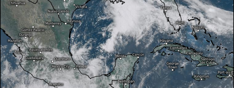
The northern edge of the cloud deck can be seen pushing into the southeast. The far outer rain bands are coming ashore in the coastal communities.
But you may notice something slightly off about this storm as you watch the satellite loop a few times. See it? PTC 3, which has not received an upgrade to depression yet as of the 11 AM advisory, is extremely eastern-weighted with almost all of the convection firing on the east side and next to nothing on the west. Northwesterly shear has prevented PTC 3 from wrapping convection around its core and strengthening. So, we are left with an easterly skewed storm that resembles a subtropical system more than it does a tropical system.
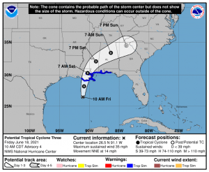
This lopsided storm makes for a difficulty when trying to communicate the risk within the cone of uncertainty.
The cone of uncertainty represents the possible placement of the center of the storm. In a normal, well-formed storm, some risk would be assumed on either side of the center. With an east-weighted storm like PTC 3, those on the western side of the center will likely see very little in the way of sensible weather.
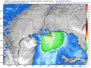
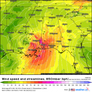
Recent recon by the Hurricane Hunters has found winds near the rather broad center to be relatively negligible while the stronger winds are displaced well east.
You’ll notice how far-flung to the southeast the strongest winds are from the center. These aren’t expected to be very strong – gusts up to perhaps 45 mph are generally forecast. It’s enough to cause local damage to trees or roofs, but isn’t dire.
As is obvious from the satellite loop, most, if not all, the heavy rain will be found on the east side as well. And this storm, regardless of any further development, will definitely be a rainmaker. The deep moisture from the tropics it’s drawing on will make heavy rain, and therefore flash flooding, the main hazard brought by PTC 3.
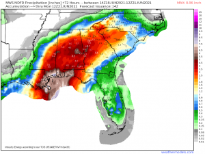
We’ve been talking about the heavy rainfall potential from PTC 3 for awhile now and not much has changed. Heaviest rainfall will be seen in coastal communities along and east of the center as the storm makes landfall and the sudden addition of friction upon meeting the coastline causes some topographically-enhanced heavier rainfall.
Basically – there is very little friction to stop the storm over open water. Once it reaches land, friction is introduced and slows the storm. This causes a “pile-up” and lifts more moisture into the atmosphere, resulting in heavier rainfall. Kind of like wringing out a sponge.
This storm has access to very deep tropical moisture, however, and will continue to carry it inland with a wide swath of heavy rain expected pretty far inland – possibly into the Carolinas.
Flash flooding is a distinct possibility, especially if we see training of the bands. Flooding is usually the number one killer in tropical systems, so be sure to remain aware. You know the drill by now – don’t drive through flooded roadways. It’s a risk that just isn’t worth taking.
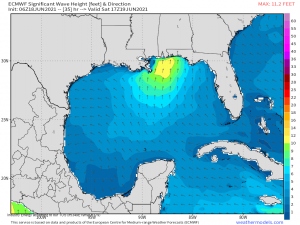
Coastal communities face another threat in a landfalling system – rough seas and rip currents.
While rough seas are generally a bigger deal for boaters, the increased wave heights and onshore flow can cause flooding via storm surge. PTC 3 is a weak system with relatively weak winds, so storm surge isn’t a huge concern this time around.
Rip currents, however, are a significant danger for beachgoers. These dangerous conditions can pull even the strongest swimmer far away from shore rather quickly. They are responsible for more than a few deaths every year. With it being Father’s Day weekend and many people celebrating at the shore, it’s important to just stay out of the ocean this weekend. Opt for the pool instead – risking your life for a dip in the ocean is simply not worth it.
Finally, PTC 3 could bring a low-end tornado threat as it makes landfall. Generally, the right-front quadrant of a tropical cyclone has winds coming from the south-southeast.
This speedy low level flow provides enough shear for a few spin up tornadoes. These are usually hard to predict, don’t last long, and are generally weak. Still, it’s something to be aware of as the system comes ashore this weekend.
In summary: regardless of any further intensification (or not), heavy rain and flash flooding is the main threat we will see from PTC 3. Winds and rain will be mainly on the eastern side of the center. A low-end tornado threat may exist as the system comes ashore.
Stay safe!
