Tracking the Tropics on the First Day of Hurricane Season
Happy first day of Atlantic Basin Hurricane Season! Well, it’s not so happy if you live in an area where hurricanes are a legitimate worry. But, either way, today is the day that hurricane season “officially” begins.
Do TCs form before this date? Of course. But the bulk of all Atlantic TC activity occurs between June 1 and November 30.
The locations at which storms are most likely to form and track changes throughout the season due to factors like water temperature, shear, placement of the sub-tropical high, and availability of leftover “energy” from old frontal boundaries.
During the month of June, we typically watch the warm waters of the Caribbean for development. Additionally, old frontal boundaries from mid-latitude cyclones along the northern Gulf and US East Coast must be watched for sub-tropical or even TC development.
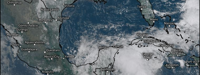
All of this brings us to the topic of today’s blog: A disturbance near the Yucatan Peninsula.
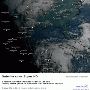
The area we’re watching is currently nothing more than a rather broad mass of thunderstorms. However, conditions are conducive to gradual development.
So, where is it headed?
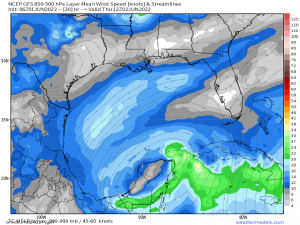
As it is a weak disturbance currently, it will “feel” the lower level flow best. Those winds are currently flowing in a north/northeastward direction. This points it in the general direction of the Florida Peninsula.
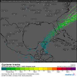
Ensembles have honed in on a landfall along the western side of the Florida Peninsula, though haven’t quite pinpointed a location. There is some clustering between roughly Naples and Bradenton, so, for now, this seems a likely location for landfall.
However, this can and will change once (if) a center forms. It’s rather hard to pin-point a landfall location without a center. Should that center form north or south of where it’s expected, tracks will shift.
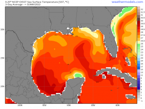
Waters in the Gulf are warm. In fact, the disturbance will encounter a plume of very warm water on it’s way toward Florida. And, while these waters cool closer to the peninsula, they are still at or above the threshold (26.5 C/80 F) to support tropical activity.
This broad disturbance has a problem, though.
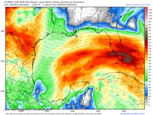
Decent westerly/southwesterly shear is a bit above the threshold (~20 kts) that TCs can handle and still develop/strengthen.
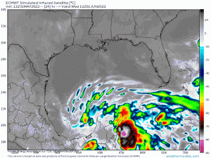
We can see the effect of the shear in the Simulated IR loop via the ECMWF. It keeps the disturbance heavily eastern-weighted as all the convection is blown to the eastern side through its interaction with Florida.
If you’ll look back at the satellite loop from the beginning of this blog, you’ll notice that much of the cloud cover is blown down-shear even now.
It is likely that shear and shorter amount of time over water will keep this disturbance from developing past Tropical Storm status, if that. However, stranger things have happened. A few of 2020’s storms fought fairly stout shear to develop or strengthen. I’m not saying it will happen, just that there’s always a possibility.
Regardless of whatever status this storm achieves, the main concern from this highly sheared mass of thunderstorms will be heavy rain and flooding.
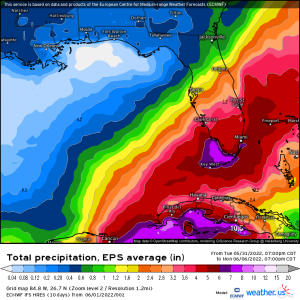
Ensembles currently estimate 4+ inches for South Florida. The axis of heaviest rain will, of course, change until the track is nailed down as there is still some disagreement between models on how far north or south this storm tracks.
Notice the gradient, though. It’s once again a sign of a highly sheared storm with most of the convection blown to the south and east.
South Florida has been struggling with a drought for awhile now, so this rain will go toward alleviating said drought. They would maybe prefer it not to all come at once, but, I guess we can’t be picky. Either way, if your location is prone to flooding, be aware of the heavy rain coming and do what you can to protect your property.
Stay tuned for another look at this storm in a day or two, once things become a little more clear.
