Tracking the Tropics: 94L
Easterly waves exiting Africa in the early part of hurricane season are common. Easterly waves surviving the trip across the Atlantic and going on to develop into a legitimate tropical cyclone early in hurricane season are not.
That’s not to say it hasn’t happened before. It has – most recently with Hurricane Elsa in 2021 and previously in 2017 with Tropical Storm Bret.
Generally, the Main Development Region (MDR) is hostile to the development of tropical waves in the early season. Dry air and shear prevail during this time of year, making it extremely difficult for a tropical cyclone to power up the vertically stacked, saturated, self-sustaining heat engine that powers it.
Every once in awhile, however, conditions become favorable enough and the timing lines up just right that one is able to form.
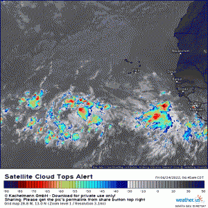
Cue Invest 94L.
Admittedly, this wave does appear to be disorganized and a bit anemic at the moment. We’ll have to see what the overnight hours (diurnal maximum) introduce as far as persisting convection.
Despite that, it does seem to have a broad cyclonic flow, especially in the lower levels and conditions ahead are favorable for development.
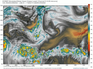
Modeling generally agrees that the environment in which the wave travels will remain moist, though dry air lurks not very far away. Dry air in the vicinity doesn’t automatically spell trouble for an emerging TC, but, it can destroy a budding storm by becoming entrained into the circulation.
Will it, though? Current modeling suggests that the potential storm will be able to keep the dry air out and go on to develop.
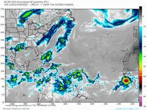
With shear forecast to remain light as well, the big question in regards to development is: Can this broad circulation consolidate?
From a modeling perspective, the answer is: yes. However, the disturbance will need to produce a bit more convection, break off from the Intertropical Convergence Zone (ITCZ), and gain latitude. It will thereby avoid the land mass of South America and remain over open water, allowing it to strengthen.
Let’s assume it manages first to detach from the ITCZ and second to consolidate and strengthen. What next? Where can we expect it to go?
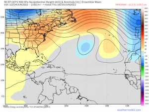
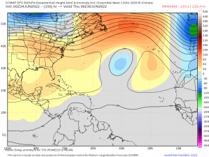
Let’s look at high pressure centers.
Both the GEFS and EPS currently agree on a blocking high building in over the E US and into the Gulf.
As our storm enters the Caribbean, this would give it no option other than to continue west into Central America.
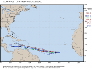
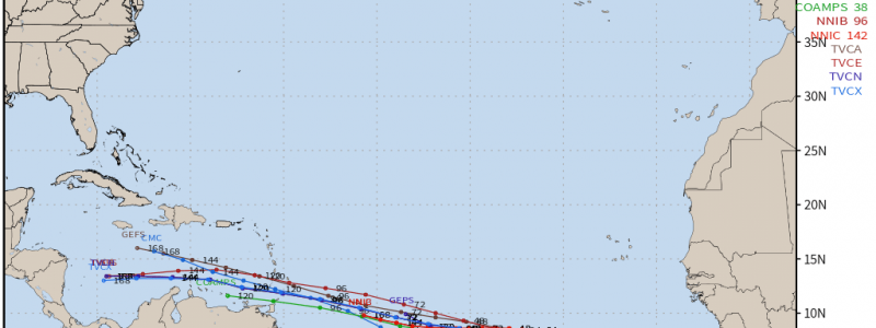
The spaghetti models agree, for now.
Let’s keep in mind that track forecasts will change as things fluctuate over the next few days.
Until a real center forms, models will struggle with pinning down an exact track. If the placement or strength of the high changes, there will be resulting changes in the track. And, most importantly, this all depends on a TC forming in the first place, which has not occurred yet. This is why most meteorologists will say “It’s too early for exact details.” Because it absolutely is. We do not have an actual TC yet, merely a lurking disturbance. Until we do, forecasts can and will change.
One thing is certain, however. I’ll be monitoring the disturbance right along with everyone else and will update as necessary through blogs and our Twitter feed.
Enjoy your weekend!
