Tracking the New Year’s System
Whether you’ve already made or are currently in the process of making your New Years Eve/Day plans, you may be wondering how the weather will factor into them. Let’s be honest, it’s been a bit of a wild ride this month, no matter what part of the country you’re from. And it isn’t over quite yet.
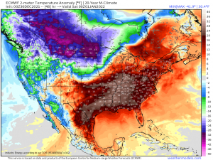
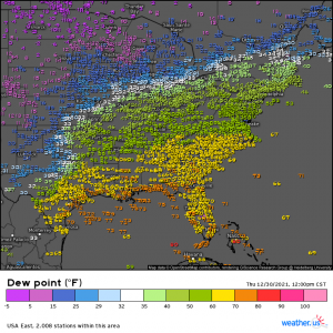
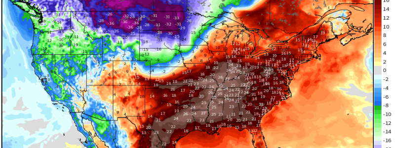
At first glance, the general pattern – at least in regards to temperature – looks much the same as it has since before Christmas. Frigid temperatures still exist in the north/northwestern part of the country while anomalous warmth holds fast in the eastern half.
But this image also points to the beginning of a change. The sharp clash between warm and cold in the center of the country is an indicator of trouble brewing. This will be the main weather story for both New Years Eve and New Years Day.
Before we dive too deep into the specifics, know that this is an evolving forecast. There are some fairly significant uncertainties remaining that will influence the intensity and location of any threats that materialize from this system. That said, we’ll look at what we know so far and update on the rest at a later time.
The Set Up
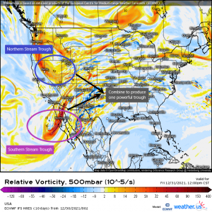
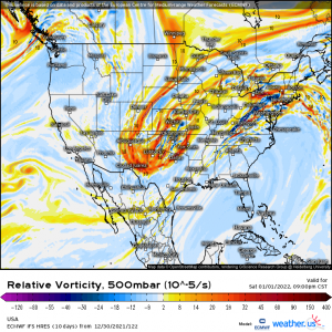
We have two troughs. One associated with the northern branch of the jet stream will be swinging out of the Pacific Northwest. The other will sweep in via the southern branch of the jet stream, over Baja California, and into the southwestern US.
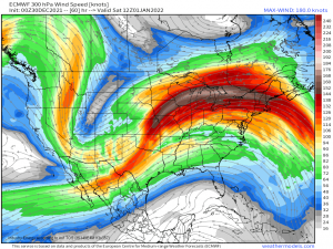
These two troughs are forecast to phase, or combine. This causes both the northern and southern branches of the jet stream to become one, leading to a fast, powerful flow aloft.
What are the immediate implications of such an amplified pattern? Well, as that trough digs, so does the northern branch of the jet stream. The frigid air which has been locked up along the northern borders of the country up until now will be free to sink south. Conversely, as the ridge builds ahead of the system, more warm air and moisture from the Gulf, which is still rather warm for this time of year, will flow northward.
When a system towing in frigid air meets an anomalously warm air mass ahead of it, expect fireworks – and just in time for New Year’s, too! These fireworks will come in the form of severe weather, yes, but also as a snowstorm on the cold side.
There are a few important aspects of this forecast that are rather uncertain. Let’s take a look.
Strength of the Low
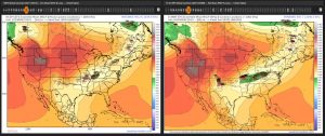
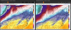
Between the GEFS on the left and the EPS on the right, there are a few differences.
One major difference is the strength of the low. The EPS is on board with the low being sub 1000 mb by Saturday afternoon but seems rather unsure of the forward speed. The GEFS is split into two camps. One that suggests a weaker, slower low and one that suggests a deeper, faster low. The strength of that low matters quite a bit. Here’s why:
- A deeper low will pull more moisture northward, leading to greater potential destabilization of the warm sector.
- A deeper low will also see more overrunning at low levels on the cold side. This creates a “warm nose” just above the ground and can quickly turn what would have been all snow into a dangerous ice event.
- A weaker low may not be able to bring in enough moisture to destabilize areas further north, leaving the main threat to a smaller area.
- A weaker low would have less/no overrunning and therefore less chance of a warm nose. Translation: more snow, less ice on the cold side.
Position of the Low
Refer back to the graphic above for comparisons. Track differences are fairly subtle right now, but they exist – and a small track shift can have big implications.
The GEFS has a few members that try to nudge the low a bit further north than the rest. Should it take the northern edge of that path, the snow line would shift north. Conversely, the warm sector would also shift north, potentially placing more people in a severe risk.
The EPS has a few members that nudge the low south of the mean. A more southern path translates to more areas on the cold side and the snow line shifting south. It also translates to a smaller warm sector and therefore a smaller area in the severe risk.
Speed of the Low
Speed matters when we are forecasting the area of greatest threat. Where will the low be during peak heating when the ingredients for severe weather are greatest? A slight increase or decrease in forecasted speed could make a big difference in where the most potent threat resides.
Moisture Advection
It’s still fairly soupy in the south. The better moisture is currently locked up closer to the Gulf, however, as a shortwave keeps it from advancing further north. So the question is, once this low begins deepening and moving east, how strong will the low level jet be and how far north can it manage to bring the better moisture ahead of the front?
The differences between the ECMWF and the GFS are subtle, but they’re there.
We discussed previously how the EPS indicated a stronger low. That shows here by the fact that ECMWF brings better moisture further north – even so far as the southern Ohio Valley. This is a discrepancy that can make a big difference either way for severe potential.
Storm Mode
One thing guidance does seem to agree on is that the trough in question will be positively tilted. Less backing in the surface winds (more of a SSW component) and a flow somewhat more parallel to the boundary is likely in such a scenario. This would favor more of a “messy” linear storm mode than discrete cells.
Parallel flow could, however, increase the possibility of flash flooding as storms train over the same areas. Last night’s system soaked parts of the south pretty well and we’ll have little or no time to recover from already-soggy ground. With anomalous moisture expected to accompany this system, it’s something to watch for.
At this point you may be wondering, “Well, what DO we know?”
- Well, we know it will rain, likely very heavily in places.
- We know that there is a severe threat beginning tomorrow evening at the eastern edge of the Plains and moving into the Tennessee valley overnight.
- We know there is a severe threat for New Year’s Day in the Tennessee Valley area. The northern extent of that threat (Ohio Valley?) is still to be determined.
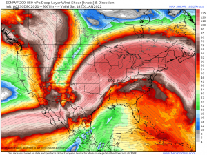
- We know we’ll have ample shear.
- Deep layer shear on the order of 50 to 60 kts seems likely. That is enough to overcome any marginal instability and set things spinning, which is why tornadoes are a possibility.
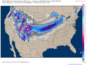
- We know it will snow on the cold side of the system.
- The southern extent of that snow will, as we discussed above, depend on the track and strength of the low.
Since this is an evolving forecast and we haven’t nailed much down beyond the fact that there is a threat and the general area in which it will occur, I will plan to push out an update on the situation tomorrow late afternoon or evening. Until then, monitor the evolution of the forecast via your local NWS or broadcast meteorologists.
Get ready for the New Year to come in with a bang!
