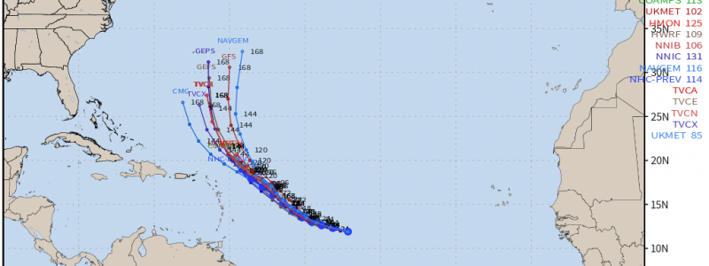
Tracking Hurricane Sam
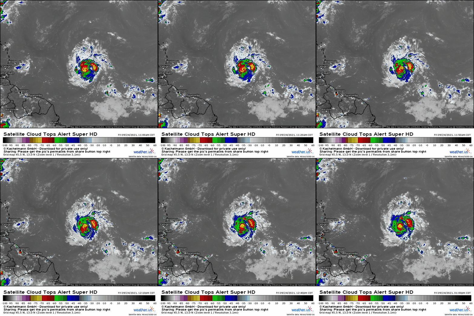
After a brief respite, the tropics are back with the development of opportunistic Sam. The category 1 hurricane intensified rapidly from a tropical depression yesterday, and now sports a well-organized structure of healthy banded deep convection.
Satellite imagery shows how this thunderstorm activity is surrounded by fanning cirrus indicative of robust, unidirectional outflow. Such symmetric, expansive venting aloft demonstrates how Sam exists within a shear-free environment with the type of diffluence conducive to deepening.
Before we figure out what the hurricane will do, though, we must figure out where it will go.
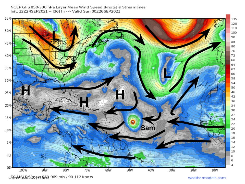
While typical late September mayhem is turning the northern Atlantic into a jumble of troughs and shear, a narrow but steady ridge sandwiched east from the Gulf of Mexico to Africa is giving Sam a cushion of steady, comfortable easterly flow.
With this largely unidirectional, well stacked flow, the next few days of Sam’s life are a fairly high-confidence forecast, at least in terms of track.
The storm will almost certainly miss the Antilles to the north, before being ejected into the open SW Atlantic between Bermuda and the Bahamas. What happens next is still fairly uncertain, but an out-to-sea track at the moment appears most likely. The point of this blog will not be to discuss possibilities beyond the day 7 frame, but rather to analyze what the storm will do as it moves over open water this week.
As you’re likely aware from reading these blogs, hurricanes are essentially atmospheric heat engines that turn the energy stored in warm water into kinetic wind energy via pressure deepening. To do this, they need both fuel and structure; your car couldn’t work without gas, but even with gas, the engine must be well-built.
That fuel comes from the ‘latent’ warmth stored in water, which is proportional to its temperature. Hurricanes feed off of the top of the ocean, which is why meteorologists often use sea surface temperatures to approximate this energy.
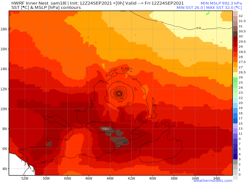
As shown by the HRRR, the ocean is quite warm under Sam, and may as well be a bathtub ahead of the storm’s eastward track.
SSTs of at least 28ºC, locally as high as 31ºC, support runaway intensification. This means it’s up to the structure of the engine that is Sam to decide whether or not the cyclone can strengthen dramatically in the days to come.
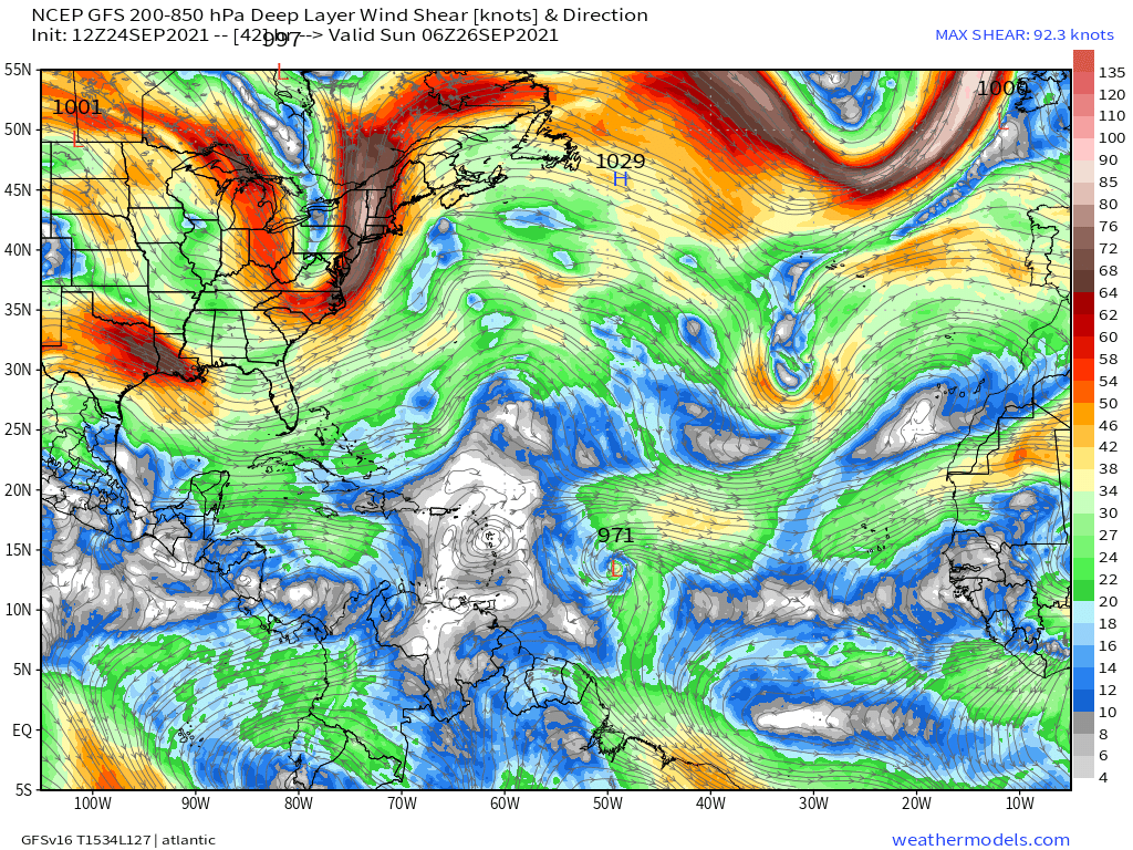
A few things can influence structure- some, like eyewall replacement cycles and other internal processes, are nearly impossible to forecast more than a few hours out. But some broad atmospheric parameters that can either degrade or improve the efficiency of a hurricane heat engine can be. A large part of this equation is in the shear dictated by flow aloft.
Favorably for Sam, the environment ahead of the intensifying tropical system is marked by very low shear. In fact, flow fanning east to the storm’s north and west south could end up favorable, allowing for enhanced ventilation of the storm’s center and increasing potential column deepening. Yeesh!
This means Sam will likely strengthen quite a bit over the next few days as it curves north, probably missing the Antilles. The situation thereafter is still quite ambiguous-Stay tuned!
