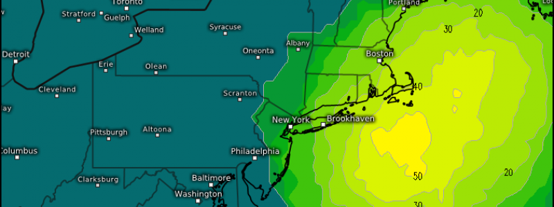
Tracking A Potentially Significant Nor’Easter
Honestly, I’ve been holding off on writing this blog. The potential storm for this upcoming weekend the models have suggested repeatedly has looked almost too good to be true. I’ve been waiting for one or the other to cave because, let’s face it, quite a few storms have looked “good” a week to 5 days out and then become underwhelming. They’ve stuck with it, however, and now we’ll need to seriously discuss it. So let’s take a look.
The scenario is this:
A southern stream disturbance tracks eastward across the southern US while a northern stream disturbance dives in from Canada. They meet over the southeastern US, phase, and produce one whopper of a nor’easter. Rapid deepening, extremely heavy snow, high winds, coastal flooding due to onshore flow…. this storm has it all.
As the past few days of model runs have showed, the signal for this storm is there. However, it needs to play out exactly as modeled. A wiggle or missed phase can change the storm entirely.
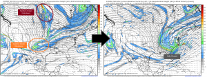
Missed Phase
This is a scenario from earlier runs of the GFS. The GFS has since (as of 12z) corrected itself to match the ECMWF, but we’ll use it to illustrate a point.
Should that southern stream disturbance lag behind, we risk it not being far enough east in time to completely phase with the northern stream disturbance. In this scenario, it only partly phases. This results in a storm that doesn’t dig quite as far south and ends up further east (offshore) and less amplified. It still ends up being a powerful storm. Its effects, however, are confined to the coast as it is too far offshore for the precip shield to reach inland.
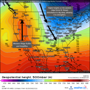
Lower Heights
The amplified western ridge depicted here is a necessary component for this storm. The higher the heights are on that western ridge, the deeper the northern stream disturbance will be able to dig as it phases with the southern stream disturbance.
Should this ridge not be as amplified as modeled, it could mean less “room” for the storm to dig in and strengthen. If we’re looking for a whopper of a storm, we want it to dig as deep as possible.
Watching trends on the heights out west is important as is watching real time observations ahead of time. As these disturbances come ashore, are the heights trending higher than modeled now? Or lower? These observations could indicate what we need to expect going forward.
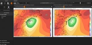
Position of the Low
We’ve talked about enough potential nor’easters this winter to know that the position of the low, once it has actually formed, is key.
The GEFS has taken a leap westward today and has brought itself much closer to the EPS solutions.
Most of these solutions are sub-980 mb – strength won’t be an issue, it seems.
There is fairly tight clustering on both the EPS and GEFS regarding the position of the low. It is suggested that it stays far enough offshore to rule out any mixing issues while staying close enough that significant impacts can be felt.
Of course, a wiggle in the track can change things dramatically. Either mixing becomes an issue at the coast or the precip shield barely brushes the coastal communities as the low slides too far out to sea. The perfect nor’easter is the result of a very delicate balance of ingredients.
The disturbances are expected to “come ashore” in the next day or so. Once the atmosphere gets sampled by our weather balloons, we’ll see if the models change their tune at all. For now, we monitor the trends and prepare accordingly. The potential for a big time storm is there. The issue is whether or not it all comes together just right.
I’ll revisit this in a blog on Thursday or Friday. By then, we’ll have a much clearer picture and can discuss impacts.


