Tracking a Nor’easter
Good Monday morning to y’all! We have a lot to discuss this morning so let’s dive right in.
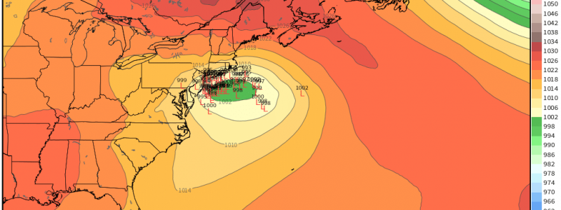
Confidence is increasing in a high-impact storm hitting the northeast in the middle of this week. The board is set and the pieces are moving. Winter storm watches have been issued throughout the northeast.
(Weathermodels link) (weather.us link)
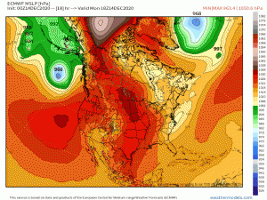
First piece: Currently, a system bringing heavy rain to the south and light snow to the northeast is impacting the eastern US. This system will exit to the northeast later today. In the next 48 hours or so, it goes on to become a very very deep (sub 940 mb!!!) 50/50 low. As discussed yesterday, this low assists in bringing in the cold air required for a snowstorm but also provides some blocking that will prevent the next system from escaping to sea too quickly. At the same time, a strong ridge builds over eastern Canada, providing a means to funnel arctic air into the northeast.
(weathermodels link) (weather.us link)
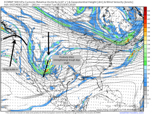
Next piece: A ridge is building into the Pacific northwest. The stronger this ridge builds in, the more the positively tilted (strengthening) trough that will become our nor’easter can dig in south. And we need it to dig south. The further south, the more the cold air wrapping around the eastern high can filter in.
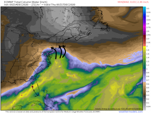
Now, as all this plays out, we still need cold air, moisture, and lift to create this blockbuster storm. We’ve covered cold air already so what about moisture?
This deep moisture will be advected northward by the southerly flow in the warm sector of our system. It will then wrap around the low, providing plenty of available water for precipitation.
And lift?
(link)
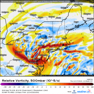
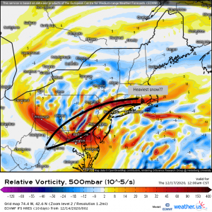
More than adequate vorticity (upward motion). The heaviest snowbanding is usually seen along the areas of most convergence, which is where we have the most vorticity. Convergence leads to rising air (lift) which leads to instability. So, it is likely that the heaviest snows will be seen where ever these areas of vorticity are greatest.
So, pulling from the same map, that would place the heaviest bands in the circled area. The models seem to agree as the heaviest forecasted accumulations also lie in that area, with a few variations north or south by a couple miles.
There is going to be a decent amount of instability with this storm, especially closer to the coast. There may even be enough for thundersnow in places like Philadelphia and New York. I don’t know about you, but it always puts me in awe when the atmosphere is dynamic enough to have both snow and thunder in the same location.
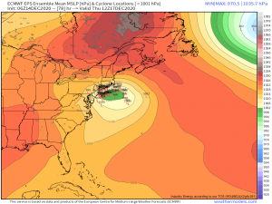
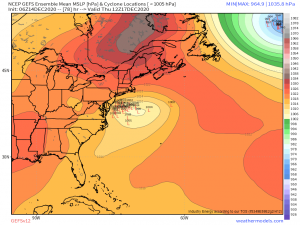
Models are coming into agreement now that, with the exception of a few outliers, the center of this storm will be far enough off the coast for this to be a mainly snow event. The only concern I have is the cluster of solutions in the EPS that are right on the coast. It’s enough to mention the possibility of the storm wiggling closer to the coast and bringing a rain/mix event to the immediate coastal area. We should have more solid agreement by this evening. But always remember, with a storm like this, a little wiggle can change the type of precipitation an area sees.
(link)
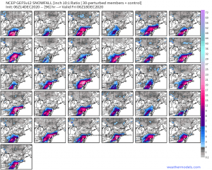
Since we don’t yet have complete agreement on track, I’m going to use the ensemble snowfall totals to take a look at what we might be seeing as far as total accumulation. IN GENERAL, the heaviest totals look to set up around the area I circled in the previous graphic. Southeast/Eastern Pennsylvania, northern New Jersey, Connecticut, Rhode Island, and parts of Massachusetts may see upwards of 12 inches. The official NWS forecast for these areas stands at 12 to 18 inches right now. If heavy banding sets up and we have a favorable track, it could be more. Some solutions show totals into the 20 inch range. Again, later today or early tomorrow, once we have better track agreement, forecasts will become a bit more concrete.
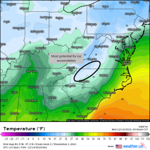
One last thing that is kind of getting lost in the shuffle with all the attention being on the snowfall totals in the northeast: There is potential for a fairly significant ice event in North Carolina on Wednesday.
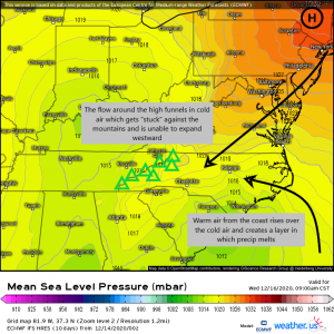
Due to cold air damming, the environment will be ripe for widespread freezing rain.
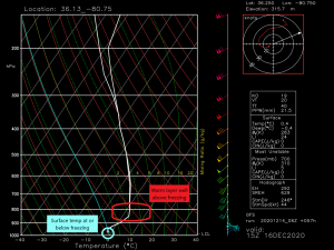
Cold air damming happens when cold air funneled in from the flow around an area of high pressure gets pushed up against a mountain range. Since cold air does not rise, it gets “stuck.” Warm coastal air then spreads over top of it creating an inversion but also a warm layer that melts any precipitation that falls. However, the temperature at the ground is still at or below freezing so when the melted precipitation reaches the surface, it refreezes, accumulating as ice.
(link)
Temperatures in the interior of North Carolina and far southern interior Virginia will struggle to rise above freezing on Wednesday. It’s here the greatest threat lies. With temperatures aloft well above freezing and temperatures at the surface at freezing, the potential for freezing rain is high. As temperatures preceding this event will be fairly cool, it’s possible conditions could deteriorate quickly, including roadways. Exercise caution if you must be out and about Wednesday morning.
And…that’s all I have for you right now. We will, as always, continue to keep you updated as the storm evolves and things change or solidify. Look for more detailed blogs from us in the coming days leading up to the storm!
