Too Much Water
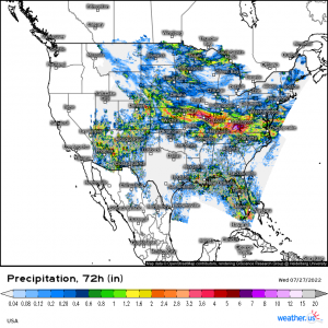
As you may or may not have noticed, the stretch of the country from roughly the Mid-Mississippi Valley to the southern reaches of the Mid-Atlantic has received a lot of rain recently.
Over a foot of rain has fallen in some places in the last 3 days with more than a couple flash flood emergencies issued as waters rose quickly, trapping people in their houses and cars. And, unfortunately, it’s not over yet.
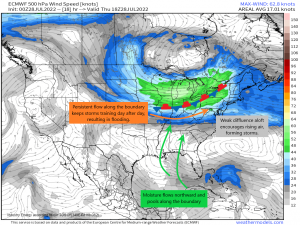
So, why is this area being repeatedly inundated day after day? The culprit is a stalled frontal boundary.
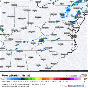
Draped across the Midwest, this boundary has been in place since early week. As moisture from the Gulf flows northward, it pools near the aforementioned boundary. The flow is weakly diffluent aloft (or in other words, air is moving apart in different directions), which encourages air from the surface to rise and fill that void. Hot, moist air below rises, and storms form. The persistent flow along the front keeps storms training over the same area day after day. Until that front moves, it’ll be rinse and repeat each day.
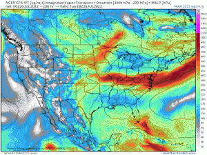
The GFS Integrated Vapor Transport does a really good job of giving us a visual. You can clearly see round after round of moisture transported from the Gulf, pool along the boundary, then move eastward.
Though there is light at the end of the tunnel, this pattern will be in place for at least two more days before the stalled front is finally flushed out. That means more rain leading to more flash flooding is likely.
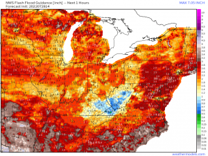
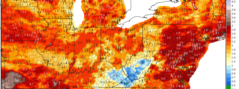
Unfortunately, FFG values are very, very low for some – especially eastern Kentucky, far southwest Virginia, and southern West Virginia.
The values on this map are the rainfall rate per hour it would take to overcome the ground’s capacity to absorb water before flooding occurs. Values of 0.9 inches are shockingly low and, as any southerner knows, can sometimes be achieved in one heavy summer thunderstorm. But we’re expecting rounds of training storms yet again today, and especially in the overnight hours.
This may lead to life-threatening flash flooding.
Rainfall rates of 1 to 2 inches per hour (potentially more) are expected. Waters will rise quickly in recently inundated locations.
If you live in this region, be on your guard and ready to evacuate if need be. If you have friends in this region, warn them. As far as weather related fatalities go, deaths due to flooding per year are second only to deaths due to heat. This could be a very serious situation. Be prepared to act if your area is vulnerable.
Drier weather is on the way, but we’ll likely have to wait until next week to find a more prolonged period in which to dry out.
