Tomorrow’s Deep South Severe Weather Threat
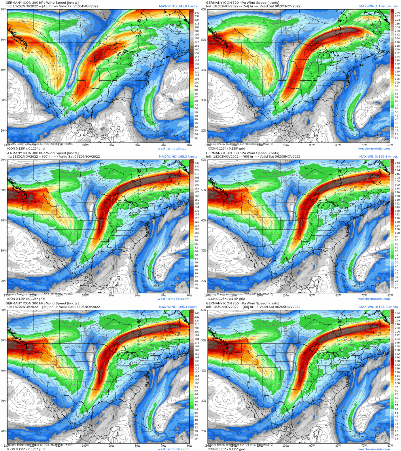
The stage is set for a strong mid-level trough that’ll dig into the SW and toward the panhandle of TX today and into tomorrow. This mid-level trough will spawn a surface low somewhere north of the TX panhandle, and with this low will feature attendant frontal features. Aloft at 250-300mb, a strong upper divergence flow will manifest, allowing for enhanced surface convergence and associated pressure responses.
Ingredients are becoming increasingly favorable viewing it through the “top-down” approach with favorable upper-level jet support, a mid-level trough sweeping and digging through the lower Plains (providing forcing for ascent), strong warm air advection via trough axis along with rendering low-mid level shear along with moisture advection, and rich boundary-layer moisture in the form of dewpoints greater than 60*F (provides high CAPE!).
Starting at the top, here is the modeled upper-level jet streak with right-rear entrance supporting upper level divergence (air rushing at the surface and converging) juxtaposed with far eastern-central TX and across the ArkLaTex region.
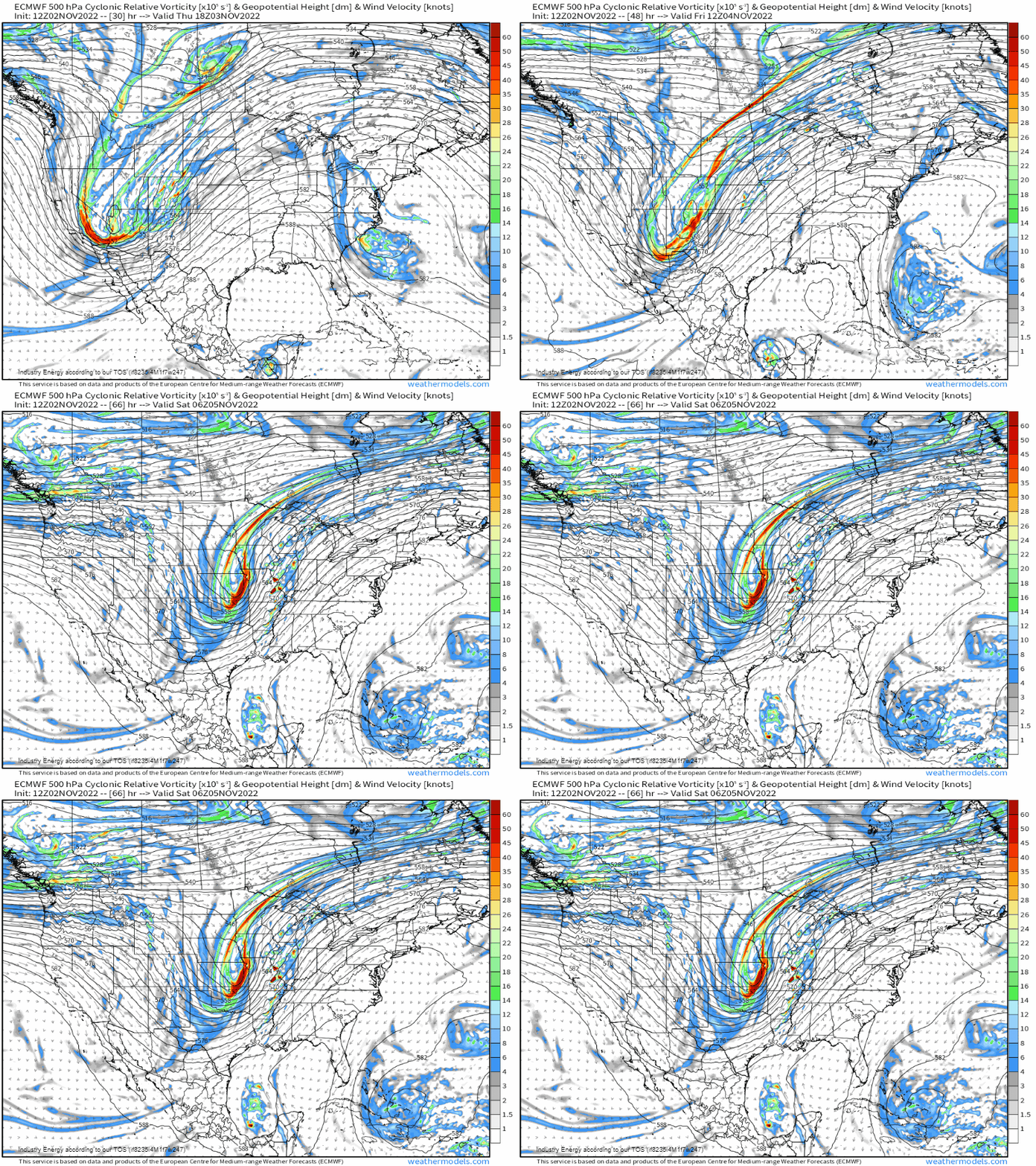
At 500mb, the trough’s axis will go from positively-tilted toward neutral and slightly negative as it ejects toward the east/northeast. This provides not only forcing for ascent, but robust mid-level winds acting to enhance speed shear with greater than 65 knots. Shear organizes convection!
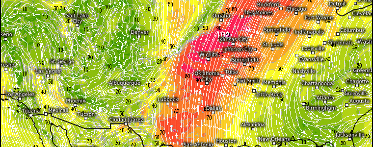
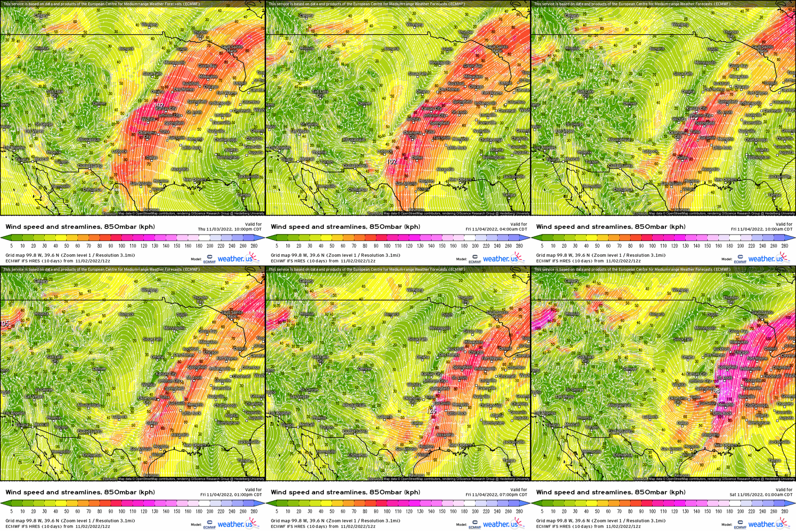
Looking at 850mb, we’re going to see strong warm air advection and also strong winds in the form of a low-level jet. This brings in moisture (further allowing for destabilization) and increased lift for storms to be able to grow. A LLJ of 50+ knots certainly raise eyebrows!
Toward the surface, we’ll see a distinct cold front sweep through out ahead of the surface low, causing thunderstorms within the warm sector to grow rapidly if any can become semi-discrete supercells given favorable thermodynamics. However, because the cold front is oriented in such a way from NE to SW and aligned parallel with the mean surface to 500mb flow, the main mode of storms will be linear. With surface dewpoints surging passed 60 providing over 1000 J/kg of SBCAPE and even MLCAPE, storms can fire quickly, which is why with the ingredients in place all severe hazards are in play! Along with displayed MLCAPE, shown also is the NAM supercell composite parameter indicating high values and implying a very favorable environment for supercells to form.
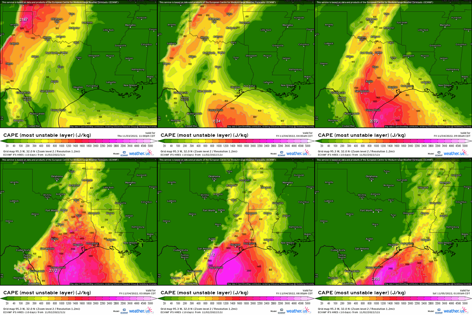
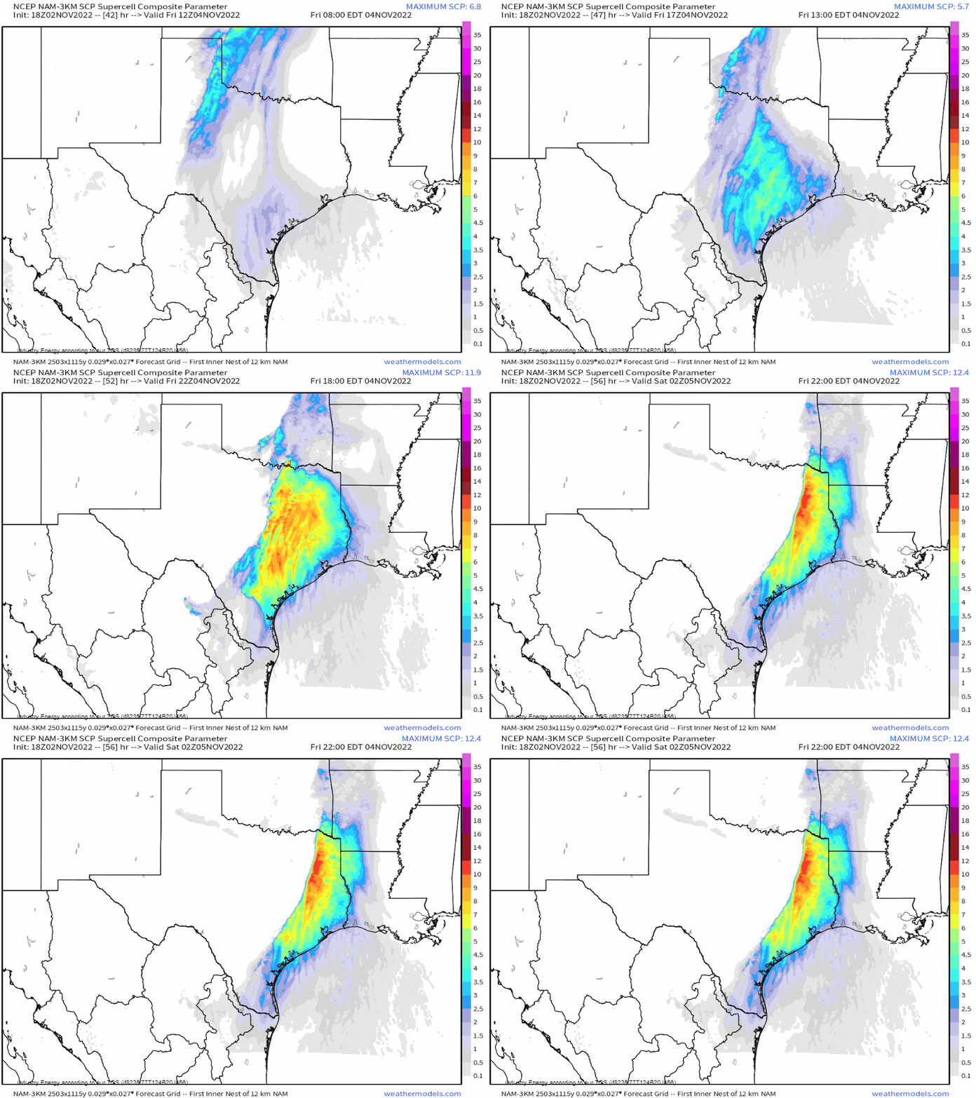
The main area for concern will be central/eastern OK, western AR, eastern TX, and into western LA. Timing appears for these regions to be from 2 p.m. onward, when we should see thunderstorms increase and where we’d look for any semi-discrete supercells to form out ahead the cold front, within the warm sector. From west to east, timing for places such as Dallas, TX and into Hugo, OK (NE TX, SE OK, SW AR, NW LA) occurs later in the afternoon Friday. This threat will carry into late Friday overnight into Saturday, rendering big concerns for nocturnal tornadoes along with heavy rainfall (localized flash flooding) and damaging wind gusts. The most likely severe weather hazard at this time will be damaging wind gusts with sufficient ingredients in place for tornadoes and hail as well! There still appears to be some uncertainties regarding the nuances of whether morning convection may ultimately hinder the higher-end potency of this event and whether or not anything can become discrete!
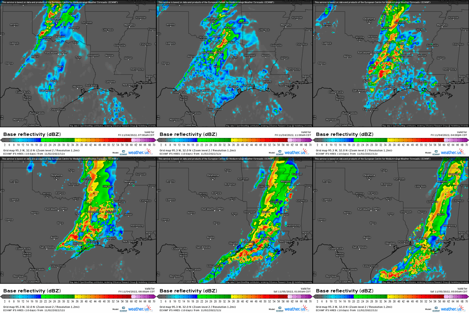
For now, we appear to be headed toward a relatively notable event compared to the last few months since Spring, so for anyone living in this generic area or know anyone, please advise them to take necessary precautionary measures!


