Today’s Central Midwest Severe Thunderstorm Threat
As Meghan and I have written about, some significant weather is occurring over the central US today as a surface low accelerates northward along a stalled stationary front. This is taking the form of freezing rain, heavy snow, and moderate liquid rain falling in a swath from Nebraska to Wisconsin and Minnesota to the northeast of the developing surface low. It will also increasingly take the form of severe thunderstorms, including tornadoes and damaging wind gusts, in the low’s warm sector from Iowa and Missouri into Illinois and Indiana.
This is late in the year for an outbreak of severe thunderstorms so far north. An integral element of any severe threat, convective instability, rarely is able to advect so far north without meaningful modification at a time of year when the sun angle is very unfavorable.
With significant eastern US ridging and powerful low-level flow advecting very unseasonably warm, moist air deep into the central US over the last week, the hardest to find piece of the severe thunderstorm puzzle will be easy to come by today- moderate convective instability.
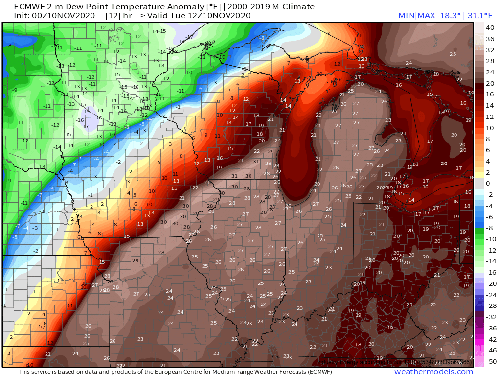
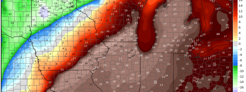
Extreme dewpoint anomalies locally exceeding 30°F will facilitate latent heat release with lifted parcels to a level quite unusual for the time of year.
This will allow 500-1500 j/kg of CAPE to develop in a swath ahead of the cold front, where lapse rates are relatively maximized, and dewpoints are relatively pooled.
The type of kinematics that favor severe thunderstorms, on the other hand, are somewhat easy to come by in November. In the summer, the temperature difference between the subtropics and the tropics is muted, preventing significant pressure gradients at really any level of the atmosphere. This, in turn, means very strong flow is hard to come, regardless of the altitude where you look. In the winter, as the subtropics cool significantly and the tropics stay basically the same temperature, these gradients intensify dramatically. As a result, it’s much easier to find very strong flow at many altitudes.
The first important kinematic parameter for any severe weather is wind shear, a function of bulk wind difference between the surface and a higher altitude, typically taken to 6km. High shear helps storms organize, allowing for convective longevity and severity.
With powerful temperature gradients in the midlevels (as we’ve been blogging about all week), flow in the atmospheric midlevels will locally exceed 70 knots over the warm sector. Also notice impressive directional divergence over the warm sector ahead of the 500mb trough, which will help allow updrafts to develop.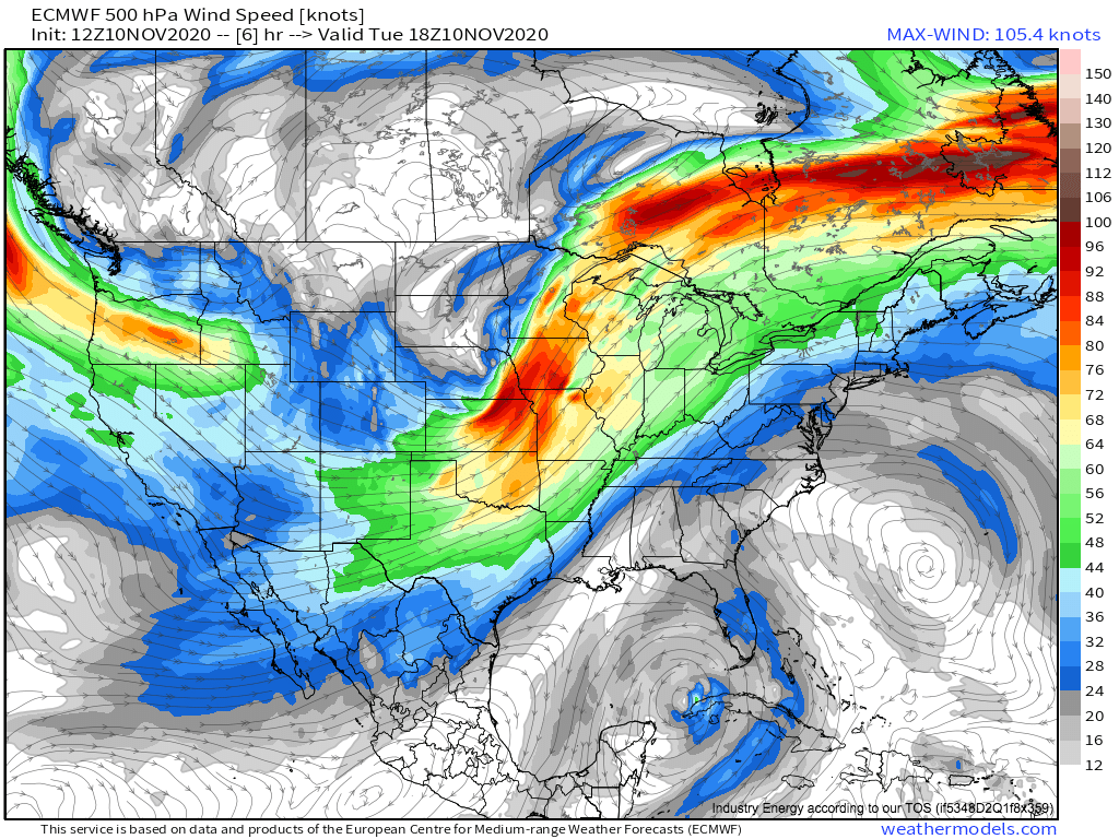
So, we have a warm sector with marginal instability, overspread by powerful flow that will generate favorable wind shear, in an environment with synoptic lifting. With initiation already occurring along the cold front, which will serve as a convergent focus point to begin forcing updrafts to their levels of free convection, it seems wise to begin looking at how, exactly, this convective threat will end up manifesting over the corn belt.
With any convection this time of year, the first consideration is always whether flow is strong enough for momentum transfer to allow even relatively weak convection to produce swaths of damaging wind gusts.
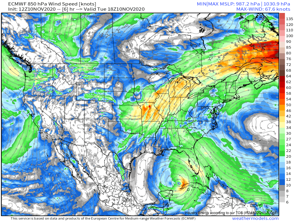
We’ve already touched on the low level jet, consisting of speedy flow in the pressure gradient between the expansive western ridge and the compact Iowa cyclone. It features wind exceeding 50 knots over the warm sector, which is absolutely sufficient for damaging winds given convection capable of transferring some momentum to the ground.
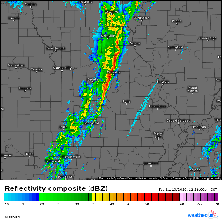
Momentum from the speedy low level jet can drop down to the surface in gusts wherever storms can produce meaningful convective energy transfer. This typically occurs wherever storms can form thin linear ‘squall lines’, like the one currently developing over Missouri.
Link: https://weather.us/radar-us/missouri/reflectivity-composite/KLSX_20201110-182600z.html
With sufficient shear and instability, and powerful low level flow, the conditions for momentum transfer will be present and swaths of damaging wind will be possible with this line. Expect a few dozen severe wind reports from Missouri and Iowa into Illinois and possibly Indiana today into tonight.
In all likelihood, powerful linear forcing with marginal instability and unidirectional shear will keep the storm mode linear, precluding a threat for tornadoes aside from weak ones imbedded in the squall. However, there will be an exception.
In the vicinity of the warm front by evening, over northern Illinois and southern Wisconsin, a glancing upper level jet may allow for discrete ‘packages’ of lift over the largely uncapped warm sector. Here, conditional on such isolated lift, a few updrafts may form ahead of the main line. If this happens, a tornado threat could develop by around 6pm local time.
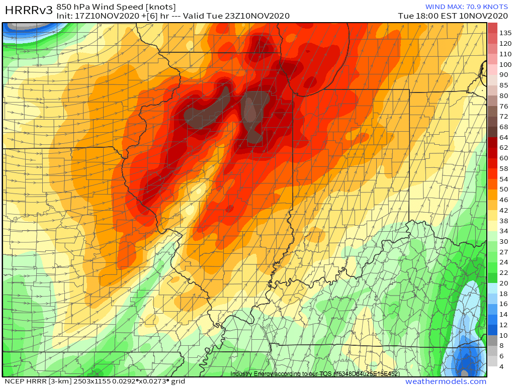
The parameter space is actually set to be pretty supportive. Expanding hodographs near the warm front, corresponding with a low level jet that will be strengthening with the intensifying surface cyclone, will locally maximize helicity in the warm sector in northwest Illinois and southwest Wisconsin. A proxy for helicity is 850mb flow, which will be roaring in the area this evening.
This helicity will overlap with CAPE exceeding 500 j/kg, and aforementioned very favorable shear.
Should a discrete updraft manage to develop here this evening, a tornado threat, potentially significant, is certainly possible. We will keep you posted here and on twitter should that happen.
