Thunderstorms Threaten Northeast with Damaging Wind; Heavy Rain
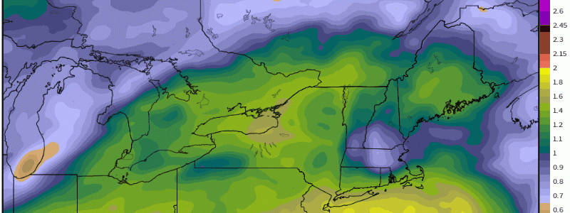
Much of the Northeast/mid-Atlantic area has been under the influence of a diffuse, stubborn midlevel trough as of late. In the exit region of this disturbance, the region has seen several days of humid Gulf advection and scattered downpours and showers amidst a southerly flow regime. Steadily increasing precipitable water has substantially increased the moisture content of this airmass, such that it is now saturated to an anomalous degree.
This moist airmass will lay the groundwork for a double-barreled threat today as a frontal system passes through: severe thunderstorms and heavy rain.
The frontal system itself, a weak and diffuse low pressure area synoptically lifted by the weak midlevel trough training over the area, will push through slowly over the course of the afternoon. It’s so weak as to be nearly imperceptible on atmospheric analysis, but will prove sufficient to lift the extremely moist airmass to a low-down LFC, allowing for eager updraft initiation despite lackluster forcing for ascent. If the LFC weren’t so close to the surface, governed by such a moist low level environment, such initiation would be unlikely.
The scattered to widespread thunderstorms will evolve amidst limited lapse rates and moderate shear, which should prevent any significantly strong storms. But with moderate low level flow and relatively robust near-surface instability, a tornado or two can’t be ruled out, and some instances of damaging wind gusts appear probable, especially this evening over the interior/northern mid-Atlantic.
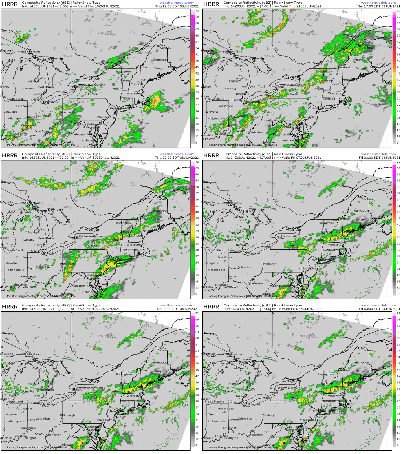
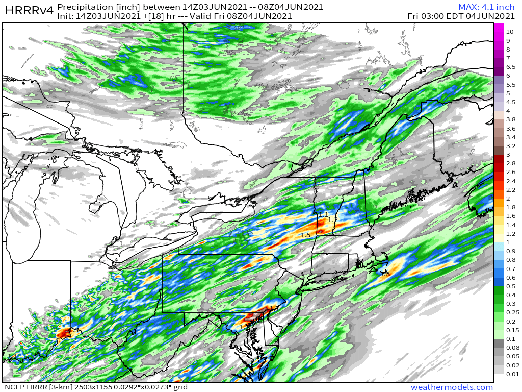
Another threat could evolve, however, as the slow-moving frontal system tracks parallel to midlevel flow. This seems especially probable from upstate NY into central New England, and could conceivably lead to the phenomena of “training thunderstorms”, in which a number of storms follow the same path. Although the storms may be moving, then, a spot on the ground sees nearly constant heavy rain. With favorable low-level flow capable of keeping the moisture advection hose directed into thunderstorm inflow, and a very moist antecedent airmass characterized by aforementioned high-end PWAT values, rain in these training storms could be unusually heavy and efficient.
In this environment, swaths of heavy rain and corresponding flash flooding could occur.


