Thunderstorm Threat Increases Northeast of Intense Ridge
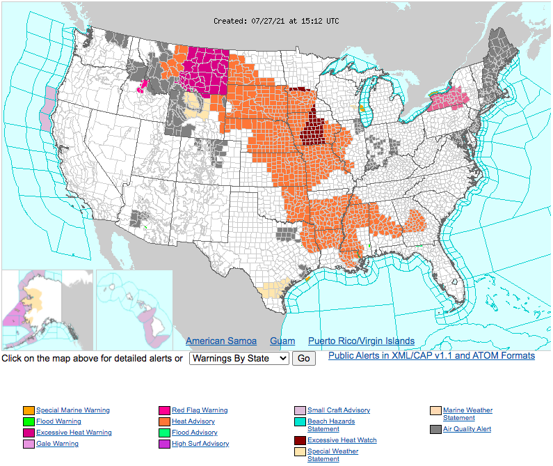
This morning sees heat advisories and excessive heat warnings that spawn more than 1500 miles, stretching from interior Montana to the Gulf Coast. They come as a massive ridge expands northwest through the heart of the US, associated with sinking air that enforces excessive heat, clear skies, and downsloping off of the Rockies to the west.
But these summertime high pressure systems, known informally as “death ridges”, pack a secondary threat aside from extreme heat: extensive, intense outbreaks of summertime thunderstorms. As I talked about in my blog last week, these thunderstorm complexes can arise along the midlevel temperature gradients north of summertime ridges, which conveniently combinine a lot of ingredients really favorable for rapidly propagating mesoscale convective systems and supercells.
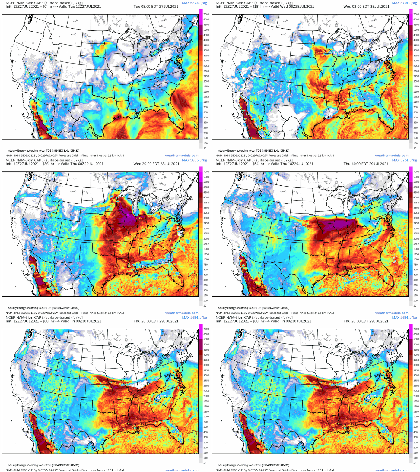
The first of these ingredients is instability, which arises from the advection regimes fostered by the ‘death ridge’. Like I wrote about last week, when broad, anticyclonic flow around heat domes is sourced from the Gulf or south Atlantic, a moist airmass modified by solar heating can turn into a ticking time bomb of high-end instability. This is especially true when the same anticyclonic advection regime transports the warm and dry high-elevation airmass known as an EML atop hot, moist air below. The combination regularly supports the most extreme instability found in the continental US, which can be found surprisingly far north and east thanks to the suppressing influence of the death ridge, which prevents thunderstorms from sucking up all of the fuel.
This instability will be increasingly plentiful across the northern tier of the ridge through the processes just discussed, with extreme CAPE developing in parts of the north-central US.
CAPE this high is more than sufficient for intense updrafts to develop, and indicates a possibility that any storms able to organize will produce substantially dangerous severe weather, including gusts beyond hurricane strength, very large hail, and potentially significant tornadoes. Of course, this organization is far from assured, and most cases with extreme CAPE are so far from the temperature gradients aloft and at the surface that shear and incite convection for such substantial hazards to occur.
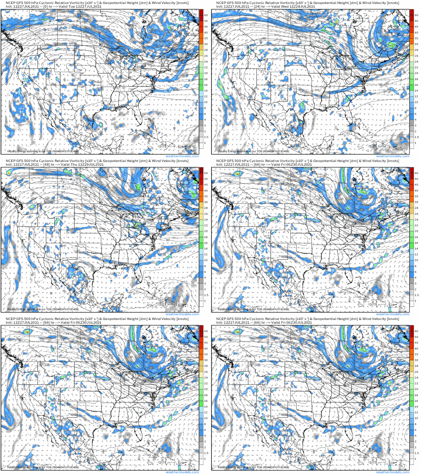
Really, we’re getting ahead of ourselves by discussing CAPE first. Before updrafts can take advantage of atmospheric potential energy, they must be lifted to a level at which internal moisture can condense and release heat. This requires atmospheric forcing for ascent, which often is found in zones of surface convergence associated with shortwave troughs. These troughs, in turn, are found imbedded within zones of steep midlevel temperature contrast… which can be found along the northern periphery of ridges. Sound familiar?
These shortwaves can become quite intense given a sufficiently strong midlevel jet, which promotes mass removal that can incite strong low level flow. Brisk wind a couple thousand feet off the ground is important in organizing mesoscale convective systems into long-lasting bow echos, and in giving the atmosphere enough low level spin to produce tornadoes. Also found along strong midlevel temperature gradients, especially just ahead of shortwaves? Maximized midlevel flow, which in turn enhances bulk shear, a crucial ingredient in organizing storms.
Clearly, the kinematic and thermodynamic support for severe weather jumps out of this type of setup. It’s why some of us call the northern edge of a strong summertime ridge the ‘ring of fire’, and it can promote some of the most intense severe weather known in the CONUS.
A lot of what happens next is based on the orientation of shear to lifting mechanisms.
Sometimes, when impressive shortwaves tilt flow far to the south, the stars align for a discrete mode, like what happened in Michigan last week. But more often, the combination of extreme instability and linear forcing with shear that flows parallel to the E-W oriented surface boundary allows storms to rapidly coalesce their outflow into broad cold pools, which propagate downshear and incite persistent thunderstorm growth. The result can be a swath of largely constant damaging wind, which can produce prolific and widespread damage if conditions are right- a phenomena known as a Derecho.
Derechos are really difficult to predict because they rely so heavily on storm scale evolution- if storms don’t remain in good equilibrium with their outflow, or if the rear inflow jet that often results from cold pool formation doesn’t align favorably, predicted derechos often falter. Additionally, all it can take is a poorly placed thunderstorm complex and sneaky shear to initiate a Derecho where none is forecast, like what happened in Iowa last August. But there’s a much better than average shot of seeing this type of fierce windstorm in a set-up like the one anticipated for the north-central and north-east US this week, thanks to the atmospheric conditions discussed above, and to the CAPE-gradient-parallel midlevel flow that can keep mesoscale convective systems oriented favorably to instability and lift for hours on end.
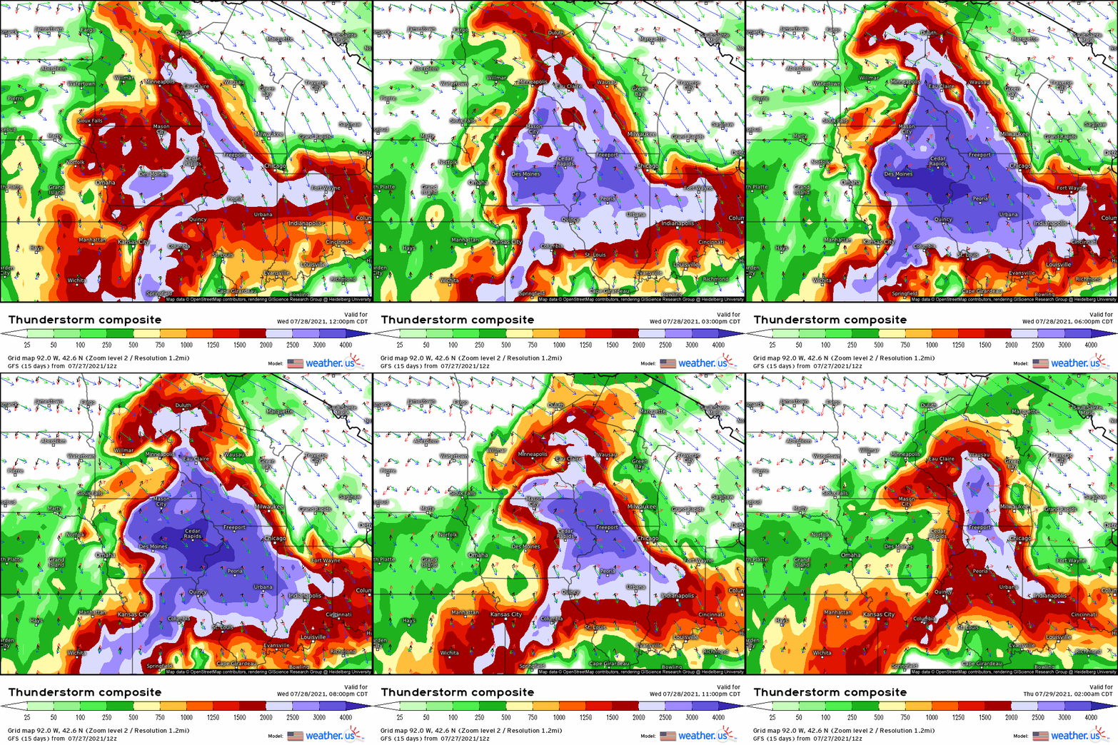
In fact, it’s a situation that seems quite possible tomorrow evening.
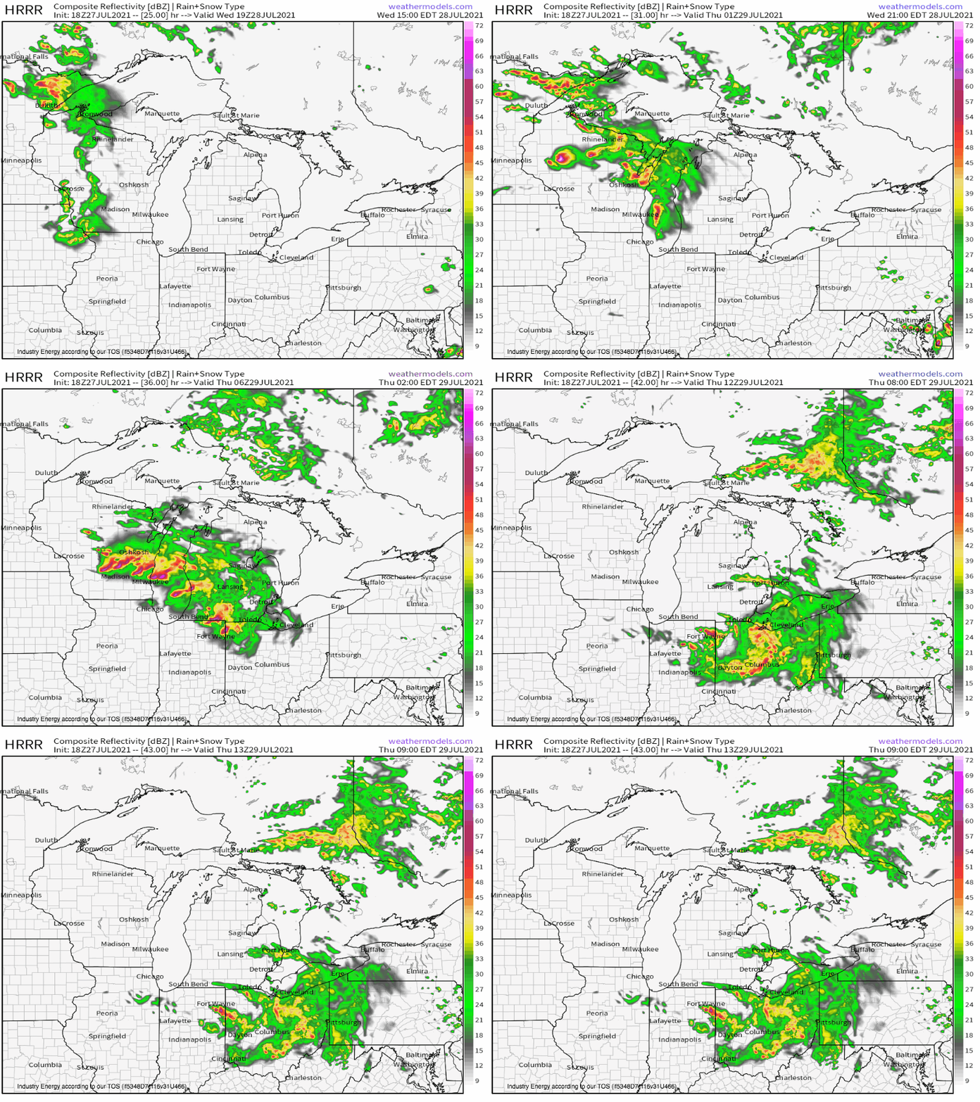
Convective allowing models depict storms blooming amidst an incredible parameter space, with an initial threat for a strong tornado near initiation over Wisconsin before cold pool development sends convection surging into one or more bow echos. Any tornado or large hail threat will in all likelihood rapidly turn into a damaging wind threat, which could well propagate into the Ohio Valley overnight. The result could be a large swath of destructive wind- potentially even a derecho.
Stay tuned.
