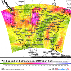
The Winds of Change
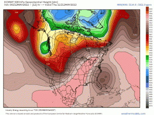
Thanks to a stalled trough-ridge-trough pattern, the Upper Midwest has experienced multiple days of record heat and threats of severe weather.
Today will be the last, though, as the flow finally begins to move again.
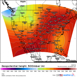
The low that has been hanging around just off the Southeast coast has begun to retrograde west. This will allow the ridge to escape east. The cut-off low then gets reabsorbed into the jet stream and flushed out by early next week. We then enter a period of more zonal flow which is generally not very supportive of widespread severe threats.
So, today is the last substantial threat, at least in the medium term.
A negatively-tilted shortwave is making its way over the Intermountain West. Ahead of it, under a northward-advancing warm front, lies an atmosphere that is already conditionally unstable and waiting for a trigger.
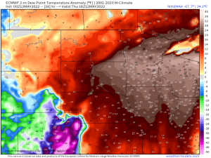
Dewpoints in this region are already in the upper 60s/low 70s and are expected to climb further as more moisture makes is advected north.
If you’re thinking that dewpoints in the 70s seem high for the upper Midwest in May, you’d be correct. These are running generally 20 to 30 degrees above where they should be this time of year. That’s what’s helping to facilitate a substantial severe threat for this region today.
Let’s look at conditions as of this morning.
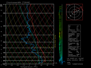
This is an observed sounding out of Chanhassen, MN, which is just to the east of the SPC’s defined Moderate risk zone.
- A strong cap is in place, however, with daytime heating and moisture advection, this cap will erode as the day wears on.
- We have dry air aloft to drive the damaging wind threat.
- Decent shear (above the inversion later) is already falling into place and will only improve as the low level jet strengthens. Winds are expected to back from the southeast along the warm front, making it the focus for tornado potential.
- Colder air aloft means rising air to be much warmer than the environment, allowing for strong updrafts. Strong updrafts are required for large hail and to strengthen a storm in general.
All hazards are possible today, however, some have limitations.
Any tornado activity will likely be limited closer to the triple point and/or warm front where shear is maximized. Here, surface winds will back from the southeast, enhancing low-level shear. The window for discrete cells is expected to be short-lived, though, so this threat may not persist for very long. Of course, QLCS tornadoes remain possible in the line as it advances eastward in the evening/early overnight hours.
With strong updrafts in play and much colder air aloft, large hail is a threat, especially in any discrete cells able to form/persist.
Damaging winds will be today’s main threat. Upscale growth into a line is expected rather quickly.
A mid-level jet streak with winds in the 80 kt range is forecast to be over the area this evening. Now, this is the 500 mb level, so it is unlikely that 80 kt winds translate directly to the surface. But winds around 65 kts (74 mph) have been mentioned in the SPC’s discussion. Those are hurricane force gusts, if you didn’t know.
So, while tornadoes and large hail are definitely possible today, wind is our primary threat. I highly suggest sheltering for a severe thunderstorm warning as you would for a tornado warning. I’ve said it before but straight-line winds can do as much damage as a lower-end tornado. Better safe than sorry.
As mentioned, this is the last substantial severe threat for this region, at least in the medium term. Once the front passes, more seasonable temperatures await along with quieter weather.
