The Tropics Awaken: Discussing Development
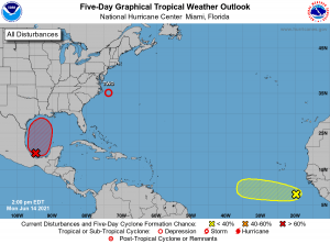
As you may have noticed this morning, if you’re a routine checker of the NHC site anyway, the tropics have suddenly decided to awaken with three areas of interest on the board for the Atlantic basin.
A few changes have occurred since this morning, though. Invest 92L has been upgraded to a 70% chance of formation in the next five days and Invest 93L has been upgraded to Tropical Depression 2. In light of this sudden burst of activity, we’ll take a brief look at each area and discuss what to expect.
Tropical Depression Two
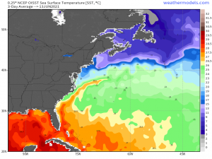
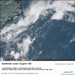
This sneaky little storm came together essentially overnight as an old area of energy exited the North Carolina coast and found itself over a very narrow plume of warm water: the Gulf Stream.
This narrow corridor is just about 80 degrees F, the threshold needed for tropical activity. However, being so early in the season, the warm waters likely don’t run too deep and quickly cool the further northeast you go. Any intensification TD2 sees will likely be extremely brief with it possibly attaining tropical storm status before it moves quickly off to the northeast.
TD2, which had a healthier look early this morning with some decent convection firing, now looks somewhat more subtropical. The minimal convection it has it mostly confined to the eastern side, away from the center. It also appears that the low level circulation is exposed, which generally isn’t a good sign if you’re expecting intensification. Currently, winds are at/near 35 mph and TD2 is expected to become a tropical storm by tonight/overnight before weakening later Tuesday.
All that said, TD2 will be moving off to the northeast rather quickly and will have no direct impact on the US beyond rough water and maybe windy coastal conditions. This will be merely satellite eye candy and a problem for the fish.
African Wave
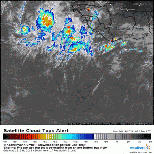
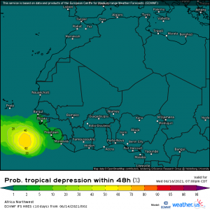
A strong wave is emerging from the west African coast. As these go, it’s a bit early in the season. Generally, we see development of African waves later in the season (August, September) due to unfavorable conditions for development in this part of the Atlantic basin at this time of year: dry air and shear.
Currently, however, conditions will be briefly conducive to development before becoming unfavorable late this week due to dry air and strengthening shear. We may see a tropical depression come of this, but more than that is unlikely at the moment.
As far as the threat it poses to the US: there is none right now. It would have to survive a journey across the Atlantic in unfavorable conditions (unlikely) before we could even consider the threat it would pose to the US. So while the emergence of an Easterly Wave this early is interesting, it’s unlikely to become something to write home about.
Invest 92L
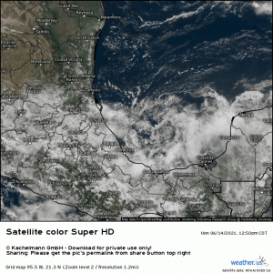
Currently, this area to watch is nothing but a broad area of low pressure with embedded showers and storms. Lacking any meaningful steering, it is just wandering the southern Bay of Campeche. It will gain direction later this week and is expected to develop as it moves northward into the upper Gulf.
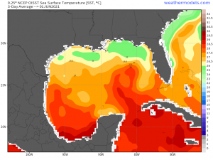
The waters aren’t extremely warm, but they are adequate to foster some development.
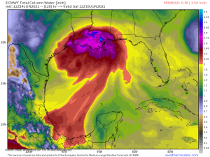
Regardless of the extent of that development, early season Gulf systems are known for deep moisture. The results will likely be the same whether this comes ashore as a general mess, a depression, a tropical storm, or a low-end hurricane:
A plume of deep moisture will move ashore somewhere in the north-central Gulf region, bringing more heavy rain to a region that does not need it. It’s far too early to discuss a track, intensity, or location of landfall. Just know that heavy rain is likely as we move toward the weekend/next week from whatever invest 92L becomes. We’ll be watching its development and keeping you informed!
