The Rex Block: From Manifestation to Sensible Impacts
There are many unique variations and meteorological processes when it comes to the atmosphere and its chaotic nature! One of the more intriguing phenomenon that can generate not only higher predictability in sensible weather, but a stagnant upper-level blocking pattern that yields consecutive days of the same weather for two different locations longitudinally! What do I mean by this?
Coined the “Rex Block” – named after Meteorologist Daniel F. Rex back in the early 1950’s, he presented evidence and eventually generated a conclusion that a quasi-stationary pattern forms sometimes in the upper latitudes whereby a high pressure system forms poleward (northward) of a low pressure center.
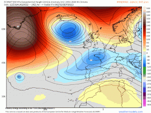
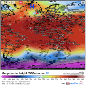
A mid/upper level ridge billows overtop a mid/upper level low, where the trough essentially, “cuts” off from the westerlies and one large envelope manifests with a high and low pressure center within that said envelope. Visually, take a look at what this looks like synoptically, as an example of this will form later this weekend and into next week across the North Atlantic – specifically across south Iceland and across Greenland.
A trough from the higher latitudes (> 60*N) allocates toward Scandinavia and cuts off from the flow. From there, the cut-off low amplifies while very slowly it propagates in an east-west fashion and spins as it does so before finally ejecting eastward. In conjunction, an ridge enters the Northern Atlantic, builds, and amplifies simultaneously with the cut-off low. This is typical with rex blocks as the opposing circulation centers work in tandem, as the pressure gradient increases along with temperature and height gradients subsequently increasing.
At 500mb, notice how close the high and low pressure centers are, but are within the same longitude causing simply a blocked height pattern.
A blocking pattern as such facilitates high predictability because simply the blocked pattern engenders the same, or very similar sensible weather at the surface whereby two locations only separated by several hundred miles would experience dry sinking air (high pressure) and the other likely clouds and precipitation (low pressure).
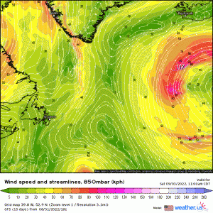
Taking a look below at what it looks like toward the lower portion of the planetary boundary layer at 925mb. Several important characteristics develop via the rex block:
- Low level easterlies remain abnormally stubborn thanks to the direction of the clockwise and counterclockwise flow around the high and low pressure centers, respectively.
- A deformation zone sets up on the western periphery of this entire gyre. What this means is that a deformation zone, or air that flows in opposite directions (diffluent) is being sheared and stretched. This is another way of saying a front is forming because different air mass characteristics are forming on opposing sides of a manifesting boundary.
Watch how persistent easterlies remain stationary over the same general area for several consecutive days and the deformation axis forms.
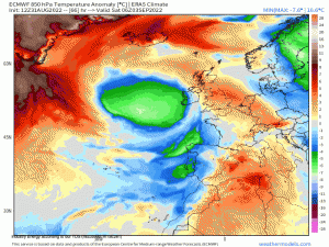
Using 850mb temperature anomalies, one can visually see the temperature characteristics underneath the opposing circulations, as the temperature gradient accentuates with time.
What’s more, this is technically considered a negative temporal phase of the North Atlantic Oscillation (-NAO) with a ridge bleeding into the Azores with a low pressure near Iceland! This is one of the more classic examples of high-latitude blocking as well, whereby the entire upstream flow becomes meridional and rossby waves are slow to propagate due to the amplified flow.
Eventually, the rex block will decay until one of the height circulation centers changes its intensity or until frontolysis occurs (i.e. breakdown of the front and deformation axis). This rex blocks, when they occur across the Western portion of the U.S., can exacerbate fire risks via Santa Anna winds and droughts (heat waves also come with these too).
The atmosphere is truly chaotic!
