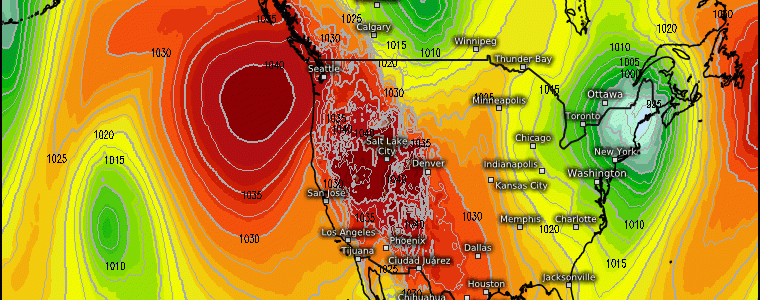
The Return of Arctic Air Into The U.S.
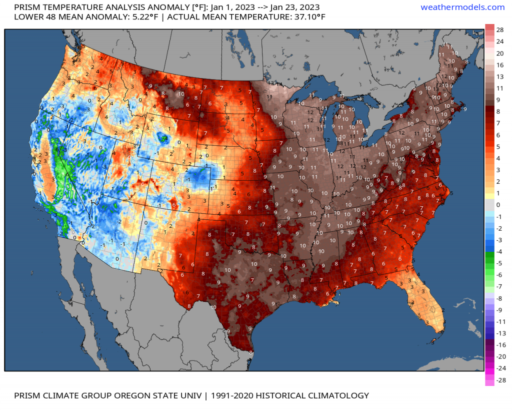
Thus far, we’ve truly lacked any arctic, cold air in the U.S. since the year flipped to 2023 primarily east of the the Intermountain West/Rockies. In fact, many places east of the Midwest are seeing a top 5 or top 10 warmest start to a January! However, we finally are looking at a change going into the last week of January into February.
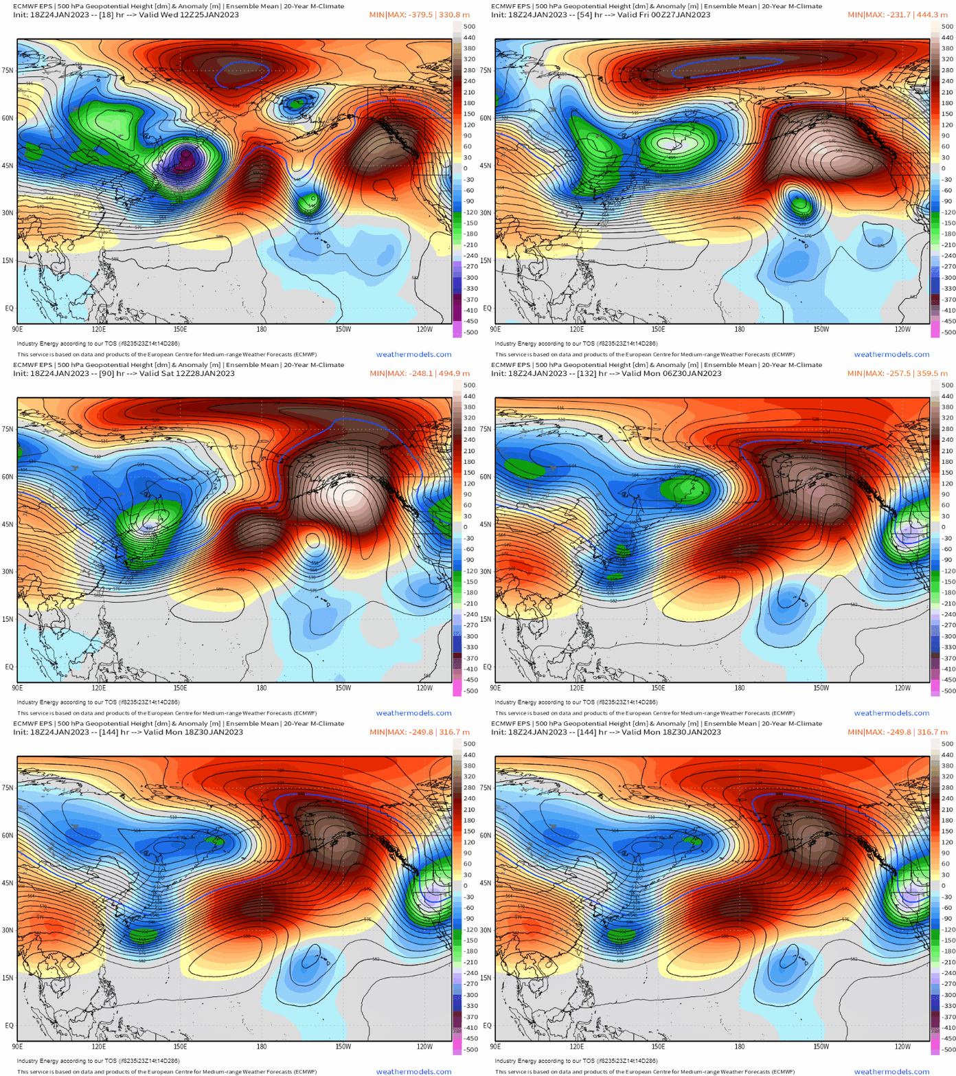
Lets first watch the evolution of the northern Pacific. Starting out east of Asia, you’ll notice initially deepening heights (purple/pink) and a robust mid-upper level low pinwheel into the Sea of Okhotsk. This then gets reinforced by upstream lower heights. This has a profound effect downstream across Alaska, Bering Sea, and into the Arctic. This deepening cyclone east of Asia will force a large-scale ridge to retract westward.
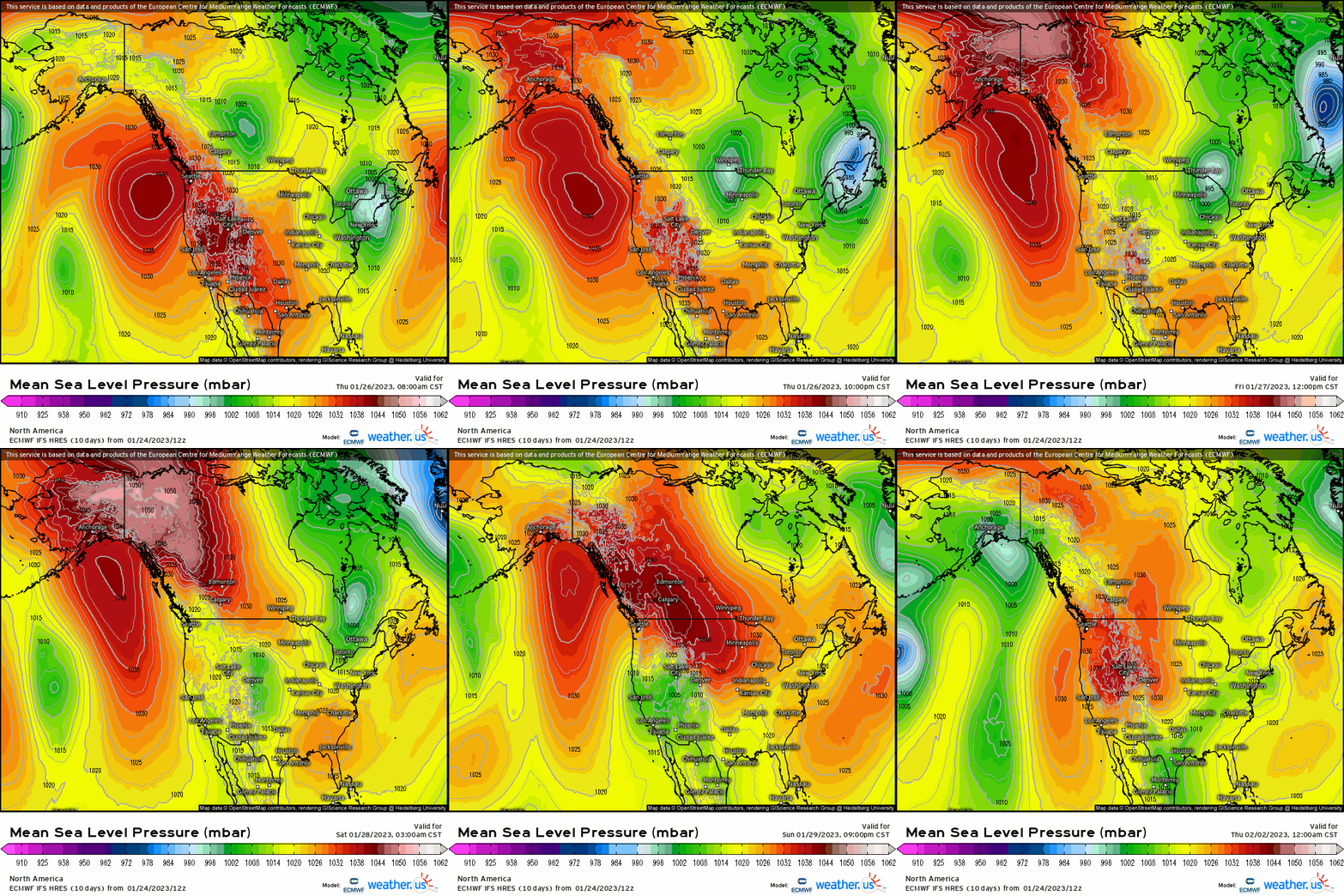
This progression establishes cross-polar flow and arctic air masses to finally eject down the ridge and into North America. We see this evolution nicely demarcated by the higher-than-normal pressures cascading along the spine of the Rockies.
What this looks like at the surface is shown below via the EPS. We see the trough and associated below average to well below temperatures first propagate into the Northwest and Plains, before shifting eastward as we open up February. Notice, though, we see moderation at it translates eastward using 2-meter temperature anomaly (top), and subsequently at 850mb (bottom).

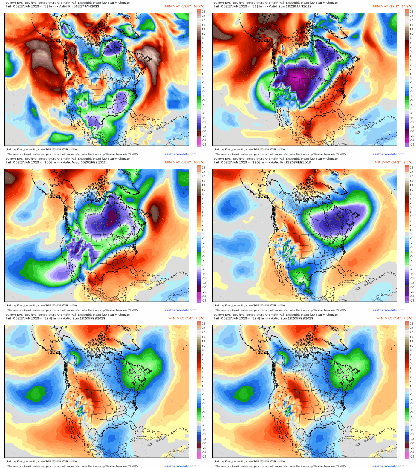
As a result, we can expect dangerous wind chills anywhere from 10 – 30+ degrees below zero toward the end of the weekend and into next week. We’ve not seen this type of cold since the week of Christmas, though it doesn’t appear to have much staying power as it’ll to be rather transient. However, with arctic air now entering into N.A., we usher in higher probabilistic odds for accumulating snowfall, and especially in places that haven’t seen much this winter. However, even the latter is certainly not guaranteed.


