The Omega Block
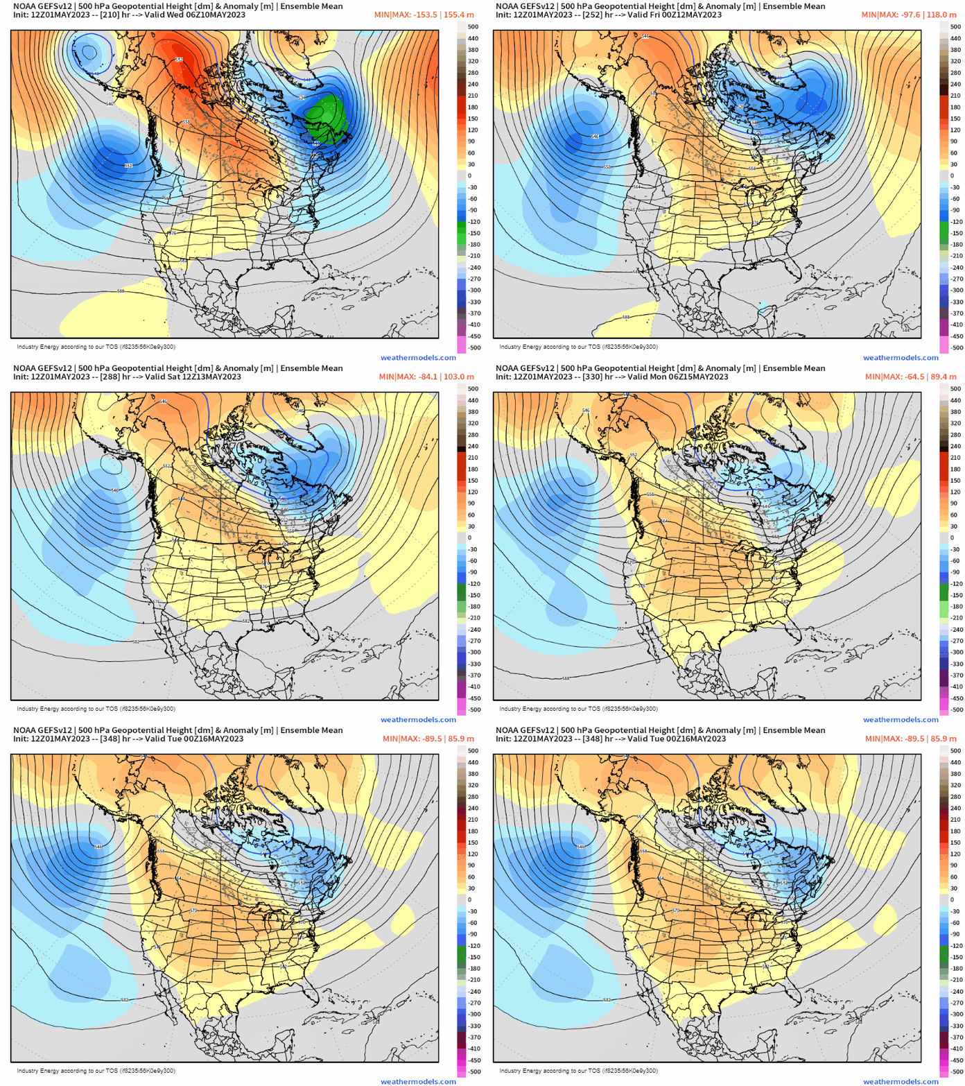
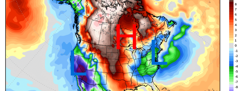
An omega block is called as such due to the fact that the upper-air pattern resembles that of the Greek letter “omega”, as shown below. With these types of patterns, you can typically get extremes (not all cases ,but if this were summer we’d be talking about record heat and issues concerning around the heat) because this pattern becomes simply stuck.
We see verbatim this week across the U.S. two troughs prevailing on both coasts while a large ridge sits across southern Canada and higher-than-average heights mostly confined across the Midwest.
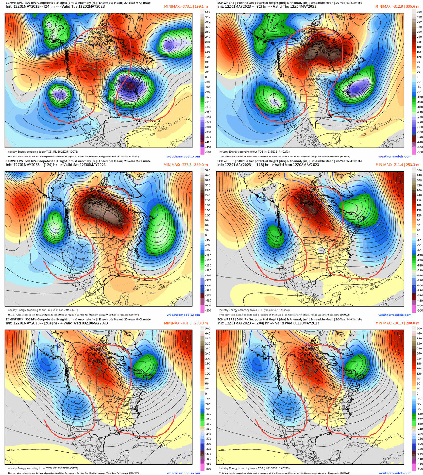
Using a 5-day temperature anomaly depiction, you can easily make out the placements of the troughs on both coasts and the ridge in between through the association with temperatures. Below average heights correspond to lower temperatures, and vice-versa and it’s this pattern exactly that’ll lead to flooding concerns across the Intermountain West and Great Basin by exacerbating snowmelt due to the warmer temperatures .
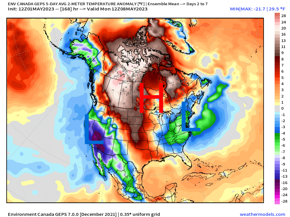
Furthermore, thanks to the high pressure “sandwiched” in between both upper lows, you can see where the most activity and unsettled weather take place, which is fascinating to watch two cyclonic circulations continue while out across the Midwest and Plains, the complete lack thereof or even any precipitation for that matter.
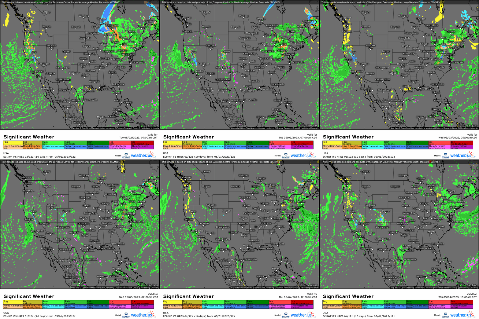
The good news is that by the 2nd week of May, this meridional current height pattern becomes “unstuck” as ridging expands across most of the CONUS, with the eastern trough being shunted out into the Atlantic while the West Coast trough pulls away. An active southern jet stream looks to occur, bringing back more episodes of severe weather likely, which also becomes absent during omega blocks as well and that of course certainly can be a good thing. However, we do see omega blocks occur randomly, and especially during transition seasons as wavelengths become shorter as we approach the summer months.
