The Official Start To Hurricane Season Begins With Interest In the Gulf
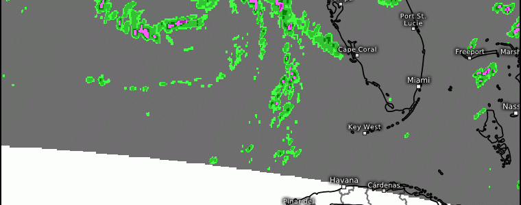
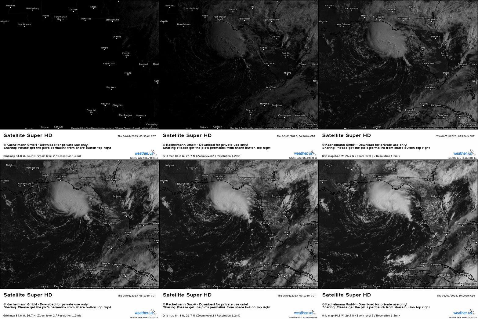
Invest 91L currently resides in the Northeast Gulf of Mexico, with an apparent low level circulation (indicated by the cumulus and stratocumulus clouds that are in curved segments), and bubbling convection above the circulation. Over the past several hours, we did manage to see some organization with thunderstorms.
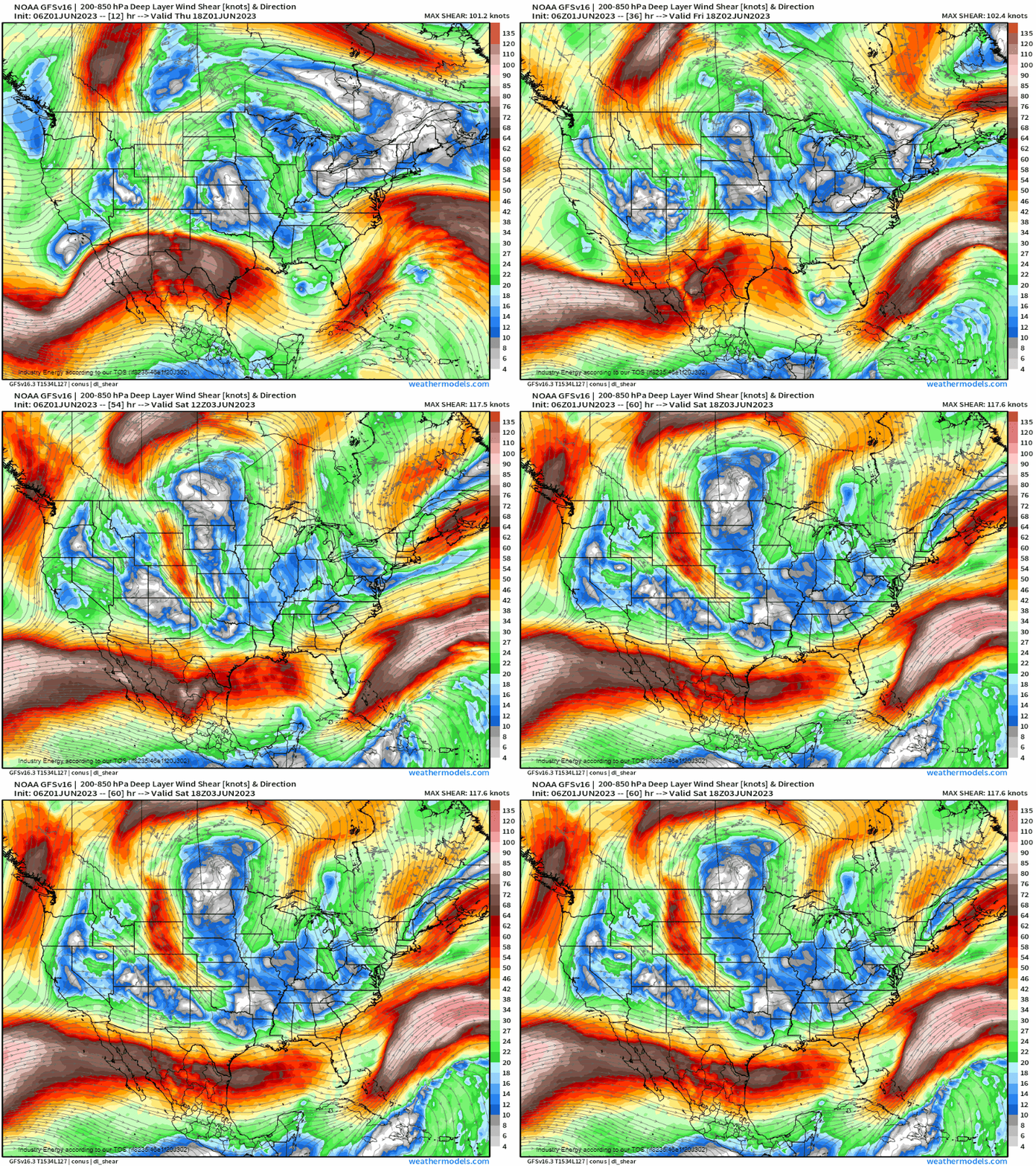
With current weak vertical wind shear of less than 20 knots heading into tomorrow morning, there is a 50% chance (according to the NHC that is) of tropical development into a depression. However, it’s inevitable it’ll proceed no more than a named tropical depression because despite current marginally favorable weak shear, lets watch over the next 24 – 36 hours what transpires. Paying attention to the Gulf offshore west of Florida, you’ll see a belt of 30+ knots of shear suddenly shift eastward into the Gulf. This will impede 91L’s circulation, causing it to tilt and eventually become one messy convective blob as we head into Saturday. So over the next 24 hours, we have a 50% chance of development into our first named storm of the 2023 Atlantic Hurricane season. The name would be Arlene.
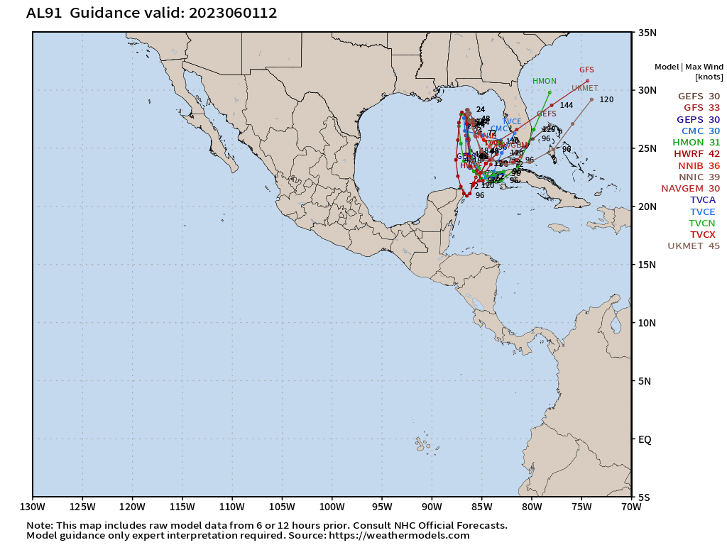
From NHC’s hurricane spaghetti plots, we’ll see a net southward motion before curving toward the Northeast. By the time we see curving, it’ll be a sheared rainy mess as we take a look below at what the NAM 12k does for example, which is backed by strong consensus from all computer models.
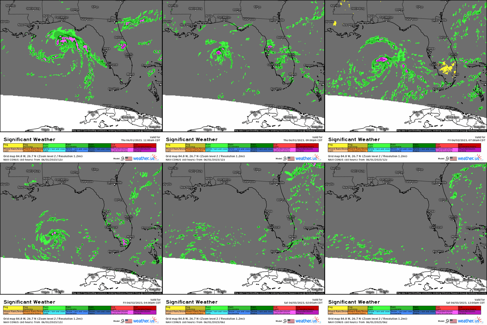
We can see how its initial organized circulation (to an extent) drifts southward due to the mean steering flow, and then becomes dismantled. However, the main concern with this will be heavy rain and winds for coastal areas mainly south of Tampa, FL targeting the southern portion of the peninsula and especially southwestern locations where we can see 1-2”+ and heavy downpours. This very well may lead to instances of flash flooding, though localized.
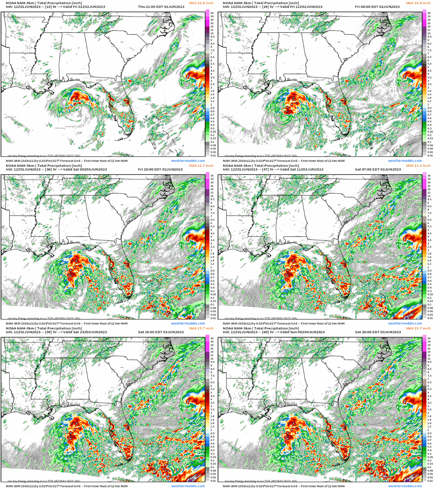
According to the NAM 3km, we see a “bullseye” of 1-2”+ across mainly the southern extent of the Florida peninsula through Saturday evening.
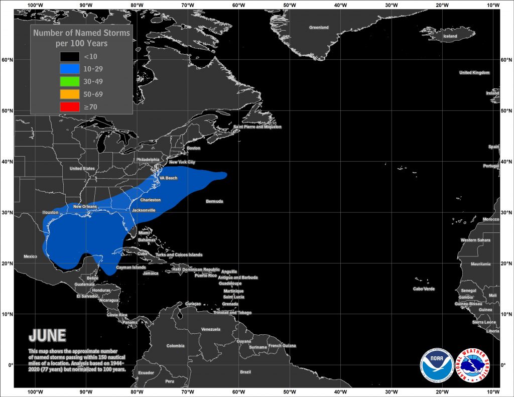
We’ve flipped the page to June, and it’s officially the start of Hurricane season. Rather fitting there’s a tropical entity we’re already discussing on the first day! Nonetheless, going forward, climatology favors the Gulf, northern Caribbean, and southwest Atlantic according to the NHC. As always, keep an eye out whether it’s from us, the NHC, or your local news so you can always be prepared especially living in vulnerable locations! We’ll always be on top of any tropical development that is worth discussing that can bring any type of impact to the U.S.!
