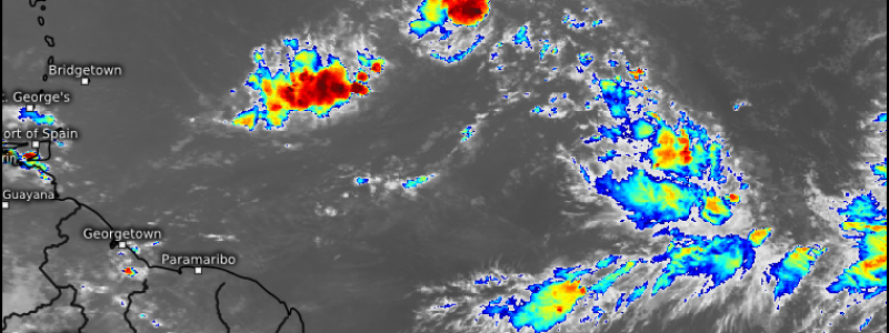
The Future of 91L
As I’m sure you’ve noticed by now, social media and the weather world in general is abuzz with talk of what could be our very first legitimate TC with hurricane potential: Invest 91L. You’ve no doubt seen model maps posted showing powerful hurricanes and concerning tracks, but what do we know about 91L right now? Let’s take a look.
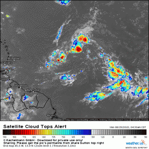
91L is currently a very elongated disturbance. Though there are areas of deep convection, no one area is dominant at the moment – and that’s a problem for track forecasting.
What we need to remember at this point in time is that 91L is not a TC yet. Until it develops a tight, defined center, trying to forecast it’s exact track is a waste of time. If the southwestern blob becomes dominant, that shifts the track. On the other hand, if the northeastern blob becomes dominant, that also has track implications.
So, what can we look at right now? Well, we can check out the state of the atmosphere ahead and the upper air pattern 91L is likely to deal with/that will control its track as it develops and moves into the Western Atlantic.
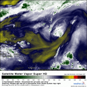
Looking at the water vapor loop, we notice a few things.
- Dry air is ahead of of 91L. As you probably already know, dry air isn’t great for a disturbance trying to sustain deep convection.
- An upper level low is lurking to the north of 91L. This feature is imparting NNW’erly shear to 91L as well as pushing dry air toward it.
It makes sense then that, despite looking fairly robust yesterday, 91L is now struggling.
The current official forecast from the NHC is for slow development over the next 5 days or so.
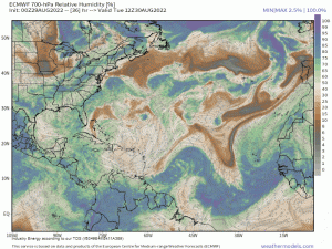
Again, this makes sense as we see the dry air lessen some and the disturbance able to wrap itself in deeper moisture.
As for approximate track…
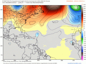
All eyes will be on ridging over the East Coast. Does the ridge hold strong? Or does an incoming trough “eat away” at the ridge, allowing the storm to recurve out to sea?
Right now, the general consensus between models and ensembles favors a recurve. Can this change? Yes, absolutely.
Timing is a factor. How slow or how fast this storm moves will make a difference. Timing of the trough also matters. Any faster or slower, and it may not clear the way in time, or clear the way too quickly.
Placement and strength of the ridge also matters.
And, most of all, this is all dependent on whether or not the disturbance develops. A high chance isn’t a guarantee, though formation does currently seem likely.
All we can do for now is monitor the trends. Watch the trends for the trough/ridge interaction. Is the ridge trending stronger? Lingering longer? What’s the timing on the trough? These are questions we’ll need to ask as we watch for 91L’s development this week. Additionally, where does the center form?
We’ll be here tracking this along with you and will update via Twitter or our blogs as the forecast evolves!
