That Deep Summer Feeling
Well folks, it’s hot.
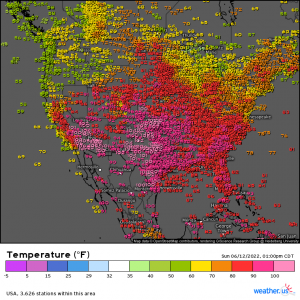
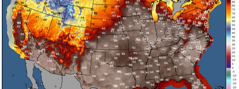
And it’ll get hotter. The toastiest temperatures are currently hanging out in the south-central and southwest US, however, they will slide eastward as this week progresses.
If you’re a reader of the weather.us and Weathermodels twitter feed, you know I’ve been talking about the arrival of this heat for roughly a week. But why? What’s the big deal about heat?
Well, believe it or not, heatwaves can kill just as many or, often, more people than any other natural disaster, especially when they occur in place where the population isn’t used to it or isn’t equipped to handle the stresses of multiple days of heat.
Think about the multi-day heatwave in the Pacific Northwest in 2021. It is estimated that over 1000 people died due to that particular heatwave (via Wikipedia). Whether it be heat exhaustion, heat stroke, or hyperthermia, heat can be dangerous or deadly.
Though its generally the more prolonged heatwaves that kill, any heat is dangerous if you don’t take care of yourself properly. By that I mean keeping cool and hydrated.
Now that I’ve warned against the dangers of increasing temps, let’s actually look at the set up.
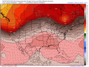
What we have is a ridge that is currently over the southern portion of the US.
As the week progresses, that ridge will amplify between two troughs – one over the NE/moving off shore and one over the PNW in a bit of an “omega block” pattern. Strong ridging (note the 594 dm height contour indicating very warm, rising air below) lingers with temperatures sky rocketing toward the triple digits from the south-central US all the way into the Midwest.
Impulses will travel around the ridge bringing cooler, wetter weather to the Northern Tier and parts of the Northeast.
By late week, a stronger trough digging in over the northeast US will force the ridge to escape west. This results in a renewed, amplifying ridge over the Central US by early next week.
So, as you can see, the heat may stick around awhile, depending on where you live.
How hot will it get?
Expect widespread temps in the mid to upper 90s.
As we’ve seen in more western locations, drought will help to enhance this heat. Parts of the coastal southeast from southern VA into Central GA are abnormally dry or officially in drought. This corridor has the best chance at topping out over 100 degrees, especially Monday through Wednesday.
Let’s also remember that it will be humid. Dewpoints will creep into the mid-70s for many. More moisture in the air means that when you sweat, it won’t evaporate as fast. This hinders your body’s natural cooling process.
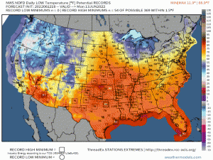
Speaking of hindering the body’s natural cooling process: nighttime is generally when the body is allowed to cool itself and reset for the next day of heat. However, during this heatwave, nighttime temps will remain rather warm.
Humidity and temps lingering in the 70s or even 80s will make for a few rather uncomfortable nights and offer no relief at all.
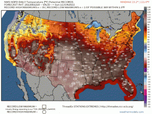
All the factors I’ve listed above are reasons to take the heat seriously, even if you think you’re “used to it.” This will be a multi-day, potentially record-breaking heatwave. Plan ways to stay cool. Don’t forget to check on your family and friends as well!
