System to Bring Moderate Snow, Rain to Eastern US
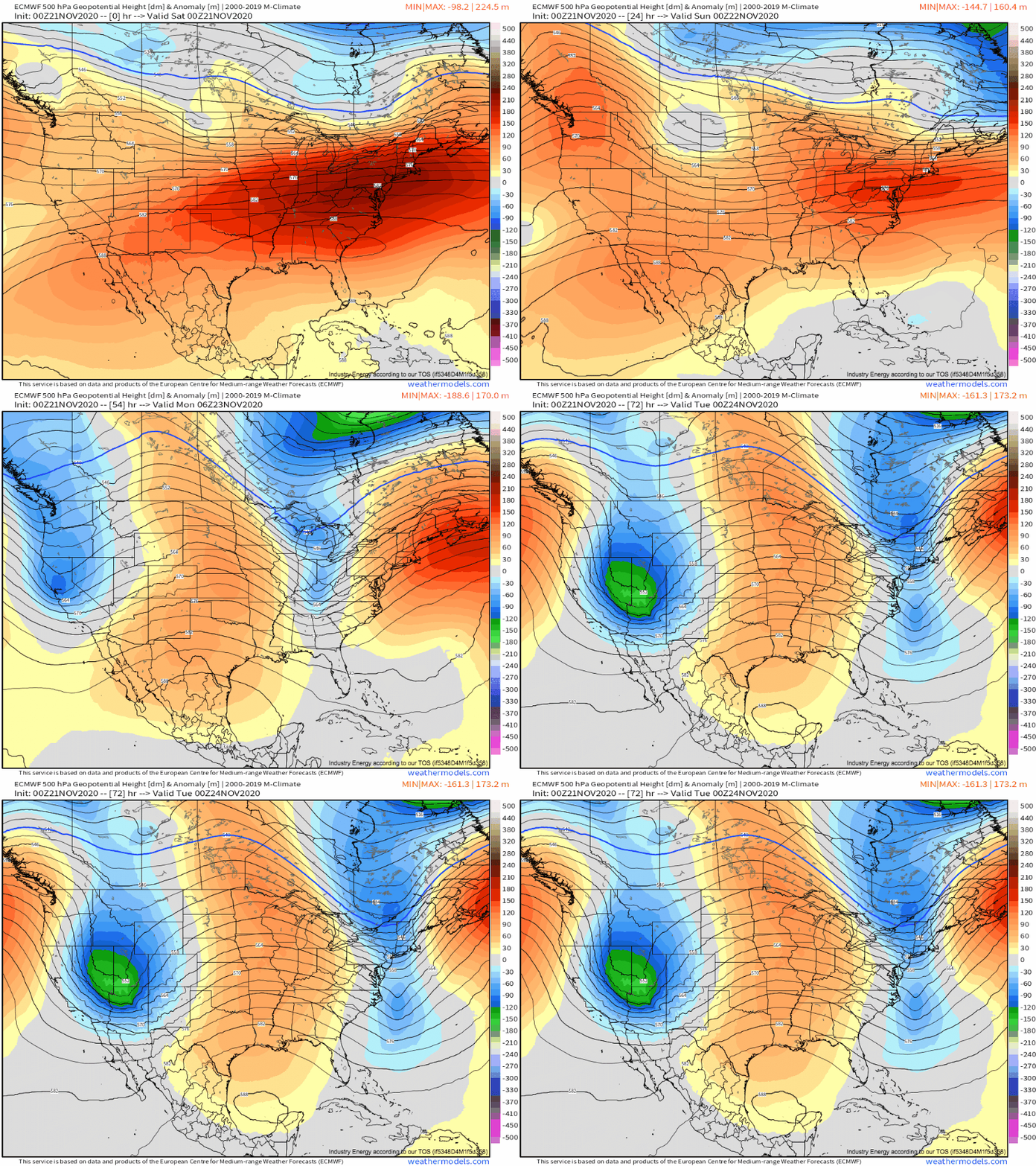
Broad ridging has kept much of the continental United States dry, warm, and clear of much sensible weather over the past few days. However, this ridging looks likely to break down as a trough bowls east towards the Atlantic coast over the next couple of days.
In fact, the broad flow pattern will shift from zonal to meridional into next week, as the expansive zone of anomalously large heights over the CONUS is replaced by a more typical high/low/high/low/high wave pattern.
Could this mean… a return to interesting weather for the eastern half of the US? Probably, although it will be gradual.
The first longwave pushing through the high-pressure wall will be rather low amplitude and disjointed, and no significant surface cyclognesis is likely, at least while the trough progresses over the United States. Without the development of a strong low level cyclone, the types of airmass advection that bring dramatic temperature swings, heavy precipitation, and severe convection will not occur. This will not be a particularly high impact system, not like there’s anything wrong with that.
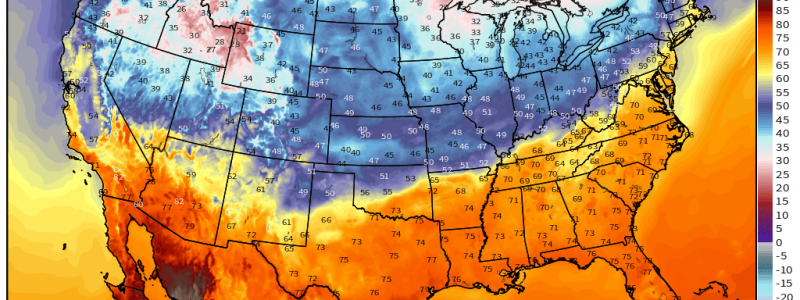
Attention shifts towards a stationary front with a corresponding ~20°F temperature gradient draped across the central US. 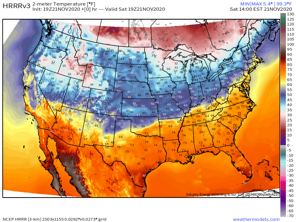
As the midlevel trough approaches this front, it will serve as the focus for our low pressure development. This is already happening over northeast Oklahoma, as increasing cyclogenesis at the hands of midlevel divergence pull warm air further north to the Missouri/Arkansas border, and allow cold air to begin surging south towards the Oklahoma/Texas border.
The surface low will progress slowly northeast today and tonight. Marginal instability, with an increasingly elevated component approaching and then moving north of the front, will mean scattered sub-severe convection on both sides of the frontal boundary. Really, the only threat with these storms will be rumbles of thunder and briefly heavy rain.
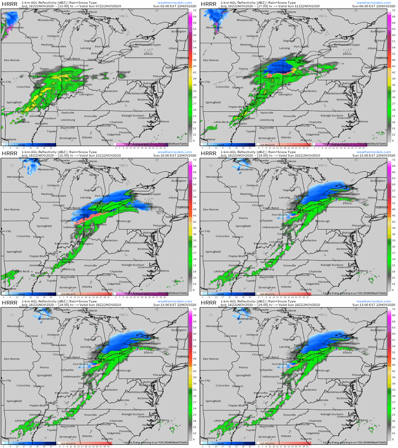
More potentially impactful weather will develop as stratiform precipitation to the north of the immature surface low’s warm front increases in coverage while the low moves northeast. As the precipitation shield moves into near-freezing surface temperatures over north-central Indiana and northeast Ohio, a few hours of evaporational cooling with rain will allow snow to begin falling, and then accumulating.
Accumulations here look modest (1-3″), but could prove impactful to Sunday morning driving.
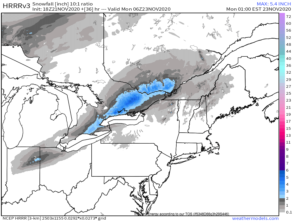
The snow shield will continue to expand and separate from the warm front, taking on an increasing comma-head appearance, as the surface low develops through tomorrow. The system is on the weaker side and largely fast moving, so nothing too significant is likely, but some locally plowable snow accumulations are possible in SE Canada and maybe far NE NY. As temperatures will be marginal, expect the biggest accumulations at high elevations.
This map of snow by the HRRR is largely in line with my expectations, with less precipitation falling than other models counteracted by 10:1 ratios, which may be on the high side for this marginal event. However, the potential for 6-10″ snow bullseys over SE Canada should not be ignored; it just seems less likely than a more marginal event at the moment.
As the snow shield of a by-now mature cyclone approaches the St. Lawrence river tomorrow night, a different threat may occur to the storm’s south. An increasing southerly 850mb jet drawn by the storm’s intensifying pressure gradient will pull moisture along a slow-moving front in eastern New England, where it will lead to a few hours of moderate rain Sunday night into early Monday. 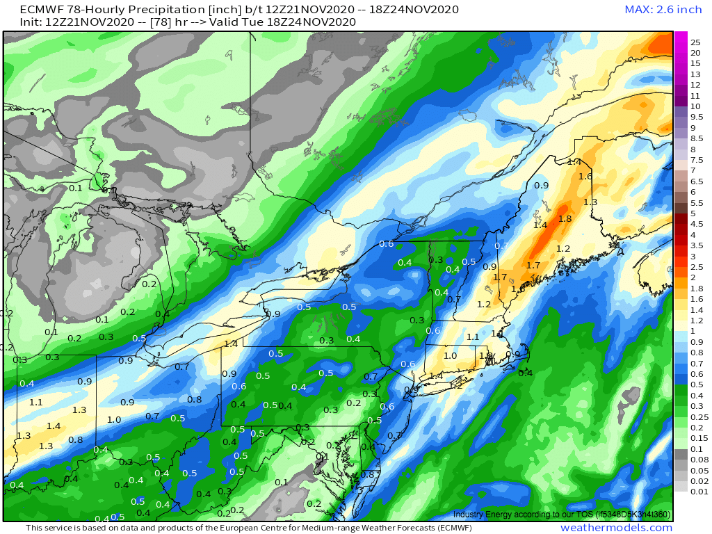
This rain will be largely beneficial, and likely not hazardous, as it falls on soils left dry by months of below-average precipitation.
The stifling ridge keeping much of the country warm and dry will finally break up this week, starting with a trough’s intrusion today. This system will lead to sensible weather in the eastern US, from snow in parts of the Great Lakes and Canada to moderate rain in eastern New England.
