Swing…. and a Miss for Parts of the Northeast?
With what appeared poised as a favorable synoptic setup for the Northeast that’s typically consistent with producing coastal storms, we’ve seen quite the adjustment and wobbling up until recently.
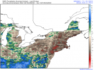
Below represents the last 60 days in terms of anomalous total precipitation – how much precipitation has fallen, or lack thereof. A large majority of the Northeast is currently suffering from a general drought with some places such as Eastern MA seeing worsening conditions by the day, and getting into an extreme localized drought even. Other areas range anywhere from abnormally dry, to extreme. This is according to the U.S. drought monitor, which can be accessed here. Unfortunately, I hate to be the bearer of bad news, but the entire trend since early last week haven’t been encouraging.
What has changed?
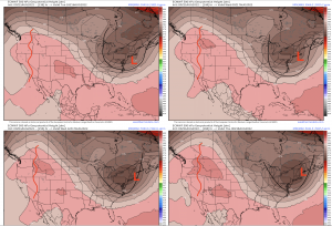
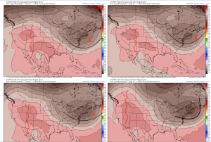
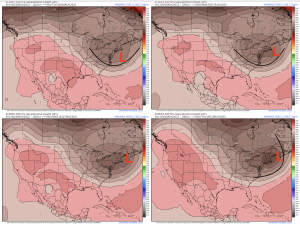
A few synoptic adjustments occurred over the last several days that have rendered an overall, more zonal flow. This is reflected in the numerical weather prediction models. These types of trends, discussed below, result in a de-amplifying flow downstream. This is illustrated using deterministic guidance as an example via ECMWF:
- Western U.S. ridge trended from meridional (North-South) to a more flattened orientation. The apex of the ridge remains upright through the period of Tuesday-Thursday using a model run from a few days ago (August 11th).
- Gradual broadening of the mid-level trough across the Northeast. The aforementioned progged amplified ridge several model runs ago resulted in the mid-level trough downstream across the Appalachian’s to dig, amplify, and its axis to tilt more neutral-negative. This ultimately renders the surface cyclone to be a “benchmark” storm, where the low pressure tracks up or nearby the classic “40/70” path (40* N, 70* W — coordinates used that are consistent with classic Nor’easter impacts), sticking close to the coast. It’s now likely this tracks east of this benchmark, rendering a miss for for areas like DE, NJ, NY, and into Southern New England. Eastern MA and New England still appear likely to get up to an inch or so.
- Progressive nature of the mid and upper-level pattern stemming across the Northeast Pacific. Essentially, the entire waveguide (i.e. trough-ridge-trough) shifted east and less meridional, which is reflected at the surface by showing a now more eastward, offshore track.
There has been consistent waffling of deterministic runs of models such as the GFS and ECMWF especially, so this is when we want to pay more attention to its ensembles. For instance, compare the runs of the ECMWF deterministic model from August 11th (00z) to the run from August 14th (12z) and the most recent run of 6z August 16th:
Older run: Amplified western U.S. ridge throughout period, even amplifying toward end of week. Mid-level trough digs and cuts off from mean flow, which at the surface, the surface low pressure would be “captured” and influenced to hug the Northeast coast.
August 14th: Mid-level ridge is flatter and the entire 500mb flow is zonal. The downstream trough is much more progressive and broad, with still a consensus in that this trough manages to cut off from the mean flow. It’s now not until Thursday that we see a late negative tilt of the trough axis, resulting in the surface low being “pulled” back toward eastern New England, but bypassing the entire I-95 corridor from NJ up to Southern New England.
August 16th 00z: Not much has changed entirely, with the exception of a bit more of a meridional western ridge. The downstream mid-level trough; however, still is remains consistent with the overall de-amplfying trend. While verbatim the trough digs a bit more and “closes” off a bit sooner, which in turn captures the surface low offshore as it tilts negative allowing the track to be influenced westward. However, the precipitation shield won’t become entirely expansive like we’d typically see in the winter time due to lacking dynamics. Regardless, this track would allow eastern MA and up into New England to see some heavy rainfall accumulating up to potentially 2″.
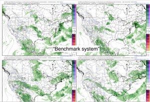
6-hour precipitation type and MSLP to help show the progression from Tuesday mid-afternoon into Thursday. Notice the change toward an offshore track, taking the bulk of total precipitation with it.
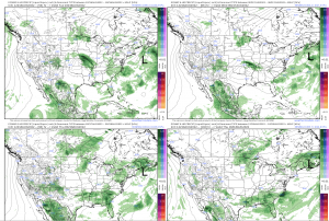
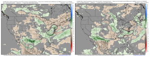
Here are the ECMWF and GFS ensembles, which show a 12-hour model cycle change to show the entire consensus shift. Both images are of model initialization times from the evening of August 12th and August 14th (12-hr change between August 10th-12th, and August 13th-14th). You can see the stark contrast and change from what appeared to be a very beneficial deliverance of rain to a bleak forecast of dryness. The only real consistent signal at the moment is that portions of Eastern and Northern New England may still get possibly anywhere from 0.5″ to 2″.
Comparing the run of the EPS from August 12th (Left) to the run of August 15th (middle) and the most recent run (August 16th). This is valid the same time for Wednesday evening. The cluster on the left represents what a more amplified pattern is capable of producing, and the cluster in the middle displays a progressive nature as discussed above. It overall makes sense to see a shift like this because realistically, we’re in the time-period of the year where we see the least amount of baroclinicity (temperature contrasts like what we may see in Fall and into winter with “fighting” between the colder polar air masses and “leftover” warmer air masses from the south); therefore, something of this nature that we’ve seen modeled several days ago would is considered anomalous. The most recent run of the EPS shows a tighter clustering, indicating better agreement on the placement of the mean SLP. It’s still not as far west as what the ECMWF deterministic model, especially from yesterday as it corrected likely too far west. This is why you want to rely more on ensembles! There is good agreement that the overall track, while not a coastal “hugger”, will remain just far enough east for areas like the Mid-Atlantic and up into Southern New England. Further to the coast one is, the higher probability of seeing rain like Eastern MA.
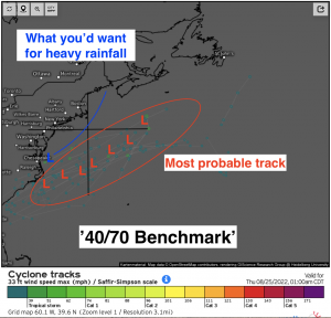
Using the EPS storm tracks, which can be accessed here, I’ve annotated the 40/70 benchmark track and where we’d want to see a track for beneficial heavy rain vs. the reality of the situation this week.
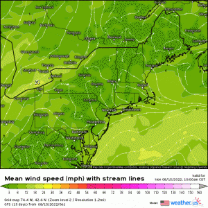
Regardless of the offshore track, there still does appear to be some minor coastal flooding concerns given the lengthy duration of onshore flow up until Thursday that began yesterday. The good news is – take it as you perceive fit, is that with a more offshore track comes a lesser chance of coastal erosion and flooding. Note the persistent easterly/northeasterly flow up until Wednesday when we finally see winds shift offshore as the result of the passing of the low with the pressure gradient also easing.
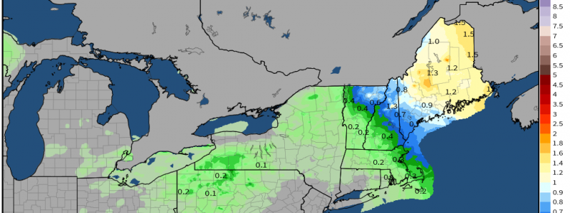
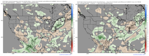
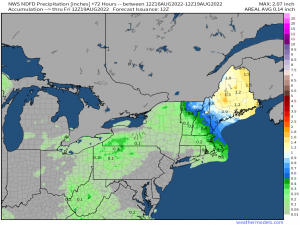
Lastly, here is what the current consensus is in terms of total precipitation expected through Friday via NWS. We see the large area absent of precipitation from northern VA into Rhode Island. Portions of Southern New England and New England – especially coastal areas, will still see anywhere from a few tenths of an inch, up to 2″. The overall track still has some uncertainty to it, so we can expect some waffling. However, given the overall synoptic pattern, a track similar to what the ensembles show make the most sense.
For now, we’ll have to rely on convective summer storms, frontal systems, and tropical moisture setups in order to help alleviate the drought across the Mid-Atlantic and Northeast. Once we get into the month of September, we’ll likely begin to see wavelengths lengthen and more of an active pattern establish and with it, beneficial rain – hopefully!



The topic was interesting to read as I had been observing significant day-to-day variance in model output (both gfs and euro) for the possible coastal storm over the last few days…thanks.