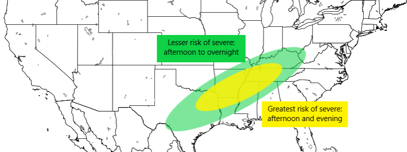
Sunday Severe Risk
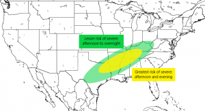
Spring temperatures have sprung in the south and, as any resident of this portion of the country knows, the warmer conditions bring with them the possibility of widespread severe threats. Today will be one of those days. Jacob discussed the possibilities yesterday in his blog. Enough confidence exists now in the severe chances for today that the SPC has upgraded an area stretching from NE Texas to central Tennessee to a slight risk. Hail, damaging winds, and a few tornadoes are all a possibility today.
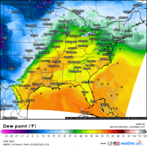
As a warm front lifts across the south through the day today, temperatures surge into the 70s while dew points climb into the mid to upper 60s, priming the atmosphere for unsettled weather.
These dew points, combined with broken cloud cover over this region allowing for further heating and destabilization, leads to forecasted CAPE values exceeding 1500 J/kg in the southwestern extent of the defined risk area and 8o0-1200 J/kg in the northeastern section. While not an insane amount of available energy, it is sufficient.
Though lapse rates aren’t impressive, deep layer speed shear of 6o to 80 kts combined with favorable directional shear are enough to support the formation of a few supercells.
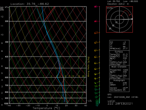
If you’ll notice in the graphic above, the red line (temperature) kind of has kinks all along it. That’s the less-than-impressive lapse rates I mentioned. A very slight inversion is present aloft in most locations inside the risk areas which means we’ll need either extra available energy (higher CAPE values) or mechanical forcing to help break through the inversion and allow the storms to really strengthen. We will find that forcing to some extent along the cold front that will approach from the west later today.
One exception to the moderate lapse rates: Texas. Lapse rates will be more impressive here and support the risk for possible large, damaging hail.
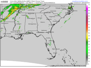
We will need to watch for the development of a few stronger cells out ahead of the main frontal line that will swing through later in the day. These lone cells generally have a higher chance of developing into supercells and bringing severe weather than a frontal line. Not to say that there can’t be severe weather contained in the line; there often is. In fact, we’ve seen tornadoes form from embedded supercells a few times this year already. But generally, the more serious severe weather comes from the formation of separate supercells. That said, the strongest forcing will be along the frontal line so that will absolutely need to be watched for the tell-tale “kinks” that indicate the formation of embedded supercells.
Fortunately, this will largely be a daytime event. Some of the threat may persist after sundown but will gradually weaken into the overnight hours with the passage of the cold front and the loss of daytime heating. Regardless, this is a day to be weather aware. Have MULTIPLE ways to receive warnings if they are issued. Have a plan to take shelter if need be. Don’t blow off the risk if you’re “only” in the marginal category instead of the slight category. Storms can’t read maps. Severe weather often forms outside of defined higher probability areas.
If you reside in this region, warn your neighbors and friends of the impending weather. If you don’t, but know someone who does, call them up and let them know. Awareness makes a huge difference during these events.
Stay safe!
