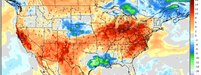
Summer Returns to the Eastern US
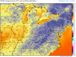
Eastern US: how do we all feel about that gorgeous fall preview we’ve had over the past ~48 hours?!
Just soak in those morning lows! Widespread 50s with a few upper 40s sprinkled about. Isn’t it wonderful?
Well, I hope you enjoyed it because it’s merely false fall. If you didn’t enjoy it, however, get ready to return to your beloved sweaty state. A warming trend will begin early this week and return us to those sticky, late-summer days and humid nights.
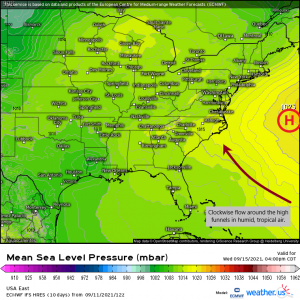
As we move through the week, ridge will begin building over the central Atlantic. As it gets stronger, the clockwise flow around the high will begin pumping in moist, tropical air to the East Coast.
Yuck.
It will be a gradual process, with that familiar sticky feeling returning in full force by the middle of the week.
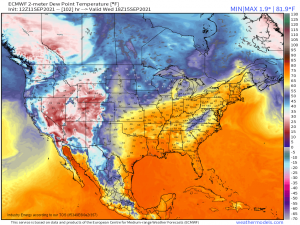
The modeled dew points for Wednesday display widespread upper 60s and low 70s. By then, our all-too-brief rendezvous with fall will be nothing but a memory.
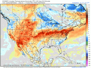
Heat levels could be fairly significant as well, at least for the Great Lakes/Northeast/Mid-Atlantic who are used to cooler temperatures already having arrived by this time of year.
Temperatures 10 to 20 degrees above average for at least a few days next week seem likely at this point so don’t close those pools just yet. You’ll need them for a bit longer.
I know this is a rather generalized look at the pending uptick in heat and humidity; it’s hard to be specific for such a large region. If you’re looking for a more personalized, focused forecast for your specific area, be sure to head on over to weather.us to check out the 14 Day Trend for your city!
Enjoy the drier air (while it lasts) and your weekend!
