Summer Comes Quickly to the Eastern US
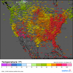
Let’s do a quick 3 pm temperature check:
Eastern US- how are we feeling about these summer-like temps? Pretty nice after weeks of chilly, rainy weather, aren’t they? Well, I hope you like them a lot because they’re here to stay, and will get even hotter, for a bit.
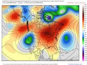
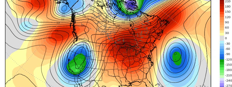
As we move into the weekend, an omega block is forecast to set up over the US.
What is an omega block? First, it is thusly named for the shape it makes – it resembles the Greek letter “omega.” It consists of a low-high-low pressure pattern oriented from west to east. High pressure builds between the two areas of low pressure and can sometimes stagnate for weeks. This leads to hot and dry conditions for anyone under the bubble and cooler, wetter conditions for those either east or west of the area of high pressure. When this pattern persists for weeks, it can often lead to drought conditions in the area of high pressure and flooding in the areas of low pressure.
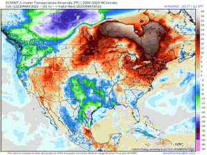
Fortunately, this particular omega block isn’t forecast to last multiple weeks. It does look to stick around until roughly the middle of next week, though. Eastern US, you’re about to get the warm weather you’ve been wanting. In fact, by early next week, the heat building under this dome of high pressure could be pressing into record-breaking territory for many locations. I did some digging into records here in Knoxville and it appears that on both Sunday and Monday we are in position to challenge high temperature records that have stood for just shy of 120 years. That’s some serious heat!
Link
Over the next 6 days or so, temperature anomalies of 15 to 20 degrees above average won’t be uncommon. Heat is often a silent killer that not many people take into account. Please be sure to take proper precautions in the coming days. Stay out of the sun during peak heating, drink lots of water, and have a way to stay cool. Oh, and don’t forget the sunscreen! All of us light-skinned easterners are likely lily white from our cool and damp winter and spring. It won’t take much to get that first sunburn!
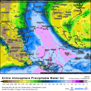
A major downside to this developing omega block is that the high pressure that settles into the mid-south will use it’s circulation to effectively steer any moisture to it’s west.
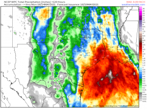
What’s to it’s west? Louisiana and Texas, unfortunately. These oversaturated states absolutely do not need any more rain, however, they are about to be facing down an atmospheric river of tropical moisture aimed directly at them this weekend.
Should it play out as the models suggest, a widespread 2 to 3 inches, with locally higher amounts where we see training of storms, is possible between tomorrow and Monday. Needless to say, flash flooding will be a concern yet again.
So: hot in the east, cool/rainy in the west at least into early/mid next week. Eastern half – enjoy your sudden summer. Texas/Louisiana – consider trading your car in for a boat (sorry).
