Substantial Late-Season Severe Threat Possible for Central US
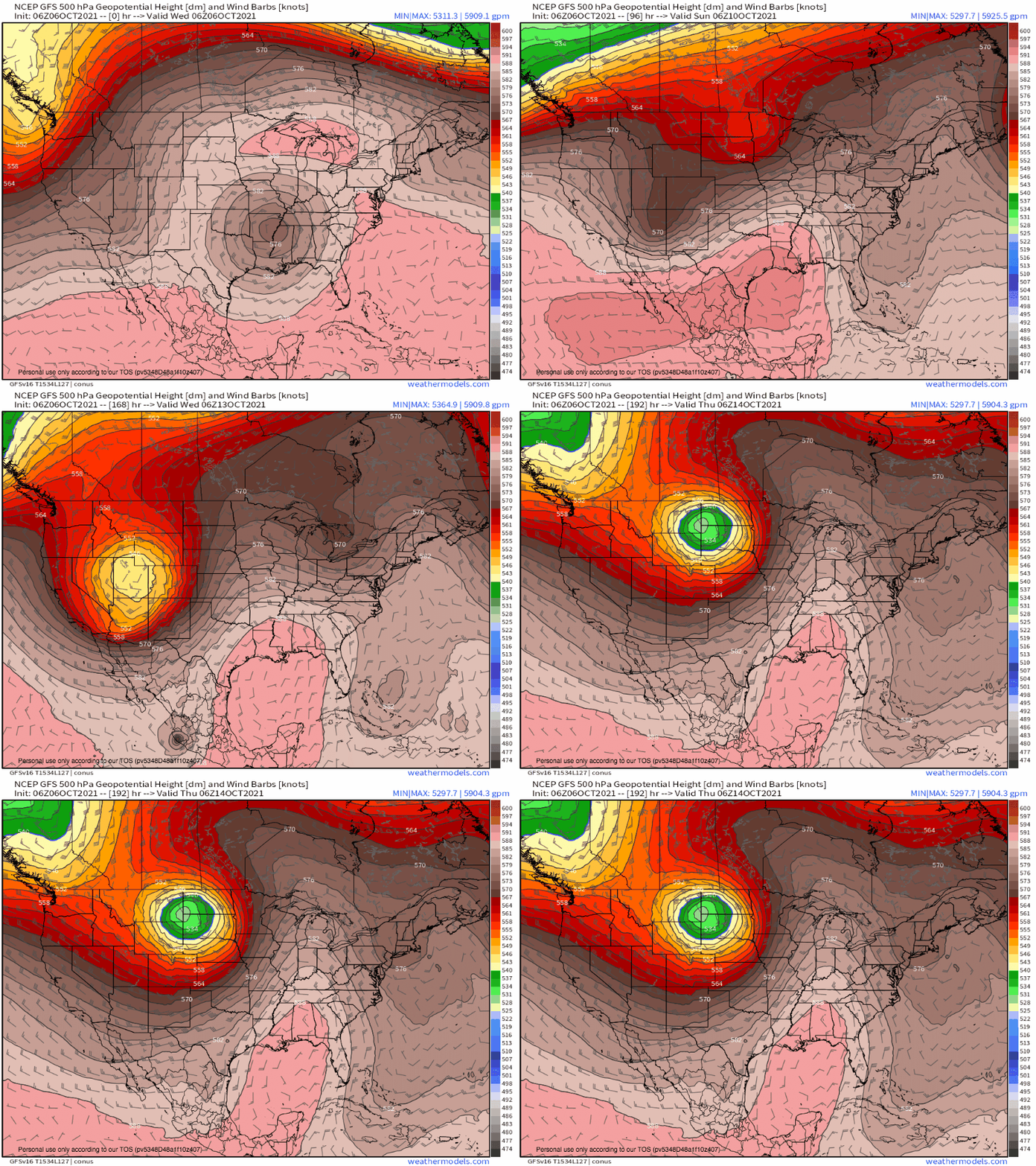
A multi-day barrage of midlevel troughing will set the stage for severe thunderstorms in the central US to kick off next week. Some of this activity could be significant.
Weather as of late has been driven by Atlantic blocking, which has sent a sluggish closed low retrograding slowly through the Southeast. But a pattern change is probable beginning this weekend, when two powerful longwave troughs from upstream can finally push through the blockage.
In the process of this sharp systemic change, two distinct opportunities for mid-US severe weather will develop. This blog will serve as an overview of each.
In the off-season, home to massive kinematics but skimpy thermodynamics, instability is the king of making or breaking severe weather setups. As September has now turned to October, this means among the most important aspects of forecasting large-scale severe thunderstorm outbreaks becomes synoptic-scale support for instability.
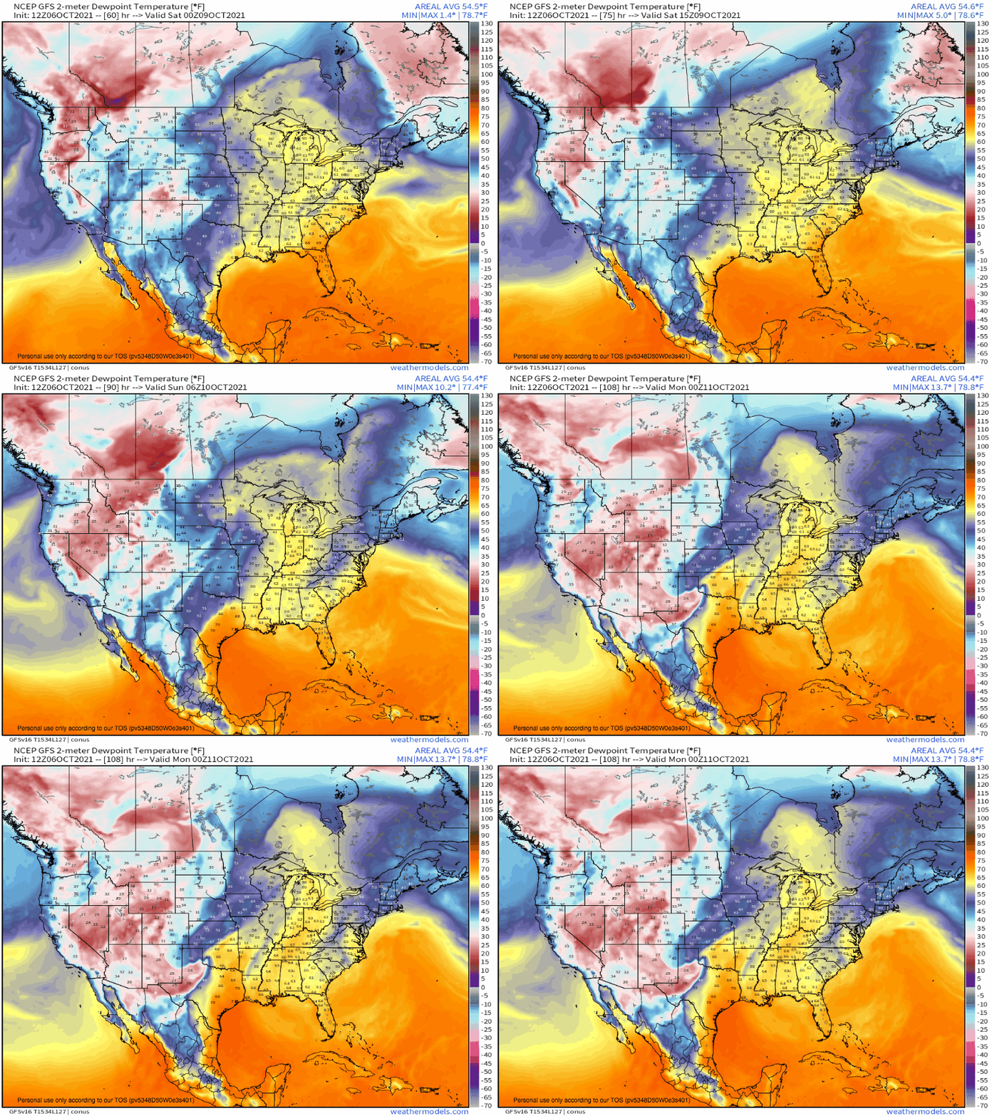
Effectively synonymous with moisture advection from the Gulf, a regime supportive of instability is largely a regime that allows southerly low level jet development and persistence well ahead of the arrival of kinematic support for severe weather. Because these LLJs form in response to midlevel mass evacuation, the most important thing to look out for ahead of off-season severe weather is a predecessor shortwave with positive enough overall tilt (relative to the ‘main’ shortwave, or longwave base) to advect in moisture but not scour it. The success of a weekend predecessor shortwave can be identified in the moisture flux that proceeds Sunday’s trough.
Sufficient moistening is the hard part of getting an off-season severe threat, and our favorably oriented troughing seems willing to provide. This means it’s left up to the ‘main act’ impulse to carry out the severe weather threat.
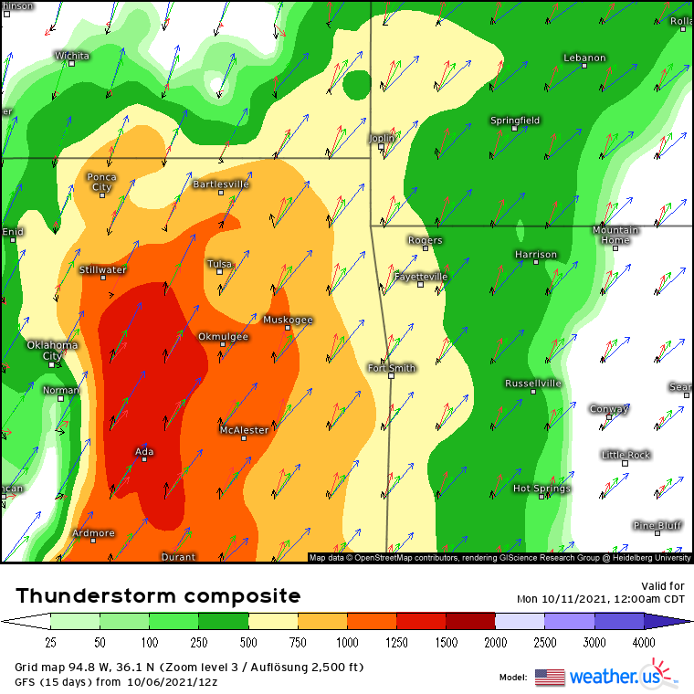
As the main trough swings into the central US, it will be accompanied by a dramatic increase in midlevel flow. A widespread plume of favorable shear will result, below which midlevel divergence will increasingly strengthen southerly low level flow. In this environment of roaring kinematics and aforementioned moistening, vigorous convection seems plausible.
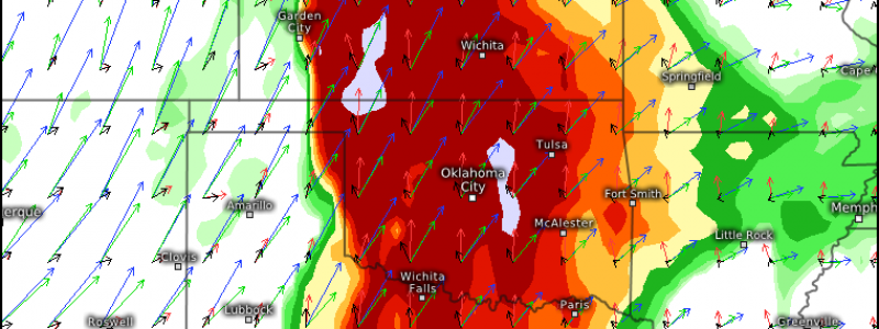
Flooding will also be likely for parts of the central US, as the midlevel low deepens largely parallel to its trough axis and height field. The result will be persistent convergence along a SW->NE line, which could lead to a fairly narrow corridor of very heavy rain. This is shown by global model precipitation fields already, though actual location is quite uncertain.
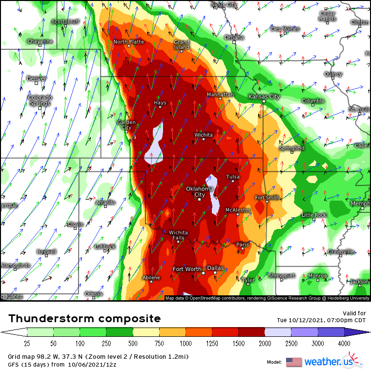
In the immediate wake of this impressive longwave, another powerhouse trough will rapidly intensify across the Western US. Building in too rapidly to allow Sunday’s cold front to scour moisture, the second trough will quickly rejuvenate southerly flow and create a second severe-hospitable warm sector in three days by Tuesday.
As this occurs, rapid development of a low level cyclone will send a dryline surging east Tuesday evening, with a once-again impressive combination of thermodynamics and kinematics unusual for October.
It’s still a little early to say much more, but this setup has my full attention for much of the central US Tuesday, when substantial severe weather could be possible. Stay tuned!
