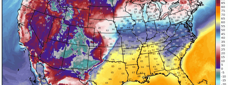
Strong Thunderstorms Possible Across Much of Central US Sunday
It sure feels more and more like spring is in the air lately, does it not?
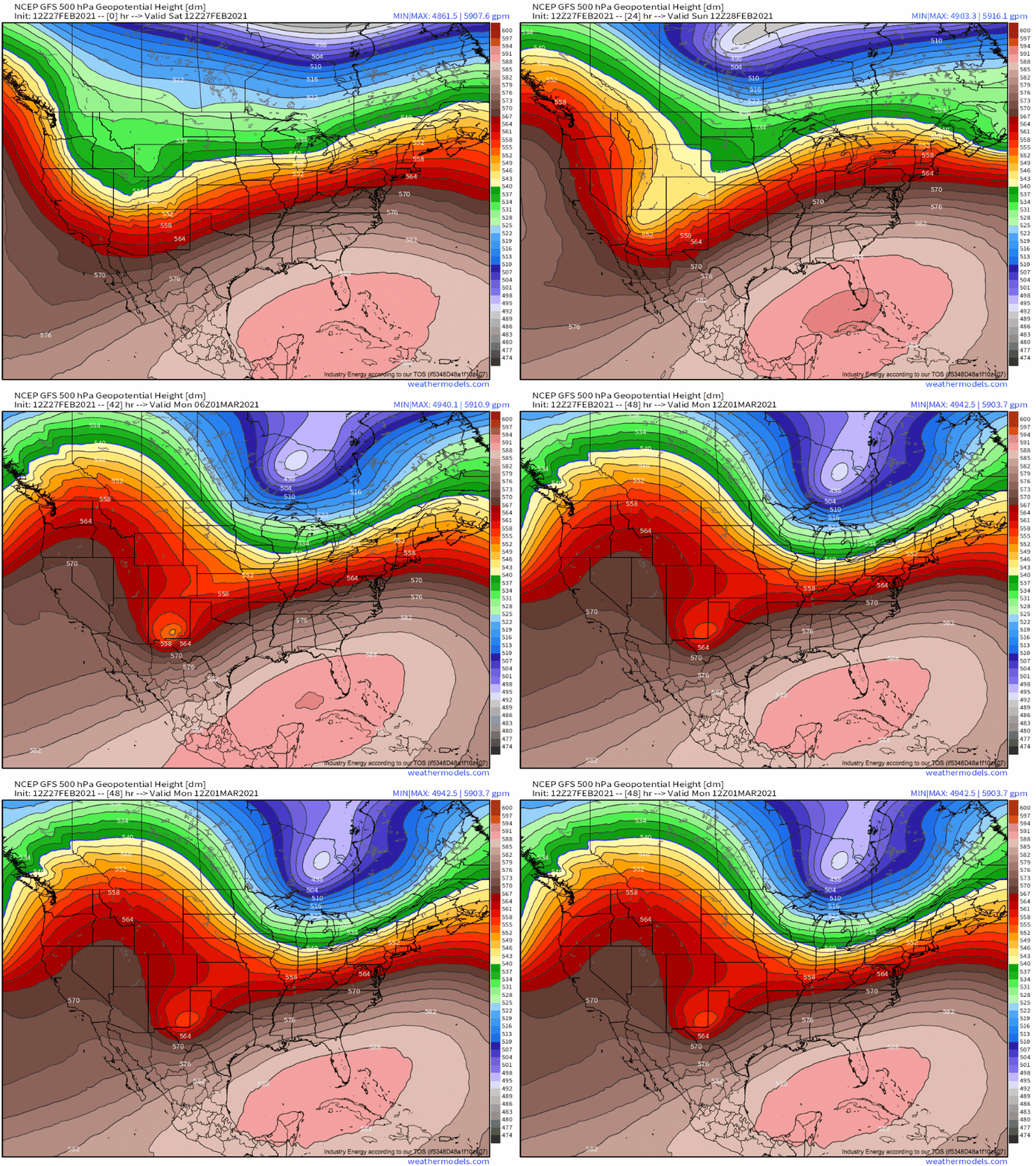
Persistent zonal flow is keeping mild Pacific air entraining into the US, and cold air is still locked north of the US/Canadian border, where it will (for the most part, sorry New England on Tuesday) remain in the medium term. The 500mb pattern absolutely shouts beautiful weather for the eastern and central US, with moderate large-scale ridging working in tandem with the aforementioned favorable mild flow to produce anomalous warmth.
This pattern supports broad cyclonic flow aloft, a storm track through the middle of the country, and a strong southwesterly low level jet. Even with the limitations imposed by the time of year, it doesn’t take much of a leap of logic to understand how this synoptic setup can spawn severe thunderstorm setups.
- Broadly quick-moving flow amidst expansive divergence east of a trough axis promotes widespread incentive for lift, while simultaneously assuring adequate shear for organization in any storms that can develop.
- The orientation promotes a cyclone track through the middle of the country, leaving a large swath of land in a sector defined by SW-ly flow aloft and S-ly surface flow. The former can advect EMLs, which promote favorable lapse rates, and the latter can pull warm, moist Gulf air north. The combination of these two flow regimes often promotes instability, as cold air aloft atop moist, warm surface air encourages great parcel buoyancy. In fact, this type of mid and low level jet setup often encourages multi-day southerly flow, of the type that can create a robust, large warm sector good for higher-end severe setups.
- In addition to the thermodynamic bounties outlined in #2, strong flow in the low level jet (which is all but assured given such impressive troughing in the mid-levels) can create an environment favorable for updrafts to start spinning.
One of these speculated well-placed cyclones will cut through the middle of the country tonight into tomorrow night. With the aforementioned synoptic-scale favorability, it’s apparent that we have to closely examine the warm sector for severe thunderstorm, or perhaps even tornado, threat.
Importantly, just because the synoptic scale environment looks good for the type of mesoscale parameters that can promote severe weather doesn’t mean that said parameters will actually develop and overlap. So, let’s break it down, shall we?
The first thing I like to look at is dewpoint profile. Indicative of absolute moisture content in a surface parcel, dewpoints do a good job indicating where there’s a chance for the kind of latent heat release that can send air careening vertically into powerful updrafts.
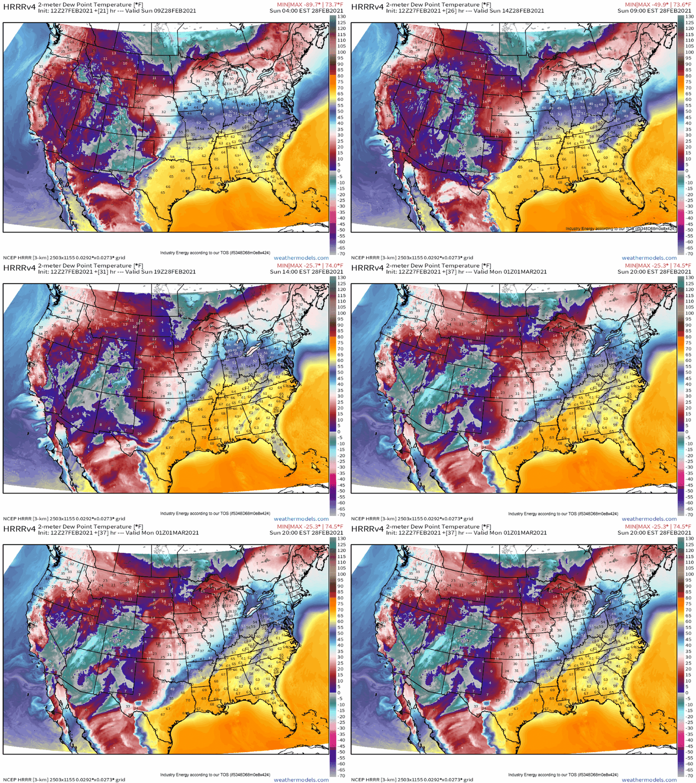
Based on the surface low track, we can surmise with a reasonable degree of confidence that surface flow with a large southerly component will be favorable for an expansive warm sector of medium dewpoints developed over several days of advection. A look at the HRRR for mid-day tomorrow confirms this hunch:
It also introduces an interesting uncertainty, namely that convection along the Gulf coast could degrade the eastern extents of the warm sector before peak destabilization can be reached. But even assuming this is the case, there’s still plentiful untouched moisture return closer to the front that could support convection.
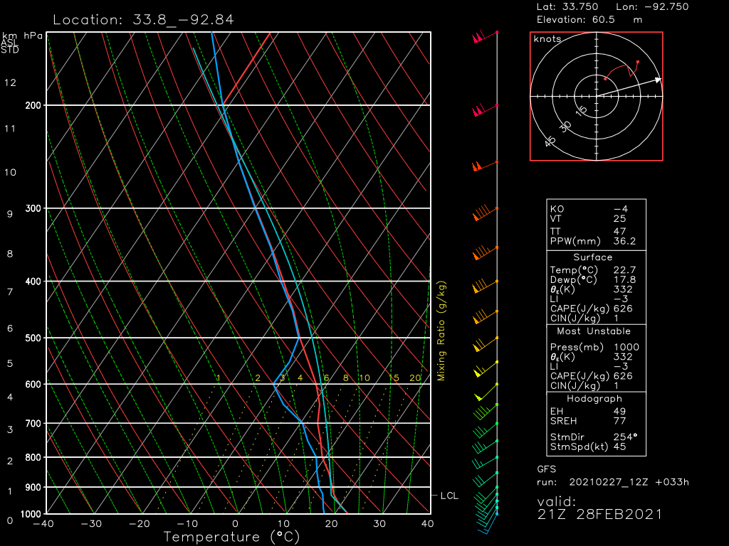
A vertical slice of the atmosphere in these zones, stretching from Texas to southern Illinois and into parts of Kentucky and Tennessee, shows a broad theme: despite potentially favorable southwesterly flow aloft, there should be no lapse rate enhancing EML to speak of. This means robust convection is unlikely, and an associated lack of capping also limits the ability of storms to stay discrete, limiting chances for strong tornadoes to occur.
It also reveals a kinematic profile favorable for storm organization, with the expected moderate shear, but with a hodograph only marginally favorable for mesocyclone development at the hands of weak low-level flow and little ‘turning’ with height. This analysis combined with the thermodynamic discussion above implies a limited tornado threat, but that thunderstorms with a damaging wind threat could occur.
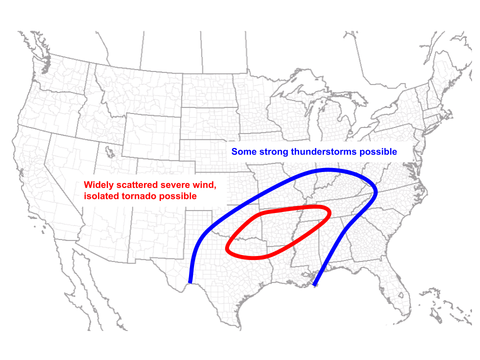
This meh parameter space is due to the typical HSLC setup of CAPE displacement from strongest forcing/kinematics. As a result, I feel the following map best represents my thoughts on tomorrow’s threat. I came up with it by feeling out where various high-res models put convection, and by overlapping my thoughts on where the most relatively favorable parameters will exist in tandem.
Remember, always check out the NWS’s Storm Prediction Center for official forecast info when it comes to severe thunderstorms.
