Strengthening Low Delivers A One-Two Punch of Moisture to the West Coast
By now, you may be tired of reading about the next system in the Pacific wave train getting ready to impact the West Coast. Honestly, I’m not tired of writing about them. I’ll tell you why:
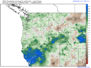
This image, right here (which is available in the Weathermodels Model Lab, if you’re curious).
Over the past 30 days, much of the West Coast has received over, if not well over, 100% of their normal rainfall. While it has come down heavier than is ideal at times, which lead to flooding and mudslides, this rain goes a long way toward making a dent in the deficit so many years in the making.
More rain means more moisture to slowly pull this region out of extreme drought. And it will be slow. A drought like the one seen in the western states is, as I said, years in the making. It will also be years to reverse it – if that’s even possible. But for now, small steps are being taken.
And because of that, I will gladly write another blog on a rainy West Coast. Besides, more systems rolling off the Pacific generally means active weather downstream for the Eastern US in a few days. Keeps things interesting.
This next wave of active weather is a bit of a two-parter.
Part One
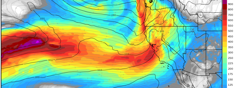
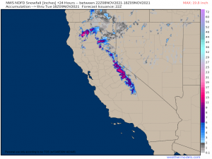
A weaker system, indicated in the map above by the disorganized-looking trough offshore of central California, is set to bring rain to the valleys and heavy mountain snow to the Sierra Nevadas.
Which is exactly what it is beginning to do right now.
This is a weaker system so it won’t be a blockbuster either in rainfall totals or snowfall totals. Valley locations will pick up around/under an inch of rain through Tuesday afternoon.
As for snowfall..
Over a foot is possible in the highest elevations – perhaps closer to 2 ft in the northern mountains – with lesser accumulations at lower elevations. Snow should be confined to above 3000 ft or so.
It’s not a lot, but it is beneficial in that it goes toward building that snowpack that will provide water for the valleys during the Spring thaw.
Part Two
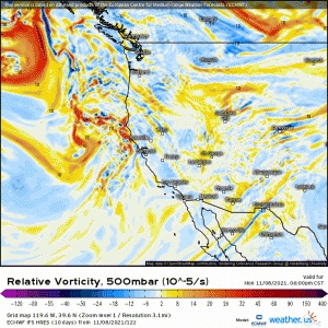
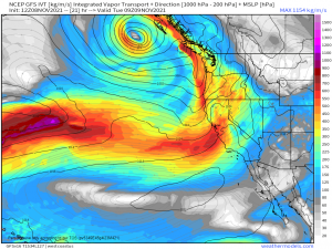
A more potent low, indicated by the well-defined trough on the Relative Vorticity map I shared above, will intensify offshore of British Columbia through the night tonight. By early tomorrow, moisture wrapping around this low will arrive in the Pacific Northwest.
Rain and mountain snow is forecast through Wednesday, however, they aren’t the headlining act for this system.
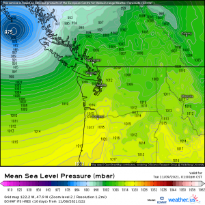
A deep low to the north and high pressure to the south will make for quite the pressure gradient between the two. Strong winds are expected with gusts up to 50 mph through early Tuesday at least.
It’s been raining a lot here lately – saturated ground and high winds don’t mix well. Scattered power outages are possible as trees, branches, or even power poles could be toppled.
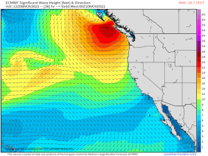
Where there are strong winds over an ocean, there is rough surf as well.
Wave heights of 10-15 plus are possible for the Washington and Oregon coasts with even bigger swells offshore and further north, near the center of the low.
Over all, this system will be moving pretty quickly. By Wednesday, the energy associated with it will be entering the Plains states where we could see a severe risk, though confidence isn’t high yet in where or what sort. More on that in Wednesday’s blog. Stay tuned!


Hi Meghan, “great” job on the blog…interesting and informative not to mention well written!