Storm to Bring Significant Snow to South-Central Appalachia
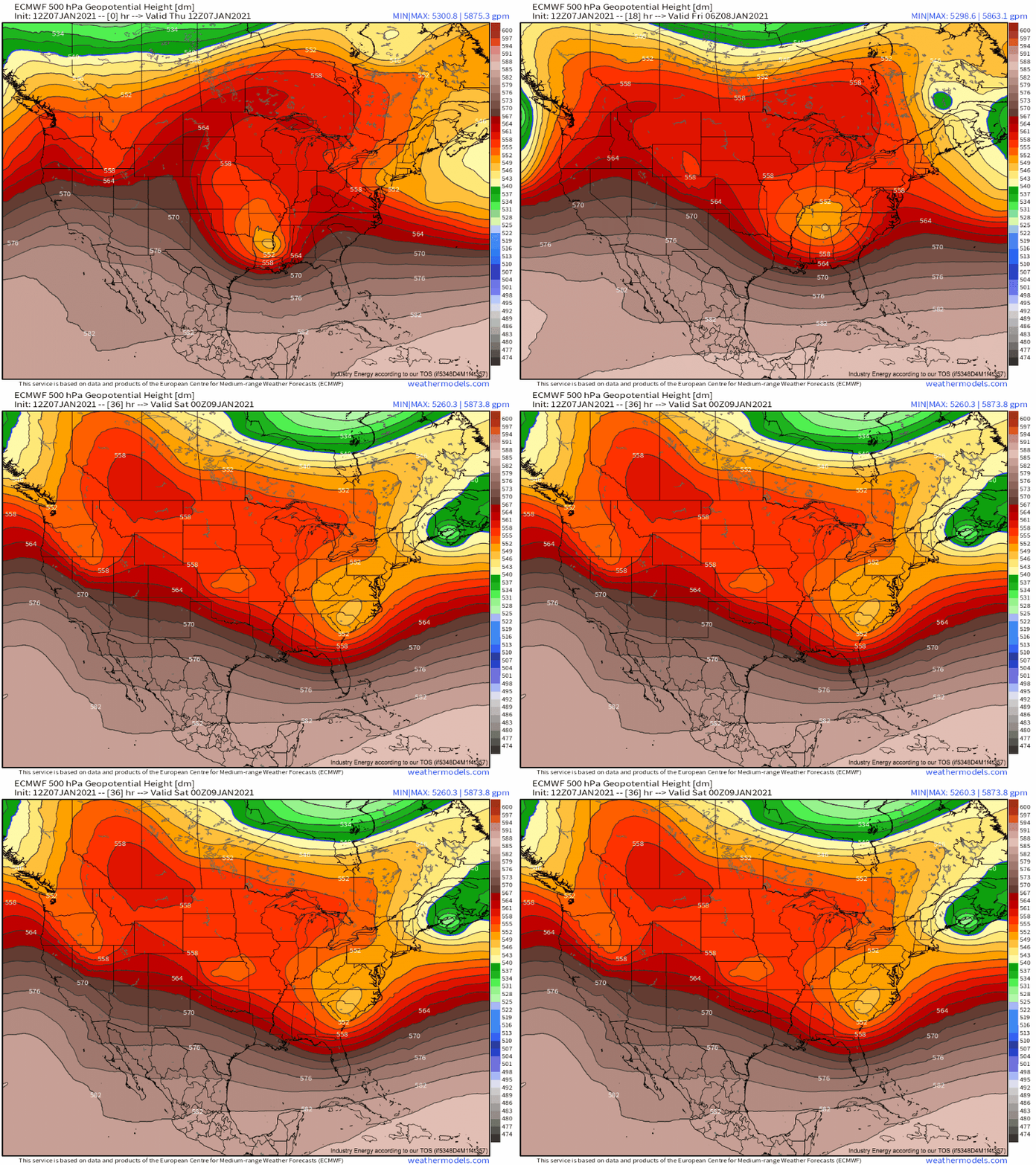
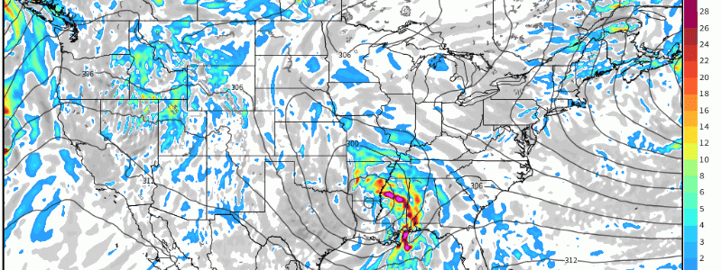
The major weather-producer of the next 24 hours will be a significant, albeit de-amplifying, midlevel low pivoting through the southeast.
A mature surface depression will continue to retrograde into the midlevel low, ‘stacking’ the cyclone vertically, through sunset over the interior Gulf coast region. This process will weaken the surface low, but maintained divergence ahead of the midlevel cyclone will incentivize additional pressure falls to the east of the primary surface depression. By tonight, an elongated zone of low pressure will extend from the primary surface depression to the secondary one, where energy will quickly begin consolidating.
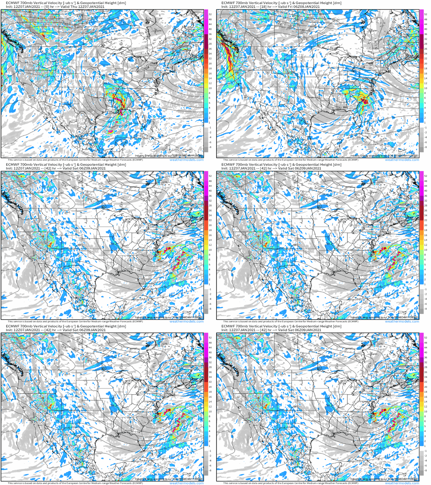
While the surface low organizes over coastal SC into the early morning hours of Friday, a slowly weakening 700mb cyclone will remain west of the Appalachians. Secondary development at this layer will commence more slowly than at the surface, and early Friday will see a boundary at this layer between the two height minima pivoting through the interior southeast as energy slowly shifts from the primary 700mb cyclone to the secondary depression.
That was really technical. But it’s important to understand what this means- A boundary capable of providing lift, and creating a band of precipitation, will develop, stretched between two 700mb depressions. The alignment of this stretching boundary, largely parallel to the direction of storm movement, will favor persistence of this sensible band.
Of course, long-lasting lift is just one of three elements needed for big snow. Cold air and moisture are also needed.
As Meghan wrote yesterday in a great blog entry, moisture is typically not a problem with these near-Gulf lows, but it isn’t easy to get cold air into the southeastern US. These two rules of thumb are certainly set to apply tomorrow, as plentiful moisture but limited cold air will constrain the storm. With persistent, impressive 700mb lift likely, then, it seems the only thing holding back widespread, significant regional snow is the marginal thermodynamic profile.
Sadly for snow lovers, though, the profile just shouldn’t fit the bill, and so many should simply see cold rain. Read Meghan’s blog for more on the temperature profile, which she wrote about in-depth.
But the topography can often be the weather lover’s friend, and the influences of higher elevations will likely allow parts of south-central Appalachia to see significant snow.
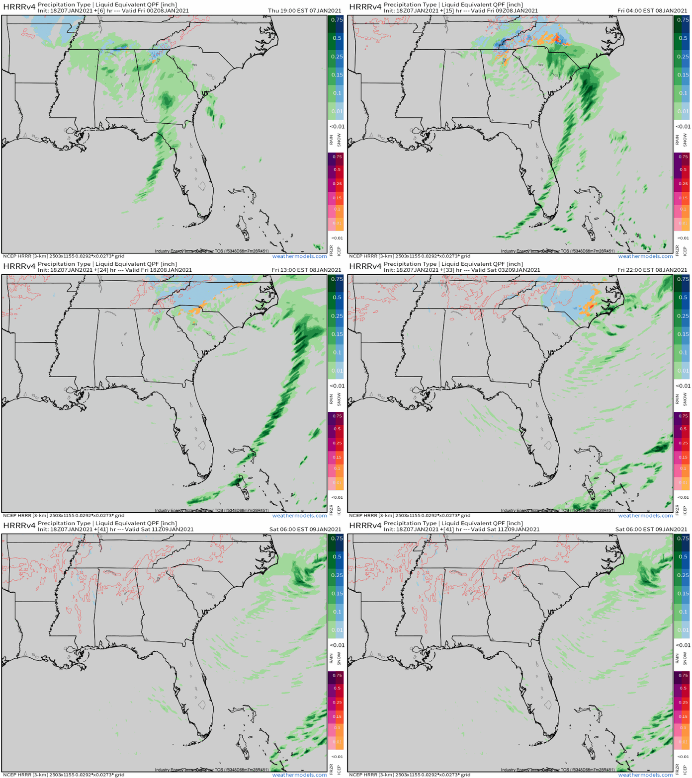
Precipitation will develop northward this evening, with light to moderate snow at higher elevations and cold rain elsewhere. As the night continues, the intensity of rain and snow will increase with the approaching midlevel boundary. With dynamic cooling coinciding with an increasingly favorable time of day, snow will expand east and west into lower elevations of NC, VA, and TN. Freezing rain and sleet will fall intermittently in places, as warm air advection intensifies while the low-level cyclone consolidates offshore. By morning, as the 700mb boundary stretches and slinks slowly east, moderate snow will continue in bands across western NC. Eventually enough of the energy will shift east and banding will pull towards the coast, giving much of the state a couple hours of moderate snow during the day.
Basically, this.
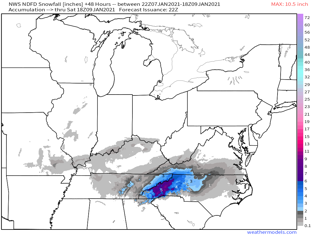
The weather service warns broadly for 4-6″ over the most topographically favored counties of NC, VA and TN, with amounts locally approaching 10″ possible in higher elevations. Further west, 2-4″ seems likely.
I largely agree with this forecast, but want to emphasize one detail.
With plentiful moisture and cold air, which should be the norm in at least the moderate elevations of south-central Appalachia, persistence of lifting will be the biggest determining factor in how much snow will fall. The most persistent lift will most likely fall wherever the 700mb boundary between the two depressions ends up ‘stretching’ before sliding east, parallel to the boundary’s orientation itself. Where this does set up, I think this storm could potentially over-perform. And, as dynamic cooling amidst heavier precipitation can overcome marginal thermodynamics, this over-performance could even end up over the relative lowlands further east. It’ll all depend on the setup of the banding.
