Storm Monday Could Bring Rush Hour Snow to Parts of Northeast
An active pattern is set to send two chances of snow to parts of the northeastern US through the first half of next week. The first chance, on Monday, is worth a close look. Of course, the second one, set for Wednesday, will be too. We’ll get there eventually.
Remember: like for every other type of precipitation, the ingredients to watch will be moisture and lift. Cold air is also important, because we’re watching to see where snow falls. Everything from here on will be figuring out how the atmosphere works to bring those three factors into the same area at the same time.
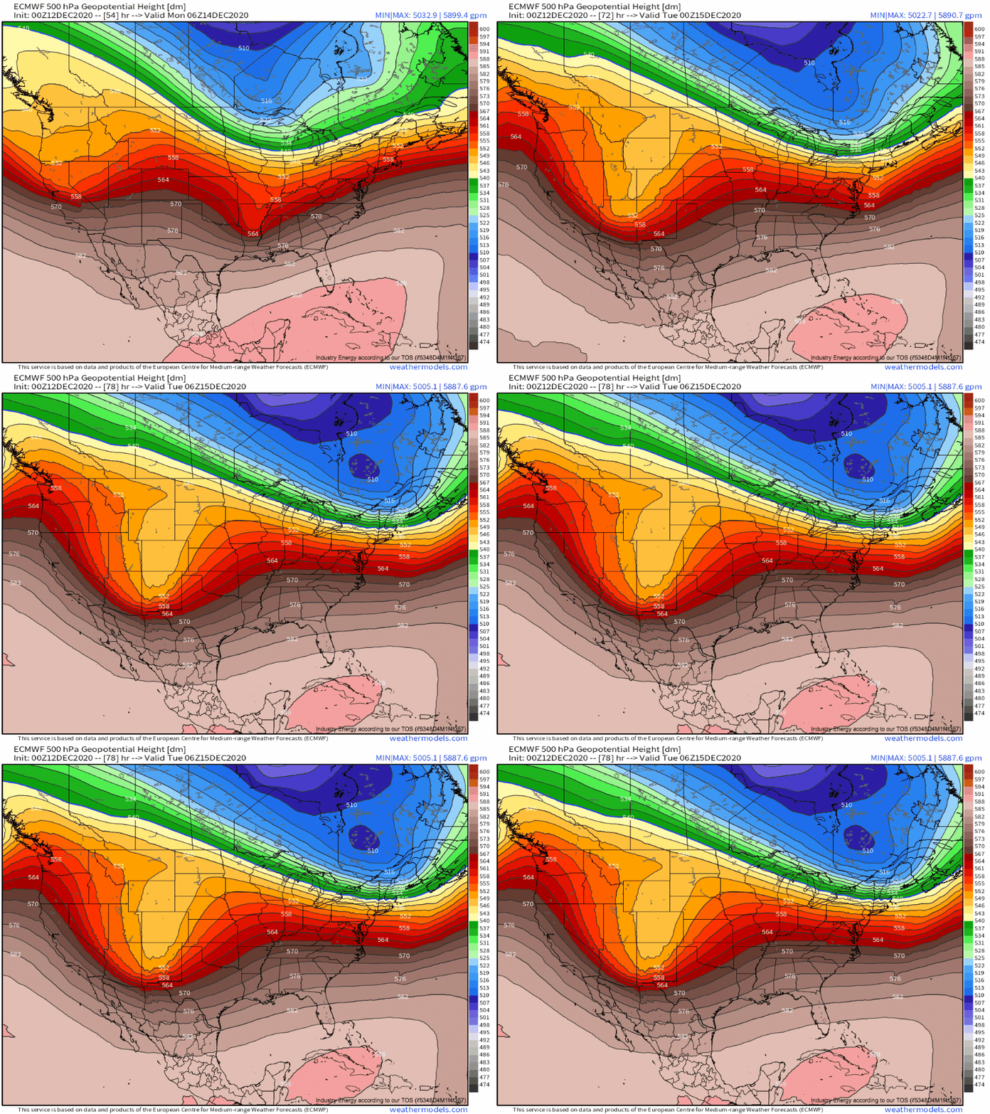
The broad set-up is certainly conducive to the development of I-95 winter weather. West coast ridging is allowing for a persistent “split stream” pattern to develop over the CONUS, in which there’s two distinct branches of relatively strong midlevel flow. This means that, where upstream blocking can develop, it’s relatively easy to get perturbations within each branch to combine, setting the stage for storms that have access to lots of southern-stream moisture and northern-stream cold. These combined perturbations, aka “phased” troughs, can also end up significantly stronger than individual troughs often are at the hands of constructive wave reinforcement. This gives storms access to dynamic processes that can aid in producing lots of lift for a long time.
Our system will develop as a compact, but intense, shortwave races towards a diving midlevel longwave. 
This won’t be an east coast blockbuster, but the early stages of the type of phase I’ve been talking about will allow for a few favorable atmospheric conditions to develop in parts of the northeast.
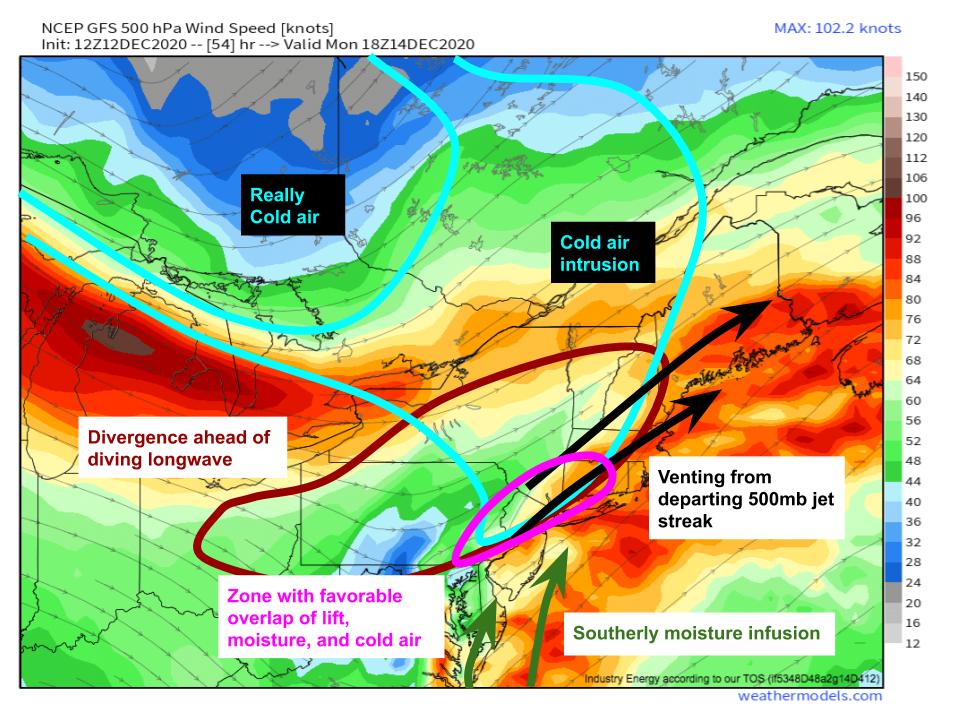
Increasing speed of flow with eastern extent along the northeastern edge of the shortwave will create a degree of “speed divergence”, encouraging uplift. Powerful directional divergence in the exit region of an impressive diving jet streak over the Great Lakes will do the same thing, and synoptic scale lifting will be very favorable across parts of the Northeast Monday.
With its southern stream origins, meanwhile, southerly mid/low level flow associated with the eastern edges of the shortwave will encourage moisture advection towards the storm. While the lack of complete phase will probably keep the coldest air bottled up over Canada for the time being, some cold air will be able to drain down to near the coast.
All of this will overlap along a zone probably stretching from parts of PA, NJ, and perhaps MD and DE to parts of NY, CT, MA, and perhaps RI.
So the atmosphere will be favorable for snow, with lift, moisture, and cold air all combining over one area around Monday afternoon. But this won’t be a slam dunk by any means.
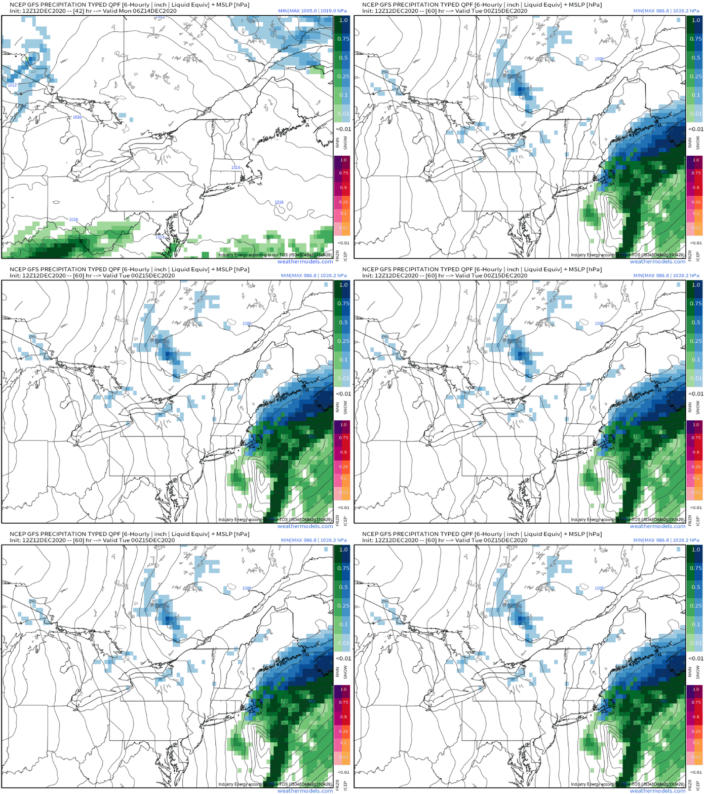
The rather compact shortwave will be moving fast, and without a full phase, the storm itself will likely be “flat” to a degree. This will mean snow will be quite progressive, moving somewhat quickly across the area. It also means that cold air will be a little late to arrive, and some rain will probably mix with snow at times. Even where precipitation is all snow, more likely north and west, the ratios will be muted.
The precipitation shield will be quick moving, flat, and not overwhelmingly cold.
So where does that leave us?
I expect, after looking at all of this, that parts of the northeast along and just inland of the I-95 corridor will see a swath of snow. With synoptic scale lifting quite favorable, snow could be moderate to heavy at times. The threat will be muted by quick motion and marginal temperatures, but I do see potential for a swath of 3-5″, with a local 6″ not out of the question. As this will probably overlap with evening rush hour, some hazardous conditions will be likely. Stay tuned!


A lot of useful information in the post. I got an alert on my Climacell app a few days ago, and it said the storm could reach up to some parts of Ohio.