Still Blocked
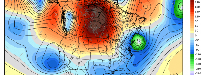
As has been the case for the past few weeks, a persistent blocking ridge over central and/or western (at times) Canada is jamming the flow and producing some unseasonable weather for parts of the US.
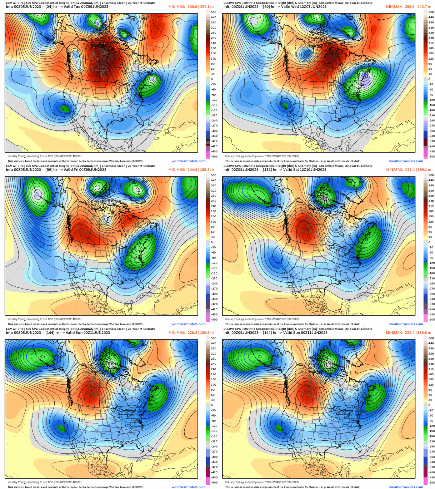
In the latest installment of our blocking saga, we once again see an Omega Block try to form. This leaves persistent troughing over both the Southwest US and the Northeast US while ridging lingers in the North-Central US.
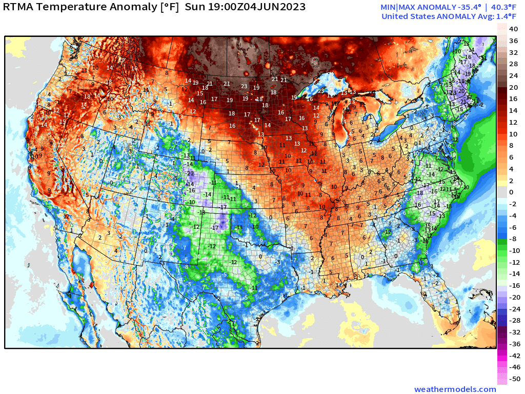
As far as temperatures go, yesterday’s anomalies tell the story quite well.
We see well above average temperatures over the North-Central US/Central US and into Central Canada, where the ridging is located. Over the Northeast and into the Mid-Atlantic as well as into the Southwest, we see well below average temperatures as troughing remains in place.
Unfortunately, this pattern won’t change much as we progress through the week.
For the Corn Belt region, this isn’t great news.
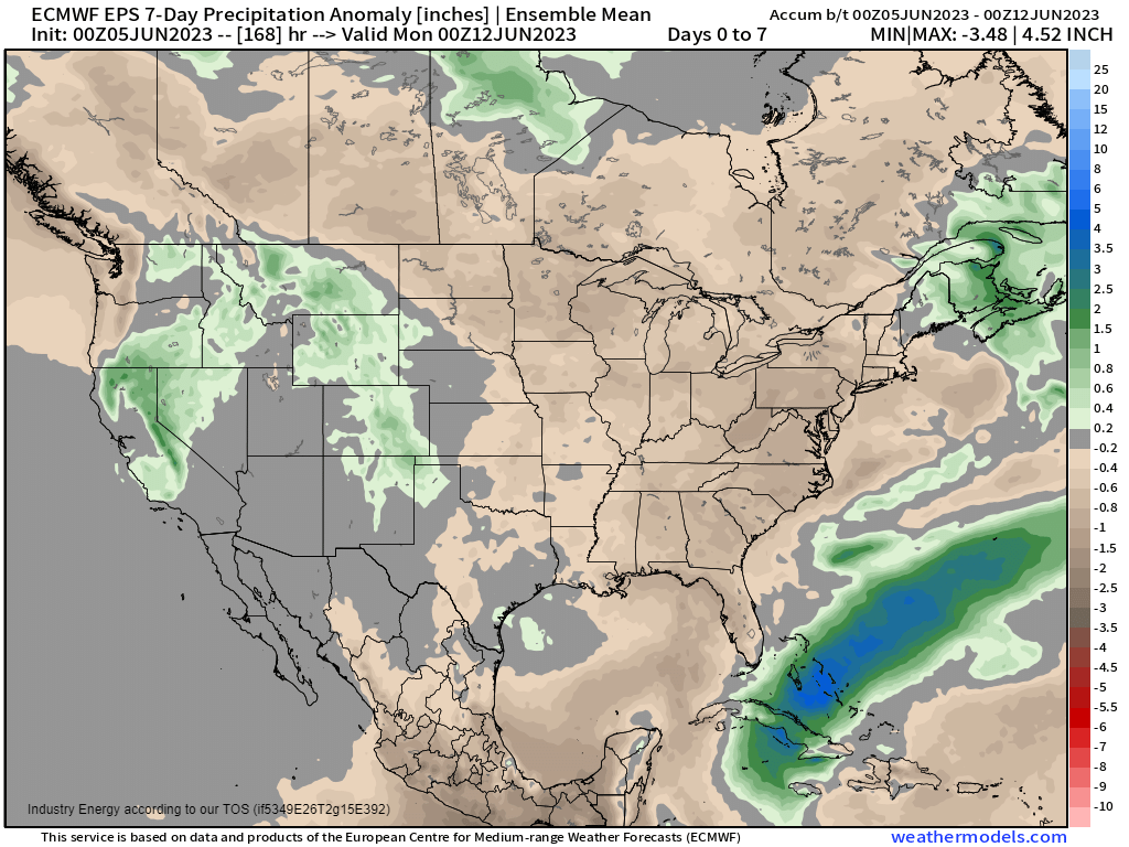
Drought keeps expanding as ridging lingers even longer. Any meaningful, drought-busting precipitation simply seems nowhere to be found.
Yes, there will be a chance for rain mid-week as a back door cold front sags into the region when ridging retrogrades west. But, overall, rainfall totals look to remain under an inch through the end of the week.
Speaking of a retrograding ridge, the ridge currently parked over the North-Central US and Central Canada will scoot westward around mid-week.
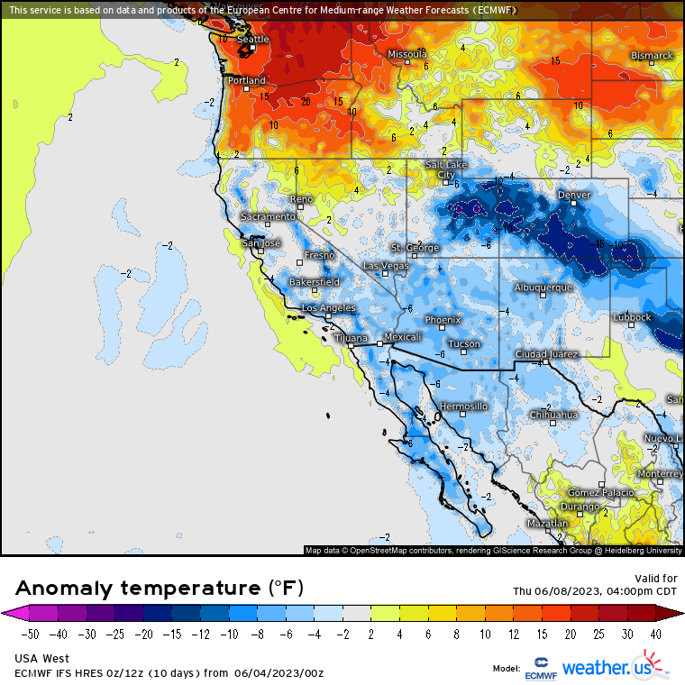
This will shift the core of the heat from the North-Central US to the Northwest US and Southwestern Canada. Widespread temperatures 10 to 20 degrees above average will be possible during the mid/latter half of the week.
If you’re looking for summer temperatures, one place you don’t want to be this week is the Northeast.
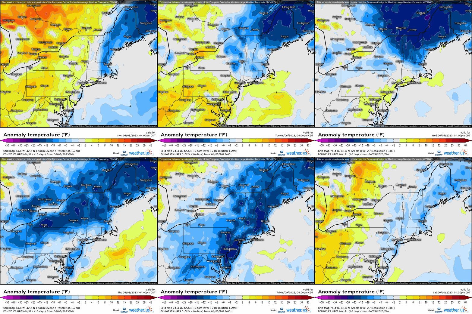
As troughing continues to dominate, well below average temperatures and showery conditions will remain in place into the weekend. Forget about swimming or sunbathing; get those sweaters back out!
Further south and west, an active subtropical jet stream will bring multiple disturbances into the Southern Plains and Intermountain West regions.
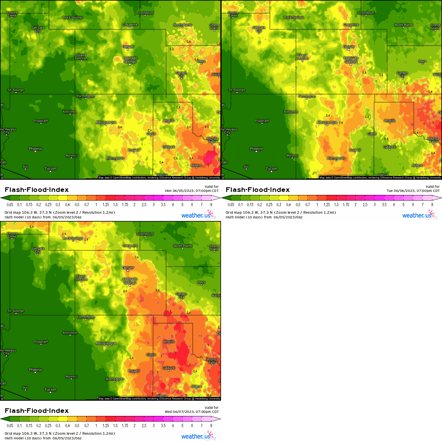
While only isolated chances of severe weather exist, a flash flooding risk will be present today (Monday) through Wednesday in the Southern High Plains. Multiple, slow-moving rounds of rain over already-saturated ground will likely cause some flooding issues in this region over the next three days.
Additionally, this continued troughing will allow for a small risk of flash flooding in the Northern California/Great Basin region as rounds of rain are expected here as well.
For the most part, the pattern won’t change much at all this week as blocking endures. In fact, we may be “stuck” in a similar pattern through mid-June. We’ll keep you updated as we move forward!


