Staying Safe During Summer Storms
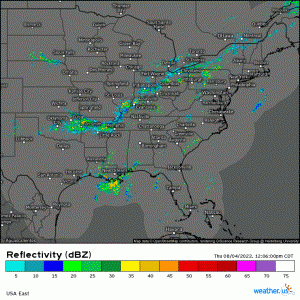
Pop-ups, air mass thunderstorms, “they said there was only a 20% chance of rain!”. Whatever you call them, we’re all familiar with those seemingly daily thunderstorms born out of heat and humidity in the summer time.
If you’re a daily checker of the SPC severe weather outlooks, you may have noticed that quite a few of these summer pop-ups have gone severe lately, and in a General Thunder risk too!
After a serious incident with lightning near the White House yesterday, I want to take a little time to look at the hazards associated with these storms and how they become severe. Additionally, I want to communicate some tips on avoiding these hazards – especially when many are outdoors during this season – and, failing that, how you can mitigate the danger you may find yourself in if you’re caught unawares.
Let’s first look at hazards.
Wind
This is the most common hazard that will cause a storm to become severe-warned.
Air mass thunderstorms aren’t quite like frontal storms or supercells.
- They aren’t driven by large-scale systems.
- There is usually very little vertical wind shear involved. Without shear, the updraft and downdraft aren’t separate, allowing these storms a very short lifespan.
- The steering winds are usually relatively light, allowing these storms to meander without direction or simply sit over the same spot.
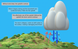
Yes, it’s time for one of my homemade explainer graphics. Hopefully this visually conveys the process that leads to severe-threshold winds.
To summarize:
- Rising, moist air (sometimes combined with some sort of boundary) forms a storm. This is the updraft. The updraft is necessary as it feeds the storm.
- The weight of the moisture inside the cloud becomes too much for the cloud to hold, and it rains. This rain-cooled air becomes the downdraft.
- Since there is no tilting of the storm structure due the absence of wind shear, the downdraft mixes with the updraft, cutting it off.
- Without the updraft feeding it, the storm begins to collapse, colder air sinking rapidly to the surface.
- This can sometimes result in wind speeds meeting the criteria for a severe thunderstorm warning (58+ mph).
- The storm will rain itself out as it collapses, then dissipate.
Lightning
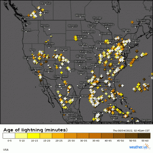
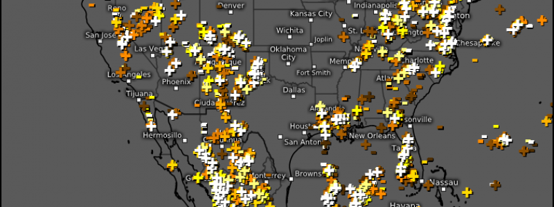
Lightning is an often underestimated, but very serious, hazard associated with summer storms.
If you weren’t aware, lightning is capable of striking roughly 10 miles away from its parent storm.
Positive lightning strikes originate from the anvil or upper levels of a storm. In the summer when storms are 40 to 60 thousand feet tall and their anvils are much wider than the base, this can cover a significant distance.
The general rule of thumb is that if you can hear thunder, you are close enough to be struck by lightning. You’ll need to pay attention here if you’re outdoors. Due to the size of summer thunderstorm anvils, you may not even see the base of the storm, but still hear thunder. Don’t wait until you see the storm to take shelter. Go when you hear the first rumble.
Flash Flooding
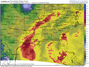
Something that is never in short supply in summer, especially east of the Rockies, is moisture.
Even without the aid of tropical cyclones, tropical moisture routinely streams into the Eastern US. It provides air-you-can-wear and is just waiting for storms to tap into it.
Moisture tends to pool along boundaries, whether they be cold fronts, warm fronts, or, more often in summer, stationary fronts. Storms can fire repeatedly along these fronts and inundate the same areas with heavy rain over the course of a few hours to a few days.
Even when a boundary isn’t in play, the lack of steering aloft combined with deep moisture can lead to pop-up storms becoming nearly stationary or even continually back-building while they dump ridiculous amounts of rainfall in one location.
Terrain can come into play here too. Often, higher terrain will provide a point for storms to fire off of, focusing a seemingly endless parade of heavy rainfall over one area. Additionally, higher terrain can “trap” a storm, forcing it to sit and back-build over one spot.
If you live in a location prone to flooding and the ground is fairly saturated from days of previous rainfall, you’ll want to be wary of any developing summer storms and have a plan of action in place in case you need it.
Tips for Safety
So, what can you do to keep yourself during these summer pop-ups?
The best course of action is to Plan Ahead:
- Recognize that if it is a hot, humid, sunny day, you likely have at least a small chance of a pop-up storm.
- Be aware of your surroundings if you’re outside. Watch the sky for any dark, building clouds.
- Listen for thunder. At first rumble, you want to head inside.
- Know where you can go if a storm is coming. If you’re not at home, have a back-up plan such as ducking into a store until the storm passes. If need be, you can shelter in your car, but only if a sturdier structure isn’t readily available.
Planning ahead is obviously preferable. But sometimes things happen, and people do get caught unawares. What can you do if you suddenly find yourself outside in a storm?
- Immediately seek shelter in a sturdy structure or closed (no convertibles) car if readily available.
- If no structure is available, stay away from open spaces and tall objects, like trees.
- Avoid open-sided structures.
- Stay off of elevated areas like hills.
- Stay away from bodies of water.
- Stay away from anything that conducts electricity (metal, etc).
- Crouch on the ground with your head tucked and hands on your ears to minimize contact with the ground. Do NOT lie flat.
- If you are in a group, spread out.
Remember, awareness and planning ahead is best. However, knowing what to do in case you are caught unaware may save your life someday!
