State Of The Tropics: Quiet For Now, Uptick Early November?
If you’re wondering why there maybe hasn’t been mention of any tropical mischief out across the Atlantic Basin, Gulf, or the Caribbean as of late – it’s because there are large-scale processes at work that are essentially inhibiting tropical cyclone development.
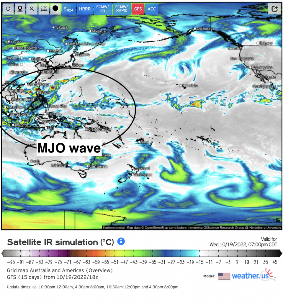
Zoomed out below using infrared reveals convection in the form of cloud top temperatures (i.e. brighter the colors, stronger the thunderstorms and vice-versa) displays one interesting phenomena that to the untrained eye, that stands out! I’ve circled it for you. That entire system of enhanced rainfall is actually the propagating, large convective “wave” known as the MJO. When it’s mainly in the Eastern Hemisphere, in particular across the Maritime Continent and Western Pacific (this is a phase 6/phase 7 on the Wheeler-Hendon Index), hurricane activity across the Atlantic is usually quiet.
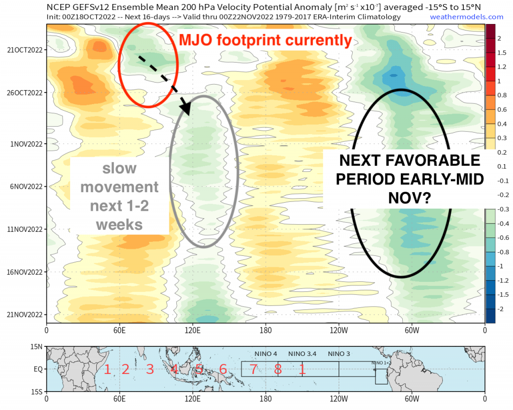
Now, it’s forecasted currently, using MJO forecast indices such as the Wheeler-Hendon diagram index along with velocity potential graphs via EPS & GEFS that it’ll slowly shift eastward into early November. That last part certainly is a bit murky given the MJO “footprint” may weaken and/or stall out across the Western Pacific. On the velocity potential graphic below (GEFS), I’ve outlined the current MJO envelope and where it’s forecasted to shift. However, on the Atlantic side, you’ll notice a standing wave, so in kind of a way, there’s some competition, but this is “muted” really by the dominant Eastern Hemisphere. Now there are some hints that by early-mid November, we may see more of a favorable tropical forcing pattern where the Caribbean area in particular may need monitoring. This aligns well with climatology too!
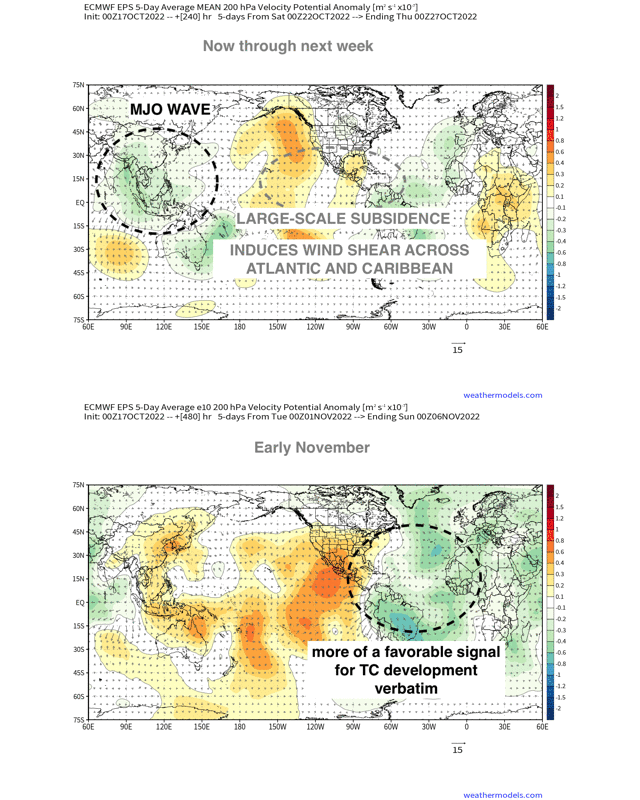
Showing this through a wide view reveals better locations of upper-level divergence and convergence, and more importantly it helps for visualization purposes! Notice initially and through October, the overall tropical forcing favors quieter Atlantic activity and favors western pacific tropical cyclones. However, toward early November or so, we may see a more auspicious tropical forcing pattern emerge where vertical wind shear lowers.
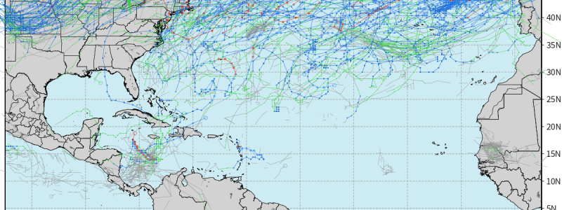
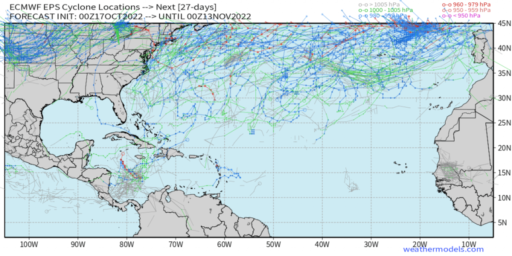
Lastly, just taking a look at the EPS cyclone tracks through early to mid November overall shows just how tame the tropics will be through October and even into November. However, there are some keen observations if you look closely around 80W, along with mainly near and around the Caribbean. This could be hints that the EPS for instance, is picking up on and would make sense given what has been explained above!
For now, it’ll just be quiet across the Atlantic Basin with the Pacific likely to be more active relatively speaking. At least in the grand scheme of things, this is definitely optimistic as we near the end of Hurricane season pushing along the weeks!


