Spring Warmth Brings Flooding Risk For Upper Midwest / Northeast Next Week
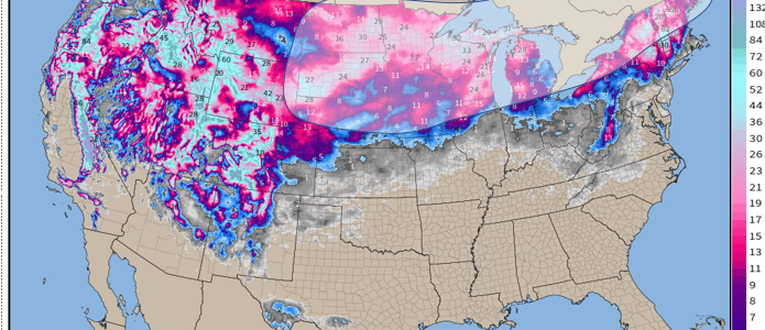
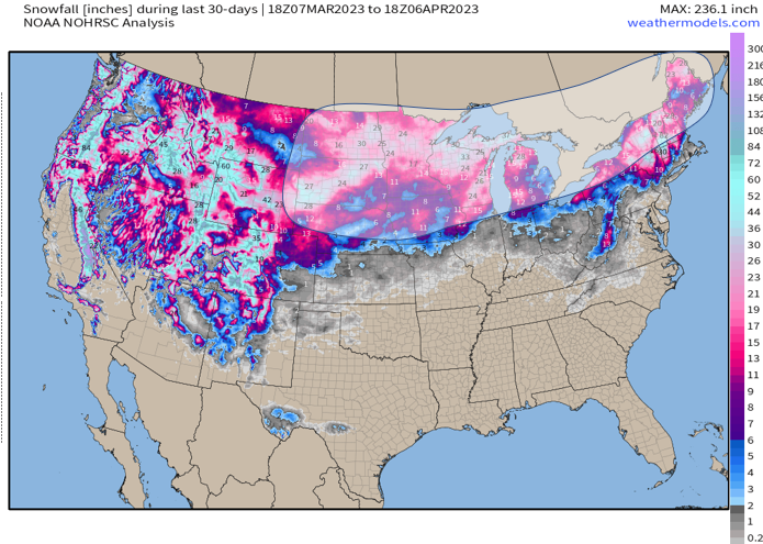
We know the “jackpot” in terms of where the snow has fallen – outside the West (clearly they’re the winners) – has occurred across the northern Plains and across the interior Northeast. The latter is more aimed across upstate NY (lake effect events we’ve seen) and more recently Maine. This is over the last 60 days, where we see over 1-2 feet of snowpack that has fallen thanks to an active northward-shifted storm track with favorably cold air that was present.

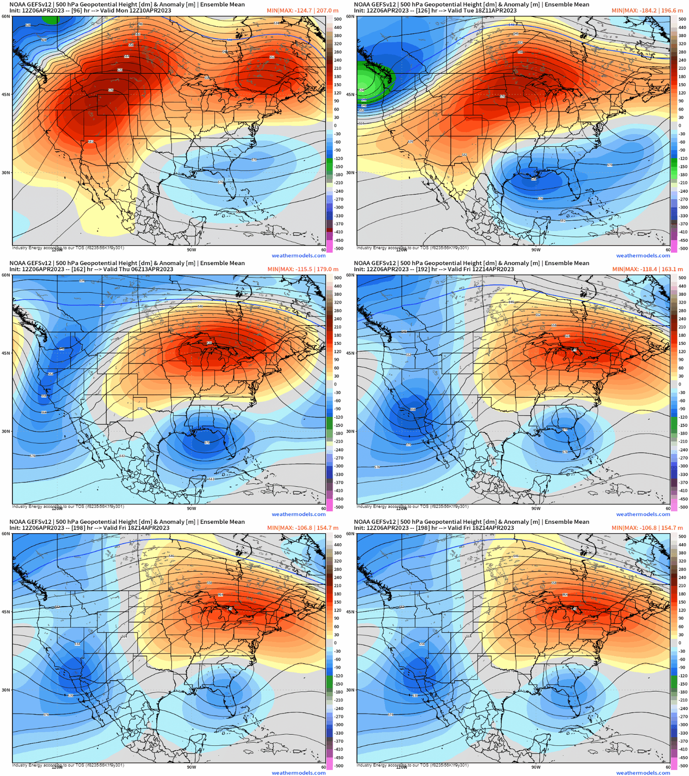
There’s undoubtedly strong agreement amongst ensembles that a 2-3 standard deviation mid-level ridge builds in first across the Intermountain West, which then translates eastward across the northern tier of the CONUS. While a pattern verbatim will surely make it feel like actually Spring (with a break in snow activity next week except for the higher elevations of the West as you probably guessed), this pattern also supports rapid snow-melting.

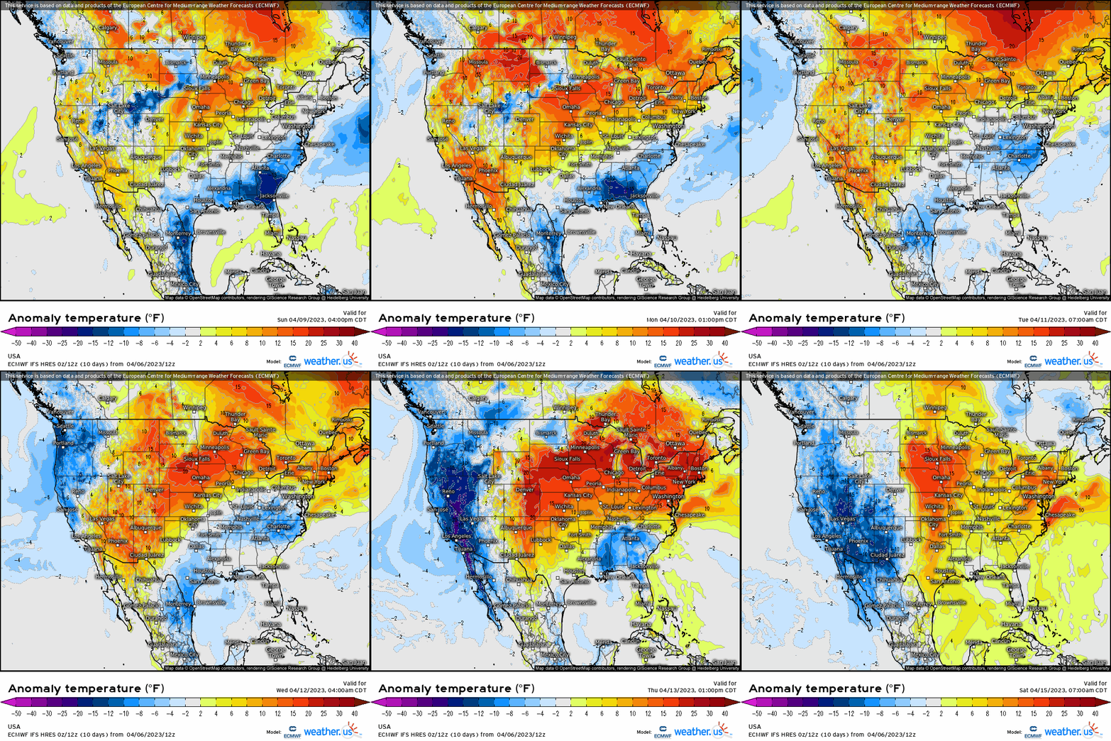
Here, we’re looking at starting Monday of next week, temperatures shoot up above normal first across the northern Plains and northern portions of the Intermountain West / Great Basin. We’re looking at anywhere from 5 to as much as 20+ degrees above average! This means widespread 50’s, 60’s, and even 70’s surging across these regions. Then as the week progresses, we see these above average temperatures prevail across the Midwest, Ohio Valley, and then shift into the Northeast bringing 10-20 degrees above normal as well. This makes it into the interior Northeast toward the middle portion of next week, and extending into the end of the week.

This has hydrologic implications where snowmelt is accelerated, and this then allows water to rush into nearby rivers, creeks, and streams. Banks are exceeded, and this then floods low-lying, flood-prone regions. So if you do or may know people that live in these general regions, I’d highly advise to prepare for flooding and take precautionary action (or pass it along) in preparation for what’ll likely be widespread rapid snowmelt and runoff next week.


