Southern California Fire Weather Abates; Parts of the Deep South Get Soaked
As we undergo a change in government today on Inauguration Day, its rather fitting that it is also a transition day of sorts in the sensible weather the US is seeing. The pattern begins to make little changes today that will disrupt the fire weather the west coast has been enduring and bring active weather back to the east coast where it has been rather quiet since the weekend.
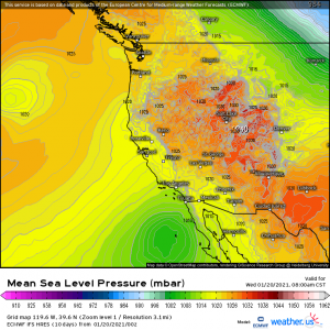
Changes start in the west as the area of strong high pressure over the Rockies begins to erode. At the same time, the low off of Baja California will slide closer to the coast. What changes does this make? Well, the relentless, roaring, downsloping winds bringing hot and dry conditions to southern/central California will begin to subside this morning. Conditions will be much improved by this evening.
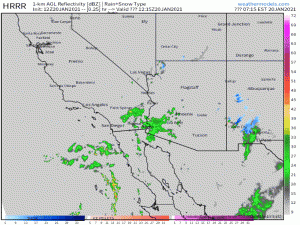
As the low creeps closer to the coast, the counter-clockwise flow will funnel in limited moisture to the drought-stricken southwest. I touched on this in my blog on Monday but it’s important enough to revisit today as well. This isn’t a drought-busting event. The location of the low, the first of a couple the west has a potential to benefit from, combined with it’s relatively weak nature, limits the moisture sent north. Though it brings some, it won’t be a lot.
(gif) Link
Much of the actual rainfall won’t make it very far north or further west than the Santa Anas. Though this is more moisture than southern California has seen recently, the atmosphere surrounding the low is still fairly moisture-starved with the exception of near the center. Unfortunately, a weaker low means weaker advection. The atmosphere will need an assist from the topography (orographic lifting that we’ve talked about before) to squeeze out any real rain, which is why we see these rain bands mainly over the mountainous terrain. Flash flooding will be possible in these areas as heavy showers will set up in the same places due to the conditions I mentioned above.
Just because the rain likely won’t make it to downtown Los Angeles doesn’t mean they won’t reap some benefits of the pattern change.
(gif) Link
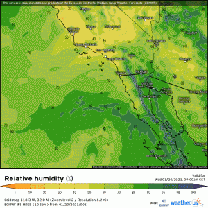
The gusty downslope winds will subside and weak moisture advection still allows the relative humidity values to climb. Why is that important? Well, a more humid environment is a an environment with more moisture in the air, even if it isn’t falling as rain. It is difficult for fires to thrive in these conditions. So, Los Angeles, though you aren’t seeing much rain just yet, you can breathe a sigh of relief as the ingredients that signal fire weather (wind, heat, dry air) gradually abate during the day today.
Southern California has a few more chances for precipitation in the coming days, but we’ll address that as we move closer to those specific events.
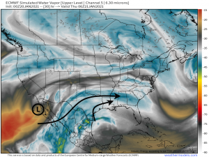
The low we’ve been talking about is still sending out deeper moisture somewhere, but where?
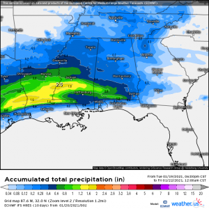
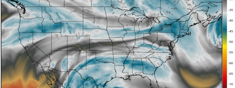
Assisted by the speedy southern branch of the jet stream, the moisture is taken east where it meets up with more from the Gulf of Mexico and sets up a heavy rain event for the Deep South tomorrow. With the northern branch sitting about midway through the country, the rain will stay confined to the south and likely won’t venture further north than Tennessee.
The heaviest, most persistent rain will be seen in a narrow corridor across Texas/Mississippi/Louisiana closer to the coast and the source of moisture. Other areas of the south can expect more showery, lighter precipitation.
This weak system will be the first in an upcoming active period. We are watching Monday for the arrival of a more dynamic system that could bring severe weather to the south and snow to the north. It’s a bit far out for specifics so, for now, it’s just something to be aware of. Watch this space for further details as we approach that forecast period.
Wishing y’all a wonderful day!
