Southeast Snow?
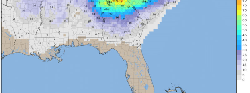
By now everyone who follows weather on social media has probably seen the deterministic GFS and Euro maps predicting a huge storm with unbelievable snow totals for parts of the southeast and/or mid-Atlantic. These maps are usually posted without context or explanation and don’t do anyone any good.
Beside the fact that the “energy” that will fuel this storm is still literally out in the Pacific Ocean and we know next to nothing about it, deterministic solutions for a winter storm are absolutely no use 5+ days out from the event, especially for an area like the southeast. Models are no where near in agreement as to track yet and ultimate track can change everything.
Also, it takes very specific ingredients to get a real snowfall in this region.
These are:
- Cold air. This cold air needs to already be in place or, at the very least, be rushing south quickly.
- Enough moisture behind the front to reach the cold sector. If the atmosphere is too dry where it is cold enough for snow, you’re out of luck.
- A weaker low close to the Gulf Coast. A stronger low introduces widespread mixing issues while a low too far north leaves many in the warm sector.
So let’s look at what guidance has for us so far:
Cold Air
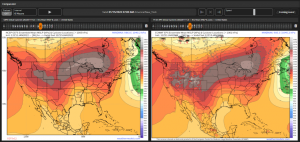
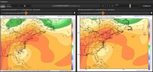
Both the EPS and the GEFS are in agreement that a strong, broad high will be draped over the northern tier of the US/into southern Canada. But just because the high is up north, doesn’t mean its tapping truly frigid air. Let’s check.
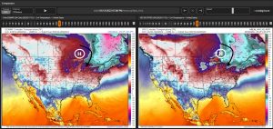
Both the ECMWF and the GFS suggest pretty chilly air near the center of the high. With the clockwise flow around the center, that air would be funneled south. This air will, of course, modify – or become warmer – as it travels further away from the source. However, its not unreasonable to think that the air would still be sufficiently cold for winter weather by the time it reaches its destination.
So, cold air: check.
Moisture
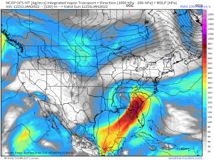
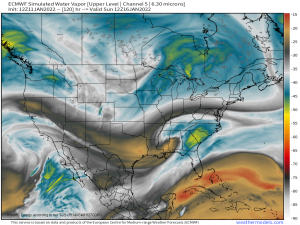
This requirement is somewhat dependent on the position of the low. If we’re talking about southeastern winter weather, we’re assuming the low will be close-ish to the Gulf and therefore have access to deep Gulf moisture. According to both the GFS and the ECMWF, that seems to be the case here.
Moisture: check.
Position and Strength of the Low
Here’s where the forecast becomes a bit murky.
As far as the position of the low goes, the EPS is starting to develop a cluster of solutions pointing to more certainty in a low tracking across central Alabama, Georgia, and South Carolina before emerging into the Atlantic.
The GEFS, however, while tightly clustered at first, spreads out rapidly with time. By the time it emerges into the Atlantic, it’s anyone’s guess where the low could be positioned.
Guidance also varies as to the strength of the low. Both the GEFS and the EPS keep the low weak over land but then diverge between members on how quickly it strengthens. This has implications on precip type. A stronger low would introduce a larger warm nose aloft through advection and therefore a larger area with mixing issues.
A weaker low wouldn’t bring quite as much warm air north and would consequently have a smaller area experiencing mixed precip.
So, position and strength of the low: Unknown.
What we can gather from all this information so far is that we potentially have the ingredients for a snowstorm… we just don’t know who gets the snow and how much/how much mixing occurs and where.
And there’s no shame in saying we “just don’t know yet,” either! Personally, I’d rather delay my forecast and have all the information than make a hasty call and be completely wrong.
For now, we’ll monitor the trends and check back in a few days when guidance will, hopefully, be in better agreement. Check back on Thursday afternoon for an update!
