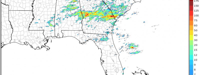
Southeast Severe Threat
After an explosively active latter half of the day yesterday, we are facing down yet another severe threat for today – surprisingly in much the same area. You would think that the atmosphere would have been thoroughly worked over after yesterday, but enough time will pass between yesterday’s event and the onset of today’s event for some recovery to occur.
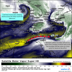
An outflow boundary is present draped across southern Alabama and southern Georgia. Below this boundary, greater moisture exists.
This boundary is expected to act as a sort of warm front, lifting slightly north into middle Georgia this afternoon. It will also provide a focal point for storms to fire off of as the cold front approaches from the west.
Further north, sub-severe storms are on-going in the Tennessee and Ohio Valleys. As these and the associated cloud shield moves off northeast, some clearing and subsequent destabilization is expected over Eastern Tennessee.
Consequently, our greatest risk areas today are from Central Alabama north to Eastern TN and then south to a large portion of Georgia.
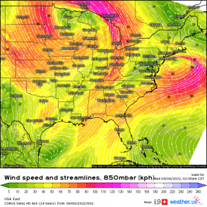
The low-level jet will ramp up this afternoon, increasing shear profiles.
While speed shear is expected to be adequate to support and sustain supercells, directional shear is a bit lacking, with the exception of SE Alabama and S Georgia where surface winds could briefly be from the south or even southeast. This would provide that extra bit of shear to warrant a slightly higher tornado risk than the rest of the defined risk area.
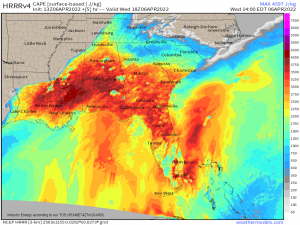
Unlike many of the severe events in the southeast lately, CAPE (instability) will not be lacking.
Moisture advection and additional surface heating from broken cloud cover should lead to a decent amount of instability for storms to access. This will help with sustaining updrafts and strengthening storms.
So let’s look at timing.
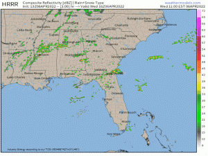
Storms should begin to blossom ahead of the cold front in the next few hours.
As instability increases, discrete supercells become possible, especially along the remnant outflow boundary draped across southern Georgia. Remember, due to locally enhanced directional shear, the tornado threat will be greatest in this area.
Upscale growth into a multi-cellular/blobby line is likely with time. The tornado threat is expected to decrease with northward extent, however, it is not zero. At this point, damaging winds become the main hazard with the chance of a embedded spin-up in the line.
Further west and north and slightly later in the afternoon, a convective line will form ahead of the cold front, driven by the lift from the system. Given the greater-than-usual available instability, the potential exists for discrete cells to form ahead of the line – though this hinges greatly on clearing and surface heating after the morning showers move off northeast.
Assuming that occurs and the atmosphere destabilizes, these cells would contain the greater tornado threat for the Tennessee Valley. More specifically: The Cumberland Plateau into Eastern Tennessee. Again, upscale growth into a line is expected and the main threat transitions to damaging winds. However, the tornado threat will not be zero. A spin-up can still occur within the line.
The potential for severe weather will lessen somewhat overnight as daytime heating is lost and the system crosses the Appalachians, but it will still present a lower-end threat and is worth being aware of into the overnight hours.
So, in summary:
Anyone from the windward side of the Southern Appalachians south to the Florida Panhandle and east to the coastal region of the Carolinas needs to be weather aware today. Greater tornado potential exists during the afternoon and evening hours in Eastern TN, Western AL, and especially Southern GA. Damaging winds will remain a threat through the overnight hours as convection moves east ahead of the cold front.
Have multiple ways to receive warnings and your plan to shelter ready to go. Stay weather aware today, folks!
