Southeast Severe Storm Blitz Set to Continue Today
No rest for the weary yet as parts of the Southeast, including some still recovering from tornado onslaughts on the 25th and 17th, stare down yet another potentially volatile severe thunderstorm event.
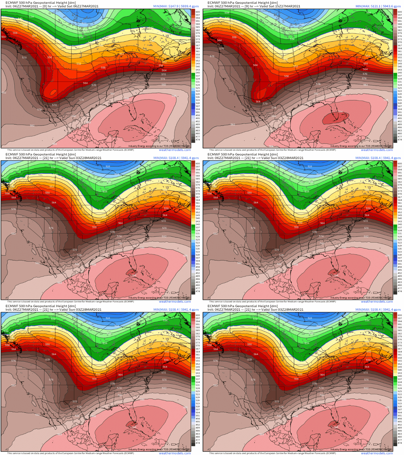
The threat will materialize at the hands of a fairly typical early season synoptic setup, as the top half of a progressive longwave accelerates east faster than the bottom half. The result will be an increasingly positive tilt to the at-large troughing as the day progresses, which will parallel the flow field to some extent. Just east, encouragement for large-scale ascent and high midlevel wind shear will overspread much of the central US.
This longwave orientation is prone to introducing fairly slow and disorganized pressure falls along diffuse boundaries, which don’t always overlap to the same extent expected in an environment with more concentrated and intense divergence aloft. The fairly unconsolidated nature of the system will there mean flow at different levels will respond to height gradients with somewhat different orientations. Still, a sufficient degree of overlap as far as parameters are concerned will ensure some parts of the south central and south eastern US see the ingredients required for severe thunderstorms and tornadoes.
At the surface, the result of the aforementioned troughing will be a fairly diffuse area of pressure falls stretching along a fairly slow moving front. As far as advection is concerned, this loose zone of low pressure will act as one cohesive cyclone, siphoning Gulf moisture north along a fairly broad warm sector. The result will be fairly widespread 60-70ºF dewpoints across much of the southeastern quarter of the US. It’s late March, and moisture isn’t as hard to come by as it was just a few weeks ago!
A fairly strong EML defined by a broad zone of 7.5-8.5ºC is currently spanning a large part of the south-central US, and it will advect northeast along southwesterly 700mb flow. The flow at this level is mostly responding to low/midlevel troughing near Wisconsin, with development in the exit region of the slow-moving southern component of the longwave remaining relatively modest and disorganized. The result will be a belt of flow that is fairly brisk, and more than sufficient to transport an EML, but only moderately enhances shear around 3km.
The system’s 3km flow magnitude will be paralleled to an extent below, from 925-850mb. Here, more pronounced development in the exit region of the southern half of the longwave will allow localized jet amplification of 40-50kt by the late evening. While this is probably stronger relatively to climatology than 700mb flow will be, it’s squarely in the moderate end of Dixie LLJs. Above 3km, shear will be expansive in scope and magnitude, as is fairly typical for this sort of longwave. No limiting factors will be found at or above 500mb today.
What does this all mean for severe weather?
As alluded to above, the zone of focused surface forcing will stay largely steady, likely along a line from SW Arkansas to east of Nashville, as large scale ascent remains mainly parallel to the longwave orientation. The overlay of the favorable parameters for severe weather, consisting of the instability where the EML tops high-quality moisture and the long, looping hodographs that result from the juxtaposition of strong flow at various layers, will similarly remain largely steady just south of this boundary.
This means training thunderstorms will be quite possible amidst an environment of atmospheric conditions quite favorable for both updraft development and organization, and mesocyclone development and strengthening.
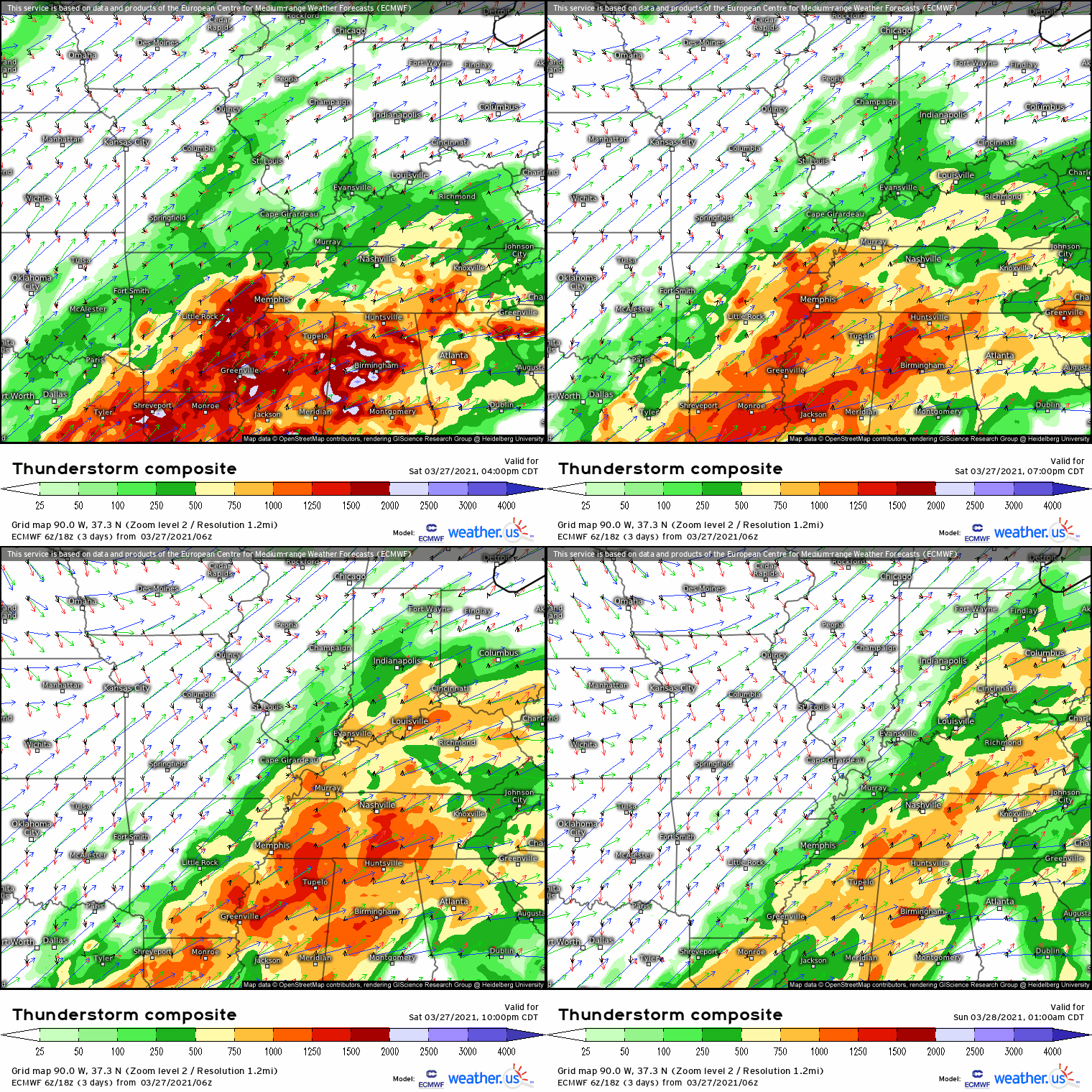
Sensibly, expect several rounds of cells today, often moving through similar areas.
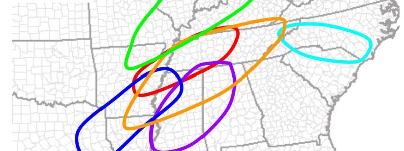
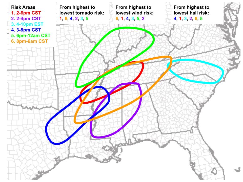
The first will evolve into the mid-afternoon as outflow from strong convection over E Tennessee interacts with increasingly impressive instability from E Arkansas to near Nashville, and will feature a risk of scattered tornadoes, one or two of which could be strong, along with scattered hail reports and some damaging wind. This region is labeled zone one on the map below.
The second is conditional on convection developing in a weakly forced warm sector south of risk area one, with an impressive degree of capping. But if it does, supercells could form, with a risk for all severe hazards. This region is labeled zone two on the map below.
The third will probably develop along a stationary front in the Carolinas, where a risk for bowing segments of hail and strong wind could develop. Aside from a swath of these hazards, a couple tornadoes are possible. This region is labeled zone three on the map below.
The fourth will develop amidst a strong EML but poor low level wind profile from NE TX to central AR and MS, and will feature supercells with a risk for large to destructive hail. Some wind damage and a tornado will be possible as well. Widespread coverage of convection here means even these relatively minor risks will still prove significant cumulatively. This region is labeled zone four on the map below.
The fifth will evolve north of the best parameter space, along a tongue of instability stretching into the Midwest. Here, wind damage will be the biggest threat. This region is labeled zone five on the map below.
Finally, the sixth will arise as storms from zones 1 and 4 coalesce and spread east into a volatile QLCS. Coinciding with an overnight intensification of the LLJ, these storms will pose a large and widespread wind risk, with a decent threat for some tornadoes too. Some could be strong. This region is labeled zone six on the map below.


