South-Central Snow Onslaught Continues Tonight, Tomorrow With Texas Storm
Yet another disturbance sliding along an active southern stream is set to bring significant snow deep into the nation’s south central plains.
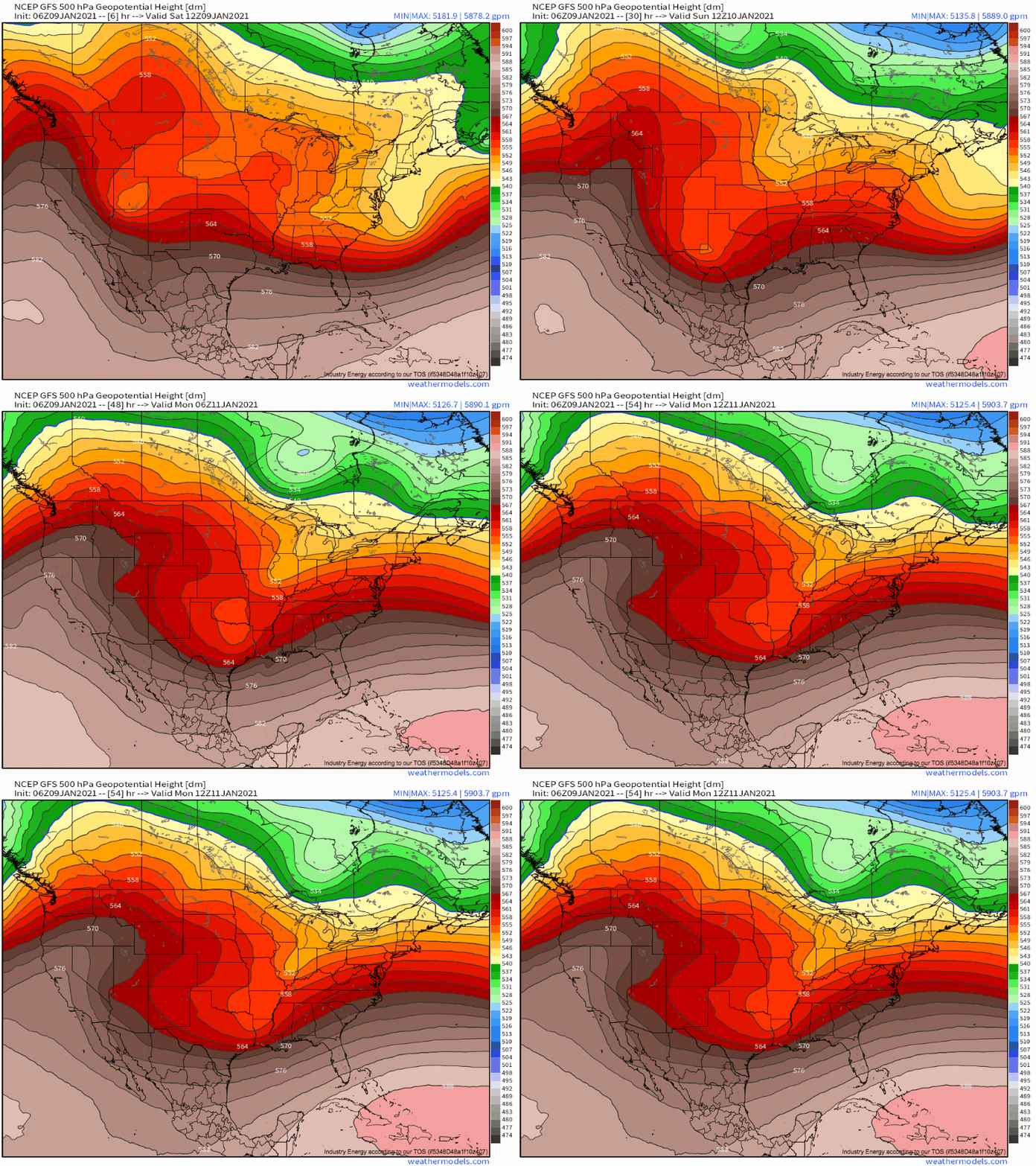
Meghan’s blog yesterday laid out the set-up: a strong southern stream trough will swing down to New Mexico before partially phasing with a subtle Gulf shortwave over Texas, promoting the consolidation of a surface low just offshore.
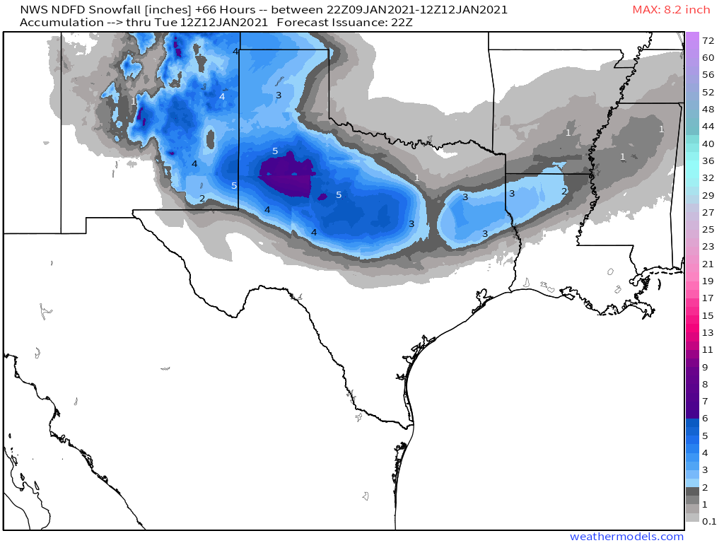
Snow will first impact New Mexico this afternoon, as a cyclone around 700mb interacts with topographical features to lift Pacific moisture into snow. Local 4-8″ will be likely in favored areas of northeast New Mexico, with a broad 2-4″ elsewhere in that part of the state.
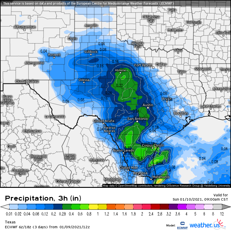
Precipitation will intensify, meanwhile, with increasingly favorable dynamics and moisture access as the primary energy descends through Texas tonight into tomorrow.
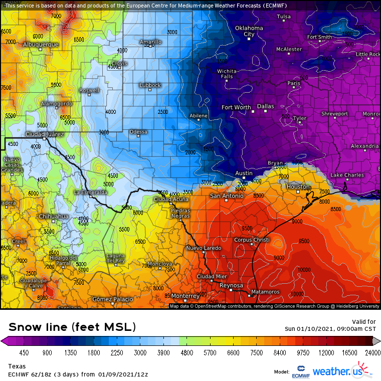
The question of where snow will fall, rather than rain, is especially important so far south. This is especially true considering the lack of real polar air- antecedent temperatures tomorrow morning will only be 2-5°F below normal. This means that dynamic cooling processes amidst falling precipitation will be especially crucial to getting snow to reach the ground.
This conditionality of frozen precipitation means that accumulations will be even more contingent on where the heaviest precipitation sets up than is typical for a snow event. This makes it both harder and easier to forecast- harder because the gradient between significant snow and almost no snow will be higher than usual, and easier because temperatures and precipitation rates are intertwined, rather than two separate entities that require independent forecasts.
So, without further ado, let’s figure out where the heaviest cold-sector precipitation will fall!
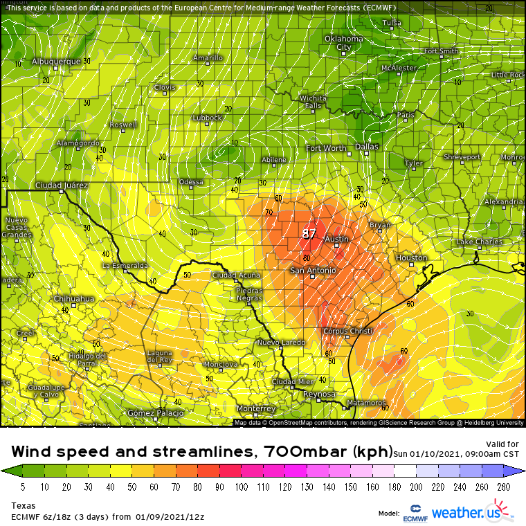
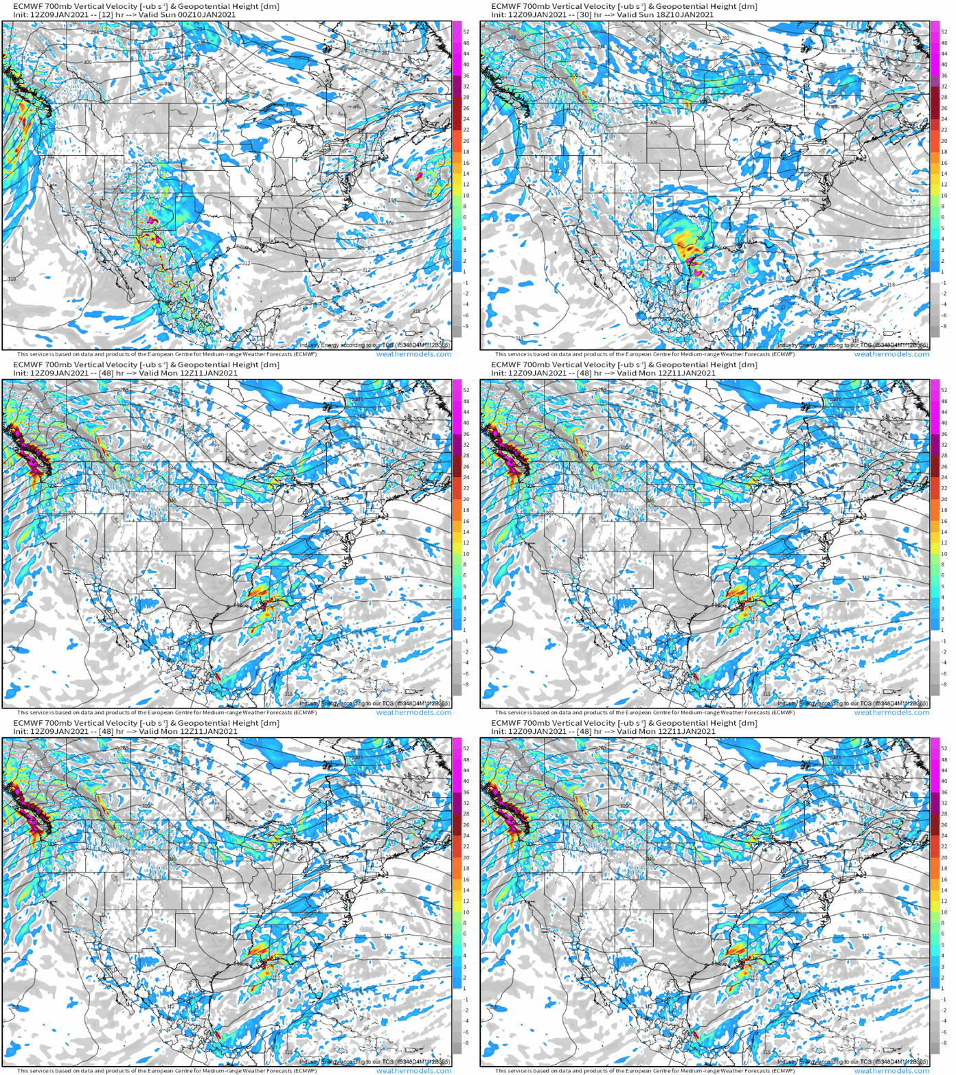
Snow typically responds to an elevated boundary, as they are more favorable for stratiform precipitation that falls atop a cold surface sector. With this in mind, let’s take a look at the 700mb layer during the storm’s passing.
As suspected, the region with the heaviest precipitation that’s falling in the cold sector, where freezing heights are <4000 ft, corresponds with speed convergence at the 700mb layer. This tells us that, to figure out where precipitation will be heaviest and most likely to fall as snow (even if surface temperatures are >32°F), we have to watch the 700mb speed convergence.
Naturally, this feature will move in tandem with the 700mb cyclone itself, which looks to take a track sliding southeastward and then eastward through Texas tonight into tomorrow morning:
Considering that the boundary of 700mb convergence itself is oriented NW to SE, motion will be more parallel to the boundary across central TX tonight into tomorrow than across eastern TX tomorrow into tomorrow night. This means heavy precipitation capable of dynamically cooling air and allowing for snow will likely be most persistent in the earlier half of the storm, from very early tomorrow into the late afternoon, and across central TX. Further east, lower quality dynamics will combine with aforementioned less-than-favorable band/storm motion orientation and slightly warmer air to promote lower precipitation rates and more mixed precipitation/rain.
By late Sunday night into early Monday, as the cyclone moves parallel to the Louisiana coast, the at last fully phased system will see dynamic support for heavy precipitation ramp up as 700mb flow increases, increasing in turn the magnitude of speed convergence and associated lift. This will likely allow a band of moderate to heavy precipitation to develop over the cold sector in far E TX into N LA, where a secondary maxima of snowfall will occur as dynamic cooling intensifies enough to allow more flakes to reach the ground, and with a greater intensity.
Once the phase reaches a climax, though, the unfavorable, extremely positive trough orientation will catch up to the system, leading the low to weaken quickly Monday. With a dramatic divorce from dynamic support, then, precipitation intensity and associated cooling will rapidly wane into Arkansas and Mississippi. So, while a quick burst of accumulating snow is certainly possible, I wouldn’t expect much.
Because of these reasons, I enthusiastically agree with the weather service’s forecast of snowfall totals as follows:
Enjoy the unusual snowstorm!
