Some Severe Threat In South-Central US To Start Week
I hope everyone has been enjoying this week of somewhat muted US weather, because a much more active storm cycle appears likely next week. We’re watching two potential winter storms, a major atmospheric river event, and potentially some more near-Gulf severe thunderstorms.
Hopefully you’re excited to read about all those, because we’re excited to write about them.
But for the time being, eyes are still on a low-end threat for severe storms and winter weather with a de-amplifying trough moving northeast through the US tomorrow through Tuesday. This blog will discuss the severe threat that could evolve Sunday and Monday across parts of the south-central US.
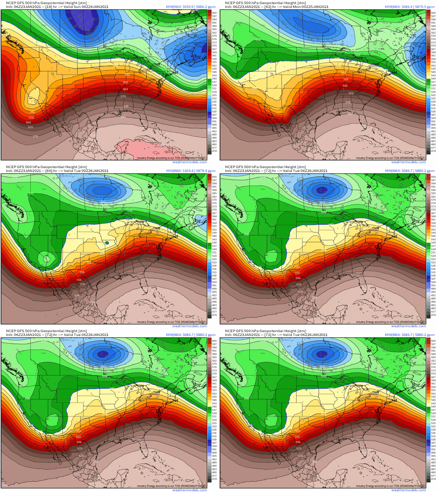
The system we’re watching is currently a powerful longwave base impulse skirting coastal California. By tomorrow, as a stronger impulse digs upstream, the trough will begin flattening and taking on an increasingly short-wave-y appearance, but will still be quite intense as it approaches Texas tomorrow evening. But de-amplification will continue- by Monday afternoon, the once mighty trough will be reduced to a rather weak impulse imbedded in a belt of strong southwesterly flow.
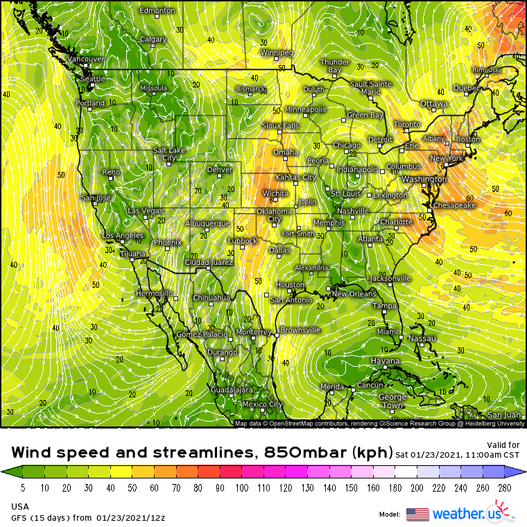
Already, the table is being set for severe thunderstorms in the south-central US, even with the shortwave hardly ashore the west coast. At fault is enhanced divergence associated with the twisting midlevel trough over the north-central US, which is helping an impressive low level jet fan north from the Gulf to the Canadian border.
This impressive jet is slowly moving an impressively moist airmass from the Gulf into coastal Texas. In fact, by the start of tomorrow’s forecast period, dewpoints in parts of near-coastal TX will already be in the 65°-70°F range!
As the impulse rounds the amplifying longwave towards the northeast tomorrow, a low-level cyclone will consolidate and intensify over the south-central Plains in the region of enhanced divergence aloft. This will encourage the southern half of the low level jet to intensify as height gradients begin to increase.
The increase in low level jet speed will pull the Gulf north with more efficiency, and by the mid-afternoon, an unusually moisture-laden warm sector will have developed over Texas and Louisiana. 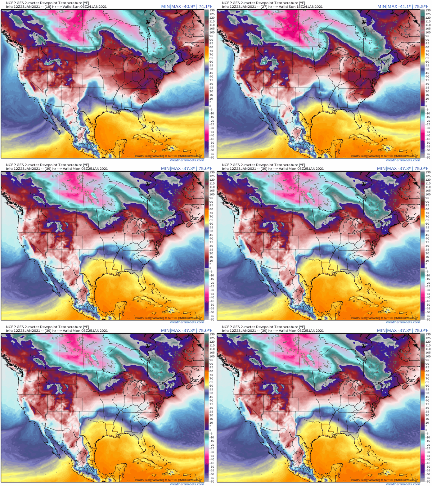
High dewpoints promote instability by implying an airmass full of moisture, which can readily condense with lift and add a great deal of heat, and buoyancy, to a parcel. This process is the backbone of convective instability, but there is another crucial aspect. The parcel pathway given condensation can only actually be convective instability if it’s warmer than the ambient environmental temperature. This is hardly a given.
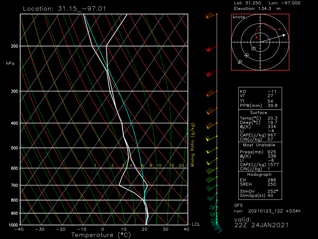
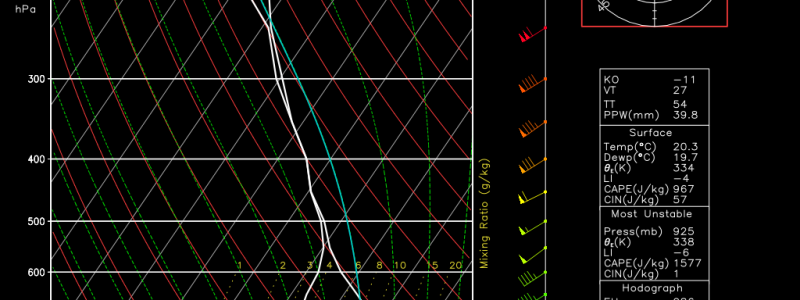
In fact, a vertical slice of the atmosphere over tomorrow’s warm sector shows that, despite plentiful moisture and a strongly conditional profile overall, an incredibly slow rate of temperature decrease with height will prevent any convective instability beneath the 700mb layer of the atmosphere. Notice how the white line goes well to the right of the blue line. This will keep the atmosphere “strongly capped”.
The implications on severe weather potential are pretty clear: it won’t happen unless there’s strong enough forcing to overcome the near-surface stability. This, frankly, will not occur, with the possible exception of along the cold front. So, despite a wind profile that strongly favors tornadic supercells, the low level thermodynamics effectively prohibit any discrete storm mode. If storms are developing, it says, they will develop linearly along the powerful, overnight forcing of the cold front. A marginal severe wind threat is most likely at the moment given the conditionality of even this development. Given the wind profile, I suppose a tornado is possible along any notches in a more robust line of storms, but I doubt that’ll happen. We’ll see.
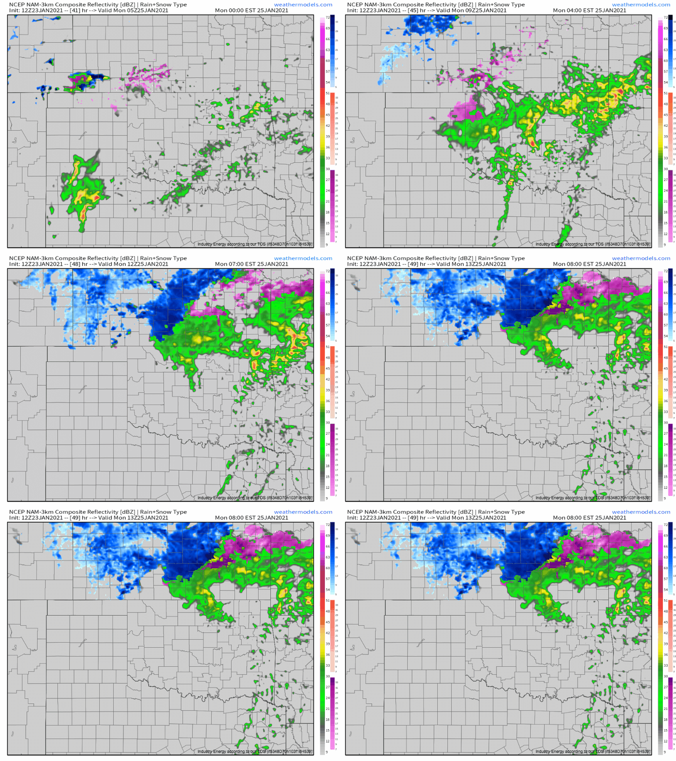
A second area of strong to severe convection can develop with moisture-ladden gulf cyclones, though, along and just to the north of the warm front. The tilted wind profile with height often means that moisture and warm air exists north of the surface warm front aloft, and this event should be no exception. With strong forcing at the hands of the warm front, the result can be a band of training elevated cells, called that because they’re based above the ground, not at the surface. This fact tends to prevent tornadoes and severe wind, but large hail is certainly possible with elevated storms, especially given the amount of moisture and the incredible wind profile. This is because wind has trouble moving through stable surface layers, but giant balls of ice don’t.
This is shown on the NAM and other CAMs:
This means a zone along the warm front from NE TX through central OK could end up the bullseye for severe storms tomorrow, which will largely be hail droppers. Some hail could well be significant, exceeding 2″ locally. The SPC has issued a slight risk for this threat.
Day three, over the southeast, should be largely more of the same. Showers will struggle to deepen given a lack of near-surface instability, and the SPC has only a general thunder threat given the difficulty in getting sustained surface-based convection.
I do think that over north-central Alabama, Mississippi, into Tennessee, there could be a conditional risk for a supercell just south of the warm front or surface low that, given a weakening midlevel warm nose and very impressive kinematics, could well end up dropping a strong tornado. Conditional is key here- in all likelihood, it seems at the moment that nothing will happen. But if warming is able to weaken the cap more than expected, or if a zone of enhanced forcing can develop, high moisture and very volatile kinematics bear watching.
We don’t usually blog on Sundays, but if the odds of a tornado threat do end up looking more likely to materialize Monday, expect a write-up.
